| Fejlesztő: | State of Colorado - Governor's Office of IT (4) | ||
| Ár: | Ingyenes | ||
| Rangsorolások: | 0 | ||
| Vélemények: | 0 Vélemény írása | ||
| Listák: | 0 + 0 | ||
| Pontok: | 0 + 267 ¡ | ||
| Pontok + 1 | |||
Ismertető
")
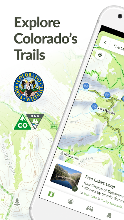
View trails by allowed uses on the map, browse featured routes, download offline maps, record trips and notes in the field, complete challenges to earn badges, and share your experiences with the community. COTREX is your gateway into Colorado’s magnificent outdoors.
■ DISCOVER TRAILS & FEATURED ROUTES
– Browse or search to find trails and Feature Routes that match your activities or interests.
– Change activity type to dynamically filter trails on the map.
■ OFFLINE MAPS
– No cell coverage? No problem! Download maps ahead of time for a continuous experience that doesn’t depend on your network.
– COTREX offline maps are lightweight in size and easy to download.
■ RECORD TRIPS & FIELD NOTES
– Capture the details of your outdoor experiences by recording Trips.
– Go beyond simple photos by taking and classifying rich Field Notes along the way. Choose from 45,000+ classifications that include trail conditions, species, rocks and minerals, historic places, points of interest, and much more.
– Seamlessly sync activity recorded on your devices with the web.
■ COMPLETE CHALLENGES TO EARN BADGES
– By recording and classifying Field Notes, you can complete Challenges and earn Badges for your profile.
■ SHARE WITH THE COMMUNITY
– Inform and inspire the entire COTREX community by sharing your Trips and Field Notes publicly or submitting Trip Reports.
– View activity feeds for all users or just the ones you follow.
– By sharing your experiences, you also help to inform trail managers about current conditions on the ground.
■ ABOUT COTREX
The Colorado Trail Explorer endeavors to map every trail in the state of Colorado in support of the Colorado the Beautiful Initiative. COTREX connects people, trails, and technology by coordinating the efforts of federal, state, county, and local agencies to create a comprehensive repository of recreational trails for public use.
This project is led by Colorado Parks and Wildlife (CPW) and Department of Natural Resources, but is only made possible through partnerships with organizations at every level statewide. COTREX represents a seamless network of trails managed by over 230 land managers.
■ DISCLAIMERS
[Battery Life] We do everything we can to make the app low power when recording, but GPS is notorious for reducing battery life
Terms: https://trails.colorado.gov/terms
Privacy Policy: https://trails.colorado.gov/privacy
Képernyőképek


Újdonságok
- Változat: 1.6.1
- Frissítve:
- - Wildfires and Prescribed Burns are now on the map
- Stability Improvements
Ár
- Ma: Ingyenes
- Minimális: Ingyenes
- Maximális: Ingyenes
Árak nyomon követése
Fejlesztő
- State of Colorado - Governor's Office of IT
- Platformok: Android Alkalmazások (4)
- Listák: 0 + 0
- Pontok: 0 + 8,947 ¡
- Rangsorolások: 0
- Vélemények: 0
- Kedvezmények: 0
- Videók: 0
- RSS: Feliratkozás
Pontok
Nem található ☹️
Rangsorolások
Nem található ☹️
Listák
Nem található ☹️
Vélemények
Legyen Ön az első, aki felülvizsgálja!
További információk
- Kategória:
Android Alkalmazások›Térkép és navigáció - Operációs rendszer:
Android 5.0 és újabb - Méret:
21 Mb - Tartalom besorolása:
Everyone - Google Play Értékelés:
4.2(267) - Frissítve:
- Kiadás dátuma:
Címtár
- Weboldal:
 https://trails.colorado.gov/contact
Akár ez is tetszhet
-
- Trail Treker
- Android Alkalmazások: Térkép és navigáció Által: Trail Treker
- * $1.99
- Listák: 0 + 0 Rangsorolások: 0 Vélemények: 0
- Pontok: 0 + 31 Változat: 3.4.4 Trail Treker is a map viewing tool for use with the Trail Treker map publishing service. Trail Treker worker works with clubs, tourism agencies and municipalities to make their maps ...
-
- The Pekoe Trail
- Android Alkalmazások: Térkép és navigáció Által: The Pekoe Trail
- Ingyenes
- Listák: 0 + 0 Rangsorolások: 0 Vélemények: 0
- Pontok: 0 + 10 Változat: 1.5.13 This is the BETA Version of The Pekoe Trail app. The app is currently in a testing phase, hence please note that certain app features may not be available for use. Explore the ...
-
- C&O Canal Explorer
- Android Alkalmazások: Térkép és navigáció Által: C&O Canal Trust
- * $0.99
- Listák: 0 + 0 Rangsorolások: 0 Vélemények: 0
- Pontok: 0 + 14 Változat: 1.1.8 The C&O Canal Trust is proud to be releasing its new C&O Canal Explorer app to help you explore all 184.5 miles of the C&O Canal National Historical Park! The C&O Canal Explorer app ...
-
- Israel National Trail
- Android Alkalmazások: Térkép és navigáció Által: Lior Boyango
- Ingyenes
- Listák: 0 + 0 Rangsorolások: 0 Vélemények: 0
- Pontok: 0 + 848 Változat: 2.2.0023 Israel National Trail app is made for you who walk the trail. Inside you can find relevant info about the trail segments and also: * Rank to different levels and see what other hikers ...
-
- Maps Explorer: old maps
- Android Alkalmazások: Térkép és navigáció Által: MDevs.
- * * Ingyenes
- Listák: 0 + 0 Rangsorolások: 0 Vélemények: 0
- Pontok: 0 + 1,130 Változat: 1.2.8 It often happens that you have old historical maps, but when comparing them with a modern map, difficulties arise. Settlements grow or disappear altogether, roads change and it becomes
-
- onX Offroad: Trail Maps & GPS
- Android Alkalmazások: Térkép és navigáció Által: onXmaps
- * Ingyenes
- Listák: 0 + 0 Rangsorolások: 0 Vélemények: 0
- Pontok: 0 + 3,942 Változat: 24.14.3 GPS mapping App that lets you easily find the off-road trails you're looking for whether you want to discover what s open nearby or explore somewhere new. Filter 615K miles of ...
-
- California Trail Map
- Android Alkalmazások: Térkép és navigáció Által: Off-Road GPS Maps
- Ingyenes
- Listák: 0 + 0 Rangsorolások: 0 Vélemények: 0
- Pontok: 0 + 20 Változat: 1.1 Southern and central California + southern Nevada All Trails, Dirt Roads and POIs on Public Land 46,575 miles of non-motorized trails! 80,160 miles of motorized dirt roads and OHV ...
-
- On trail - Tatra, Beskid, Gorc
- Android Alkalmazások: Térkép és navigáció Által: WEIGA
- Ingyenes
- Listák: 0 + 0 Rangsorolások: 0 Vélemények: 0
- Pontok: 0 + 64 Változat: 2.3.36 Browse maps of Tatra, Beskid, Gorce, Pieniny, Karkonosze, Bieszczady, and more. Discover peaks, huts, saddles, waterfalls and caves. Plan your hike trails minding the distance, ...
-
- Decentraland Explorer
- Android Alkalmazások: Térkép és navigáció Által: Decentraland Apps
- Ingyenes
- Listák: 0 + 0 Rangsorolások: 0 Vélemények: 0
- Pontok: 0 + 44 Változat: 3.7 Explore the lands of the most popular metaverse, Decentraland. Search for lands, wearables and names (ENS) for sale in a user friendly way. View bids on NFTs and the sale history of ...
-
- Natural Atlas: Trail Map & GPS
- Android Alkalmazások: Térkép és navigáció Által: Natural Atlas
- * Ingyenes
- Listák: 0 + 0 Rangsorolások: 0 Vélemények: 0
- Pontok: 0 + 78 Változat: 4.7.1 Explore nature in a new way with the ultimate field guide and recorder. Navigate with super-detailed original maps, discover local plants and animals, and build an atlas of your ...
-
- AlpineQuest Off-Road Explorer
- Android Alkalmazások: Térkép és navigáció Által: Psyberia
- $12.99
- Listák: 3 + 0 Rangsorolások: 0 Vélemények: 0
- Pontok: 1 + 9,088 Változat: 2.3.8 No advertisements ~ No data sharing & monetization ~ No analytics ~ No third party libraries AlpineQuest is the complete solution for all outdoor activities and sports, including ...
-
- COtrip Planner
- Android Alkalmazások: Térkép és navigáció Által: STATE OF COLORADO OIT
- Ingyenes
- Listák: 0 + 0 Rangsorolások: 0 Vélemények: 0
- Pontok: 0 + 351 Változat: 5.5.99 The COtrip app is the Colorado Department of Transportation's (CDOT) official real-time traffic and traveler information app. The COtrip app provides statewide travel information for ...
-
- VesselFinder
- Android Alkalmazások: Térkép és navigáció Által: VT Explorer Ltd
- * * Ingyenes
- Listák: 0 + 0 Rangsorolások: 0 Vélemények: 0
- Pontok: 0 + 8,962 Változat: 5.6.5 VesselFinder is the most popular vessel tracking app, providing real-time data on the positions and movements of vessels, utilising a large network of satellites and terrestrial AIS ...
-
- AppyParking+ Plan, Park & Pay
- Android Alkalmazások: Térkép és navigáció Által: AppyWay
- * Ingyenes
- Listák: 0 + 0 Rangsorolások: 0 Vélemények: 0
- Pontok: 0 + 530 Változat: 4.8.0 Welcome to the UK's best parking app. Park faster and start saving today. Our easy-to-use app allows you to see and understand all on-street parking areas, restrictions and operating ...
Akár ez is tetszhet
- Android Alkalmazások
- Új Android Alkalmazások
- Térkép és navigáció Android Alkalmazások : Új
- Videók Android Alkalmazások
- Népszerű Android Alkalmazások
- Térkép és navigáció Android Alkalmazások : Népszerű
- Kedvezmények Android Alkalmazások
- Térkép és navigáció Android Alkalmazások : Kedvezmények
- Rangsorolások Android Alkalmazások
- Vélemények Android Alkalmazások
- Listák Android Alkalmazások
- Pontok Android Alkalmazások