| Nhà phát triển: | FLYTOMAP INC (337) | ||
| Giá bán: | * $3.99 | ||
| Xếp hạng: | 0 | ||
| Đánh giá: | 0 Viết đánh giá | ||
| Danh sách: | 0 + 0 | ||
| Điểm: | 0 + 0 ¡ | ||
| Điểm + 1 | |||
Mô tả
")
Featured on the Deck
Featured on Geomedia
Worldwide Marine and Outdoor Maps available when connected, thanks to viewer.flytomap.com
Worldwide Satellite images overlay on charts
Worldwide Terrain features overlay on charts, thanks to Open Street Map, Open Cycle Map, Earth,Google Map,topo maps by ESRI
Now with NOAA raster charts seamless with continuous updates from the official Government server
Now with ActiveCaptain - Worldwide boaters community * 200.000 + Captains
Use to Explore:
√ Latitudes and Longitudes to go to your favorite places
√ Search your Favorite points directly
√ Zoom, Rotate and Pan fast just by a finger touch
√ Route with unlimited waypoints
√ With Head Up and Course Up feature
√ Geocompass
√ Navigate and see your GPS position on the map
√ Heading Vector Towards the direction movement
√ Distance Measurement Tool to easily calculate the distance from one location to another
√ Insert the target/destination and see in real time your speed, distance and bearing
√ background mode - Flytomap works in background as well, you can swap with another app and receive/make calls send sms while panning and zooming.
√ Unlimited Tracks share via email, visible on Google, Flytomap Viewer, KMZ format - Store your track without the need of cellular data or mobile signal
√ KMZ KML from / to GPX Converter
√ Optimized battery usage
√ ActiveCaptain
• View and contribute to the best boaters community available in the world
• Continuous update of all info (including reviews from the deck) about :
• Marinas
• Anchorages
• Hazards
• Local Knowledge
√ And so much more to come - It’s the only app you will ever need! Our charts are installed on: GARMIN NAVICO LOWRANCE B&G NORTHSTAR EAGLE SIMRAD
Follow us:
▶Twitter @flytomap
▶Web Site flytomap.com
▶Web App viewer.flytomap.com
▶Facebook facebook.com/flytomap
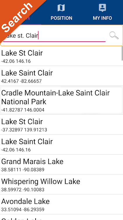
The cartography of Lake St. Clair is included in this application
Flytomap is committed to constant improvement, this App is developed with the help of professional boaters to get the best experience on the sea, we listen to our users and systematically add the most requested features.
Thank you for the feedback!
Additional info about Flytomap products
FLYTOMAP LAKE MAPS:
We offer high quality lake maps with detailed information and important features compressed to assure the larger coverage in USA region. Lake maps contain most important DNR lakes with detailed ‘Depth Contours, Boat Ramps, Fishing spots etc. Also includes Trails, Roads and Railways information.
WATER MAPS (Marine):
Water map navigator is the new ‘Marine Navigator for all mobile devices contains embedded Electronic Nautical Charts (ENC) from NOAA compressed to a large coverage.You can now download the application and transform your Phone in a chart plotter with best NOAA, ENC S57 cartography; which includes Anchoring areas, Fishing areas,restriction areas, obstructions, rocks, Buoys, Beacons, Lights, Depth contours with Values display on map, Spot Soundings and more. The only marine app’s available in the market with such huge information. Every effort is made to be as accurate as possible when presenting information for every destination.
“We work to delight your moments”
! Enjoy great Journeys!
Ảnh chụp màn hình


Tính năng mới
- Phiên bản: 4.4.3.7
- Cập nhật:
- Updated to latest Android version.
Giá bán
-
*Trong ứng dụng mua hàng - Hôm nay: $3.99
- Tối thiểu: $3.99
- Tối đa: $3.99
Theo dõi giá
Nhà phát triển
- FLYTOMAP INC
- Nền tảng: Android Ứng dụng (337)
- Danh sách: 0 + 0
- Điểm: 1 + 745 ¡
- Xếp hạng: 0
- Đánh giá: 0
- Giảm giá: 0
- Video: 0
- RSS: Đăng ký
Điểm
Không tìm thấy ☹️
Xếp hạng
Không tìm thấy ☹️
Danh sách
Không tìm thấy ☹️
Đánh giá
Hãy là người đầu tiên đánh giá!
Thông tin bổ sung
- Danh mục:
Android Ứng dụng›Bản đồ và dẫn đường - HĐH:
Android 5.0 trở lên - Kích thước:
21 Mb - Xếp hạng nội dung:
Everyone - Google Play Xêp hạng:
0 - Cập nhật:
- Ngày phát hành:
Danh bạ
- X: flytomap
- Facebook: flytomap
- Trang web:
 http://flytomap.com
Bạn cũng có thể thích
-
- GPS Navigator- Traffic Weather
- Android Ứng dụng: Bản đồ và dẫn đường Bởi: Spectra Apps
- * * Miễn phí
- Danh sách: 0 + 0 Xếp hạng: 0 Đánh giá: 0
- Điểm: 0 + 0 Phiên bản: 2.22-Titanium GPS Navigator - Traffic alerts, Navigation & Weather facilitates user with best route possible after analysing and comparing all the routes available to generate fastest and safest ...
-
- GPS Navigator for Truck
- Android Ứng dụng: Bản đồ và dẫn đường Bởi: NavionTruck™
- Miễn phí
- Danh sách: 0 + 0 Xếp hạng: 0 Đánh giá: 0
- Điểm: 0 + 0 Phiên bản: 5.5.118 -- NO INTERNET REQUIRED -- THE NAVIGATION APPLICATION FOR PROFESSIONALS NOW AVAILABLE FOR YOUR TABLET AND SMARTPHONE Try the application for free for 7 days NavionTruck Truck ...
-
- Lake Winnebago GPS Navigator
- Android Ứng dụng: Bản đồ và dẫn đường Bởi: FLYTOMAP INC
- * $3.99
- Danh sách: 0 + 0 Xếp hạng: 0 Đánh giá: 0
- Điểm: 0 + 0 Phiên bản: 4.4.4.6 Flytomap is a valid and interesting alternative, Worldwide Marine and Outdoor Maps available when connected, thanks to viewer.flytomap.com Worldwide Satellite images overlay on charts ...
-
- Lake Ellis - IOWA GPS Map
- Android Ứng dụng: Bản đồ và dẫn đường Bởi: FLYTOMAP
- * $3.49
- Danh sách: 0 + 0 Xếp hạng: 0 Đánh giá: 0
- Điểm: 0 + 0 Phiên bản: 4.4.4.3 Flytomap is a valid and interesting alternative, Benetti Yachts Featured on the Deck Featured on Geomedia Worldwide Marine and Outdoor Maps available when connected, thanks to ...
-
- GPS Navigation Live Map Road
- Android Ứng dụng: Bản đồ và dẫn đường Bởi: GPS Map Navigation: English Grammar Learning Apps
- * Miễn phí
- Danh sách: 0 + 0 Xếp hạng: 0 Đánh giá: 0
- Điểm: 0 + 0 Phiên bản: 1.3 Explore the whole world by the GPS navigation live map road app. Visit the live satellite view in real-time. 3d earth map app is using the GPS map to display all locations on your ...
-
- GPS, Maps, Street View
- Android Ứng dụng: Bản đồ và dẫn đường Bởi: GPS & Map Navigation Tool
- Miễn phí
- Danh sách: 0 + 0 Xếp hạng: 0 Đánh giá: 0
- Điểm: 0 + 0 Phiên bản: 1.1 Live Earth Map : Street View application is a combination of World Earth Map, Live Satellite Map and Live Street View. However, access to live images of world famous places and the ...
-
- GPS Tracking LITE
- Android Ứng dụng: Bản đồ và dẫn đường Bởi: GPS Technical Software
- Miễn phí
- Danh sách: 0 + 0 Xếp hạng: 0 Đánh giá: 0
- Điểm: 0 + 0 Phiên bản: 14.0 Get the ultimative best GPS Android Tracking app designed for all your outdoor activities like running, walking, outdoor, hiking as well for car, cycle and other. Safety first: all ...
-
- GPS cards - for GPS Trackers
- Android Ứng dụng: Bản đồ và dẫn đường Bởi: GPS.cards
- Miễn phí
- Danh sách: 0 + 0 Xếp hạng: 0 Đánh giá: 0
- Điểm: 0 + 23 Phiên bản: 2.17.4.4674 GPS.cards mobile app is for Real-Time tracking your fleet GPS Tracker, whether it be one or several hundred. We ve curated a professional easy to use app for easily tracking and ...
-
- St. Louis Taxi
- Android Ứng dụng: Bản đồ và dẫn đường Bởi: St.Louis County Cab
- Miễn phí
- Danh sách: 0 + 0 Xếp hạng: 0 Đánh giá: 0
- Điểm: 0 + 201 Phiên bản: 8.5.0 St. Louis Taxi is the leading provider of Taxi services in St. Louis, Missouri and surrounding areas. We are pleased to offer our valued clients the very latest in smartphone booking ...
-
- GPS Navigation Globe Map 3D
- Android Ứng dụng: Bản đồ và dẫn đường Bởi: GPS Apps Box
- * Miễn phí
- Danh sách: 0 + 0 Xếp hạng: 0 Đánh giá: 0
- Điểm: 1 + 4,712 Phiên bản: 1.6.7 GPS Navigation: Globe Map 3D is fastest and easiest application to get driving routes, street view, maps and best features of Globe map. GPS navigation app show you traffic free routes
-
- GPS Message
- Android Ứng dụng: Bản đồ và dẫn đường Bởi: GPS Message
- Miễn phí
- Danh sách: 0 + 0 Xếp hạng: 0 Đánh giá: 0
- Điểm: 0 + 0 Phiên bản: 0.0.22 GPS Message allows you to effectively manage your mobile workforce. It improves productivity, customer satisfaction, increases revenue & safety while reducing management costs, ...
-
- GPS.AZ
- Android Ứng dụng: Bản đồ và dẫn đường Bởi: GPS Azerbaijan
- Miễn phí
- Danh sách: 0 + 0 Xếp hạng: 0 Đánh giá: 0
- Điểm: 1 + 0 Phiên bản: 2.14.11.3940 The mobile application allow subscribers of GPS.AZ service, which equipment is connected to GPS monitoring system, track their objects in real-time mode from a mobile phone or a tablet
-
- GPS Tracker & Speedometer
- Android Ứng dụng: Bản đồ và dẫn đường Bởi: GPS Family
- * Miễn phí
- Danh sách: 0 + 0 Xếp hạng: 0 Đánh giá: 0
- Điểm: 0 + 159 Phiên bản: 25.0 Effortlessly track your car rides, runs, walks, or bike rides using your phone's built-in GPS. Switch between map, digital or analog speedometer. App can continue to record your route ...
-
- Lake County PASSAGE
- Android Ứng dụng: Bản đồ và dẫn đường Bởi: Lake County PASSAGE
- Miễn phí
- Danh sách: 0 + 0 Xếp hạng: 0 Đánh giá: 0
- Điểm: 0 + 104 Phiên bản: 2.8.1 PASSAGE is an Intelligent Transportation System, designed to provide motorists real time traffic congestion information for Lake County, IL. PASSAGE Android app includes: * Incident ...
Bạn cũng có thể thích
- Android Ứng dụng
- Mới Android Ứng dụng
- Bản đồ và dẫn đường Android Ứng dụng : Mới
- Video Android Ứng dụng
- Phổ biến Android Ứng dụng
- Bản đồ và dẫn đường Android Ứng dụng : Phổ biến
- Giảm giá Android Ứng dụng
- Bản đồ và dẫn đường Android Ứng dụng : Giảm giá
- Xếp hạng Android Ứng dụng
- Đánh giá Android Ứng dụng
- Danh sách Android Ứng dụng
- Điểm Android Ứng dụng