| Nhà phát triển: | Avenza Systems Inc. (3) | ||
| Giá bán: | Miễn phí | ||
| Xếp hạng: | 0 | ||
| Đánh giá: | 0 Viết đánh giá | ||
| Danh sách: | 0 + 1 | ||
| Điểm: | 0 + 122,854 (4.8) ¡ | ||
| App Store | |||
Mô tả
")
On your next adventure, stay on track with GPS using offline mobile maps. Make your own maps? Import your custom maps and never get lost off the grid.
Explore the largest mobile Map Store of hiking, topographic, cycling, city, nautical, travel, and trail maps. Featuring maps from professional publishers including National Geographic, National Park Service, and the US Forest Service. Discover maps for your next camping, fishing, or backpacking trip with your family and friends. Navigate confidently when off-roading or taking those backcountry trails. Precisely identify your location with what3words and stay safe wherever you are.
Avenza Maps is free and the best map app for recreational use. Maps are available for free or purchase from the in-app Map Store. Plus subscription is available for unlimited custom map imports. Pro subscription is available for professional users with full access to all features and mapping tools.
Avenza Maps for your offline adventures on all trails!
ENHANCE YOUR MAPS WITH THESE FEATURES
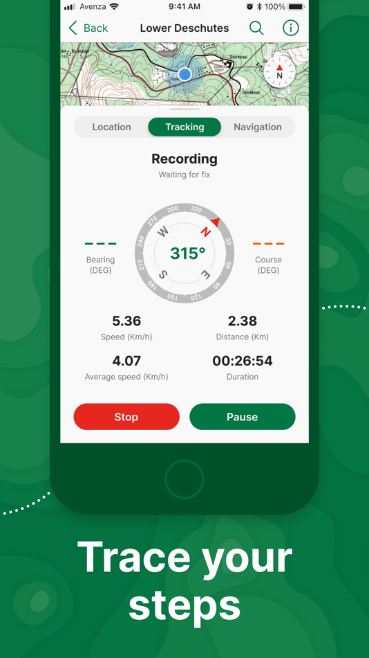
- Locate your realtime GPS position and find direction, even when offline
- Record GPS tracks during your activities
- Navigate to features using compass tools
- Add photos and notes to any location
- Add placemarks to your map and style them with recreational symbols
- Measure distances and estimate times
- Supports KML, GPX, and CSV Formats
EXPLORE THE MAP STORE
Search and download maps by activity, category, and specific publishers with premium maps from:
- National Geographic
- Michelin
- Backroad Mapbooks (BRMB)
- New York - New Jersey Trail Conference
- USFS (United States Forest Service)
- USGS (United States Geological Survey)
- FAA (Federal Aviation Administration)
- NOAA (National Oceanic and Atmospheric Administration)
- BLM (Bureau of Land Management)
- HarperCollins
- DeLorme Atlas & Gazetteer / Garmin
- BaseImage
- National Park Service
- And thousands more!
A free account lets you access all of your map downloads.
GET MORE WITH AVENZA MAPS PLUS
For recreational and power users who need more
- Unlimited import of your own geospatial PDF, GeoPDF®, and GeoTIFF maps
- Create geofences for up to 50 individual features and up to four geofence layers
GET EVEN MORE WITH AVENZA MAPS PRO
For professionals and organizations who require an offline mapping solution with location awareness with more features and tools
- Unlimited import of your own geospatial PDF, GeoPDF®, and GeoTIFF maps
- GPS averaging, additional coordinate display formats, custom symbol sets
- Connect high-accuracy GPS devices including Trimble, Bad Elf, and Dual via Bluetooth
- Created unlimited geofences and get global geofence notifications
- Convert tracks to areas
- Map orientation lock
- Import and export Esri® Shapefiles
- Import and manage custom symbology sets
- Priority technical support
Avenza Maps Pro subscription required for commercial, academic, government, and professional use.
Avenza Maps Plus and Pro are available as annual subscriptions. You can subscribe and pay through your Apple ID. Subscriptions are 12 months in duration and will automatically renew unless auto-renew is turned off at least 24 hours before the end of the current period. Your account will be charged within 24 hours prior to the end of the current period at the rate of your selected plan. Auto-renewal can be turned off in your iTunes Account Settings. If you didn’t use iTunes to subscribe, you can manage your subscription through Avenza.
SUPPORT
We can help! Go to support.avenzamaps.com
LEGAL
Privacy Policy: avenzamaps.com/legal/privacy-policy.html
Terms of Use: avenzamaps.com/legal/terms.html
CONNECT WITH US
avenzamaps.com
facebook.com/avenzamaps
twitter.com/avenzamaps
instagram.com/avenzamaps
Ảnh chụp màn hình


Tính năng mới
- Phiên bản: 262
- Cập nhật:
- Thanks for using Avenza Maps!
What's new in Avenza Maps 5.5:
- New Library tab
- Improved UI for Import and Export
- Enhanced filters, sorting and in-app search experience
- Bug fixes and performance improvements
Giá bán
- Hôm nay: Miễn phí
- Tối thiểu: Miễn phí
- Tối đa: Miễn phí
Theo dõi giá
Nhà phát triển
- Avenza Systems Inc.
- Nền tảng: Android Ứng dụng (2) iOS Ứng dụng (1)
- Danh sách: 0 + 1
- Điểm: 0 + 225,730 ¡
- Xếp hạng: 0
- Đánh giá: 0
- Giảm giá: 0
- Video: 0
- RSS: Đăng ký
Điểm
0 ☹️
Xếp hạng
0 ☹️
Danh sách
0 ☹️
Đánh giá
Hãy là người đầu tiên đánh giá 🌟
Thông tin bổ sung
- Phiên bản: 262
- Danh mục:
iOS Ứng dụng›Bản đồ và dẫn đường - HĐH:
iPad,iPhone,iOS 16.0 trở lên - Kích thước:
183 Mb - Ngôn ngữ được hỗ trợ:
Chinese,Danish,English,French,German,Indonesian,Italian,Japanese,Portuguese,Russian,Spanish,Swedish - Xếp hạng nội dung:
4+ - App Store Xêp hạng:
4.8(122,854) - Cập nhật:
- Ngày phát hành:
Danh bạ
- X: avenzamaps
- Facebook: avenzamaps
- Trang web:
 https://store.avenza.com/
- 🌟 Chia sẻ
- App Store
Bạn cũng có thể thích
-
- Google Maps
- iOS Ứng dụng: Bản đồ và dẫn đường Bởi: Google
- Miễn phí
- Danh sách: 14 + 9 Xếp hạng: 5 (3) Đánh giá: 5 (1)
- Điểm: 5 + 6,972,366 (4.7) Phiên bản: 25.47.0 Explore and navigate the world with confidence using Google Maps. Find the best routes with live traffic data and real-time GPS navigation for driving, walking, cycling, and public ... ⥯
-
- onX Hunt: GPS Hunting Maps
- iOS Ứng dụng: Bản đồ và dẫn đường Bởi: onXmaps, Inc.
- Miễn phí
- Danh sách: 0 + 0 Xếp hạng: 0 Đánh giá: 0
- Điểm: 1 + 263,121 (4.9) Phiên bản: 25.45.1 Navigate your next hunt and view species distribution, topo maps, hunting units, and more. Whether you re a private or public land hunter, know where you stand with land ownership ... ⥯
-
- Apple Maps
- iOS Ứng dụng: Bản đồ và dẫn đường Bởi: Apple
- Miễn phí
- Danh sách: 3 + 3 Xếp hạng: 4 (1) Đánh giá: 0
- Điểm: 2 + 48,514 (2.4) Phiên bản: 1.9.1 Apple Maps is the best way to navigate and explore the world - all with your privacy protected. What's new: Topographic maps with stunning details like contour lines, hill shading, ... ⥯
-
- Sygic GPS Navigation & Maps
- iOS Ứng dụng: Bản đồ và dẫn đường Bởi: Sygic a. s.
- Miễn phí
- Danh sách: 0 + 1 Xếp hạng: 0 Đánh giá: 0
- Điểm: 6 + 56,332 (4.6) Phiên bản: 25.6.0 Sygic GPS Navigation & Maps is innovative GPS navigation app with monthly-updated offline maps and with precise live traffic & speed camera alerts, both updated in real-time. It s ... ⥯
-
- what3words: Navigation & Maps
- iOS Ứng dụng: Bản đồ và dẫn đường Bởi: what3words Ltd.
- Miễn phí
- Danh sách: 0 + 0 Xếp hạng: 0 Đánh giá: 0
- Điểm: 0 + 43,033 (4.8) Phiên bản: 5.2.1 what3words is an easy way to identify precise locations. Every 10 foot square has been given a unique combination of three words: a what3words address. Now you can find, share and ... ⥯
-
- Yandex Maps & Navigator
- iOS Ứng dụng: Bản đồ và dẫn đường Bởi: Direct Cursus Computer Systems Trading
- Miễn phí
- Danh sách: 0 + 1 Xếp hạng: 0 Đánh giá: 0
- Điểm: 3 + 28,250 (4.7) Phiên bản: 26.7.2 Search for an address or the best places nearby both online and offline. Yandex Maps provides information about organizations and helps you reach your destination by car, public ... ⥯
-
- Gaia GPS: Mobile Trail Maps
- iOS Ứng dụng: Bản đồ và dẫn đường Bởi: TrailBehind
- Miễn phí
- Danh sách: 0 + 1 Xếp hạng: 0 Đánh giá: 0
- Điểm: 2 + 31,620 (4.8) Phiên bản: 2025.11.1 Welcome the warm weather with the ultimate collection of hiking trails and camping sites around you Gaia GPS. Find amazing adventures with topographic maps while spending less time ... ⥯
-
- Hammer: Truck GPS & Maps
- iOS Ứng dụng: Bản đồ và dẫn đường Bởi: TruckersReport.com
- Miễn phí
- Danh sách: 0 + 0 Xếp hạng: 0 Đánh giá: 0
- Điểm: 1 + 33,427 (4.7) Phiên bản: 2.2.5 Smarter Trucking Starts Here. Hammer is a powerful GPS navigation app designed specifically for commercial truck drivers. Built by the community at TruckersReport.com, Hammer Truck GPS ⥯
-
- FarOut: Offline GPS Trail Maps
- iOS Ứng dụng: Bản đồ và dẫn đường Bởi: Atlas Guides DE, Inc.
- Miễn phí
- Danh sách: 0 + 0 Xếp hạng: 0 Đánh giá: 0
- Điểm: 0 + 24,879 (4.8) Phiên bản: 15.0.4 Embark on the adventure of a lifetime with FarOut, the most reliable navigational guide app for long-distance exploration. With over 200 hiking, biking, whitewater rafting and paddling ⥯
-
- MapQuest GPS Navigation & Maps
- iOS Ứng dụng: Bản đồ và dẫn đường Bởi: MapQuest Holdings LLC
- Miễn phí
- Danh sách: 0 + 1 Xếp hạng: 5 (1) Đánh giá: 0
- Điểm: 1 + 20,099 (4.3) Phiên bản: 10.4.2 Get where you need to go with the MapQuest turn-by-turn GPS Navigation app. Whether it s using voice navigation for walking or driving directions or exploring points of interests on ... ⥯
-
- Trailforks: Offline Bike Maps
- iOS Ứng dụng: Bản đồ và dẫn đường Bởi: Pinkbike.com
- Miễn phí
- Danh sách: 0 + 0 Xếp hạng: 0 Đánh giá: 0
- Điểm: 1 + 15,532 (4.7) Phiên bản: 2025.5.7 Trailforks is a trail database & map with over 650,000 trails. Users can contribute data and then local trail associations have the control to approve & curate the data. Get 14 days of ⥯
-
- Transit • Subway & Bus Times
- iOS Ứng dụng: Bản đồ và dẫn đường Bởi: Transit App, Inc.
- Miễn phí
- Danh sách: 3 + 0 Xếp hạng: 0 Đánh giá: 0
- Điểm: 0 + 845,875 (4.6) Phiên bản: 6.0.10 Transit is your real-time urban travel companion. Open the app to instantly see accurate next departure times, track buses and trains near you on the map, and see upcoming transit ... ⥯
-
- HuntWise: A Better Hunting App
- iOS Ứng dụng: Bản đồ và dẫn đường Bởi: Sportsman Tracker
- Miễn phí
- Danh sách: 0 + 0 Xếp hạng: 0 Đánh giá: 0
- Điểm: 0 + 66,900 (4.7) Phiên bản: 9.3.5 HuntWise provides the ultimate hunting advantage that optimizes your outdoor experience and increases your odds of filling your tag and your freezer every season. Here s how: WEATHER ... ⥯
-
- Moovit: Bus & Transit Tracker
- iOS Ứng dụng: Bản đồ và dẫn đường Bởi: Moovit App Global LTD
- Miễn phí
- Danh sách: 1 + 0 Xếp hạng: 0 Đánh giá: 0
- Điểm: 1 + 53,675 (4.6) Phiên bản: 5.180.0 Transform the way you navigate your city with Moovit, the all-in-one app for urban transit. Whether you re taking the bus, subway, train, or even hopping on a dockless scooter, Moovit ... ⥯