| Geliştirici: | Navimatics Corporation (3) | ||
| Fiyat: | Ücretsiz | ||
| Sıralamalar: | 0 | ||
| Yorumlar: | 0 Yorum Yazın | ||
| Listeler: | 0 + 0 | ||
| Puanlar: | 0 + 17 ¡ | ||
| Puanlar + 1 | |||
Açıklama
")
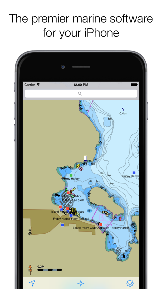
Charts&Tides was designed with ease of use in mind. The interface is intuitive and tasks have been streamlined. Unlike other marine software, you do not need to download, store and manage individual charts or load them into the software; we have done the legwork for you and compiled large area charts that combine information from multiple sources.
In more detail:
- Provides continuous and seamless large area charts derived from NOAA and CHS vector cartography.
- Shows tide levels and current speeds on the chart using easily interpreted icons. Allows you to judge the water situation around you with a single glance.
- Integrates with the ActiveCaptain interactive cruising guidebook providing you with access to thousands of marinas, anchorages, hazards and other local knowledge.
- Stores the entire ActiveCaptain database offline so that it is always available to you, even without an Internet connection.
- Allows you to instantly search thousands of chart features and the ActiveCaptain database.
- Supports waypoints, routes, tracks and allows you to import and export them in GPX format. Route navigation with automatic waypoint sequencing is also supported.
- Supports multiple options for navigation. You can use your device's built-in GPS or connect to an external GPS via Bluetooth or Wi-Fi. You can also use dead reckoning mode.
- Supports external AIS devices and performs Closest Point of Approach (CPA) computations.
- Comes with a dark UI that looks good during the day and will preserve your night vision when it is dark.
The software comes with a world base map, but does not come prepackaged with any detailed marine charts. You can purchase detailed marine charts from within the application. You can also use the software without purchasing additional charts.
Ekran görüntüleri


Yenilikler
- Sürüm: 5.4.15229
- Güncellendi:
- - ActiveCaptain changes for 2015
- Misc other fixes
Fiyat
- Bugün: Ücretsiz
- En az: Ücretsiz
- Maksimum: Ücretsiz
Fiyatları takip et
Geliştirici
- Navimatics Corporation
- Platformlar: iOS Uygulamalar (2) macOS Uygulamalar (1)
- Listeler: 0 + 0
- Puanlar: 1 + 20 ¡
- Sıralamalar: 0
- Yorumlar: 0
- İndirimler: 0
- Video: 0
- RSS: Abone ol
Puanlar
Bulunamadı ☹️
Sıralamalar
Bulunamadı ☹️
Listeler
Bulunamadı ☹️
Yorumlar
İnceleme yazan ilk kişi siz olun!
Ek Bilgi
- Kategori:
iOS Uygulamalar›Navigasyon - İşletim Sistemleri:
iPad,iPhone,iOS 7.0 ve sonrası - Boyut:
34 Mb - Desteklenen diller:
English - İçerik Derecelendirmesi:
4+ - App Store Kullanıcı Oyu:
2.1(17) - Güncellendi:
- Satışa çıkış tarihi:
Kişiler
- Web sitesi:
 http://www.navimatics.com/ChartsTidesIOS/
Şunları da beğenebilirsiniz
-
- Tides Planner
- iOS Uygulamalar: Navigasyon Göre: Imray
- Ücretsiz
- Listeler: 0 + 0 Sıralamalar: 0 Yorumlar: 0
- Puanlar: 0 + 13 Sürüm: 5.17 Essential TIDES tool for sailors, divers, canoeists, fishermen, surfers, swimmers, photographers and anyone involved with sport or leisure at the seaside. At the push of a button Tides
-
- Sea Drive: Charts, Nav, Routes
- iOS Uygulamalar: Navigasyon Göre: Sea Drive, LLC
- * Ücretsiz
- Listeler: 0 + 0 Sıralamalar: 0 Yorumlar: 0
- Puanlar: 0 + 134 Sürüm: 14.0.0 * What is Sea Drive? Sea Drive is a marine and boating application focused on charting, navigation, route building, track recording, tides, currents, and more! Our goal is to provide ...
-
- PRO CHARTS - Marine Navigation
- iOS Uygulamalar: Navigasyon Göre: MiraTrex, Inc.
- Ücretsiz
- Listeler: 0 + 0 Sıralamalar: 0 Yorumlar: 0
- Puanlar: 0 + 7,912 Sürüm: 5.70 MiraTrex PRO CHARTS™ is a powerful, yet easy-to-use marine navigation system. Whether you re a fisherman, weekend cruiser, sailor, diver, jet-skier, or an offshore captain needing to ...
-
- Real Tides & Currents Graph HD
- iOS Uygulamalar: Navigasyon Göre: Flytomap
- $6.99
- Listeler: 0 + 0 Sıralamalar: 0 Yorumlar: 0
- Puanlar: 0 + 422 Sürüm: 3.5.10 FlyToMap is a valid and interesting alternative, Benetti Yachts! Top Ten since 2008! Featured in : On the Deck! 15000+ Tide & Current spots available! Worldwide Marine Charts Coverage ...
-
- SeaNav
- iOS Uygulamalar: Navigasyon Göre: Pocket Mariner Ltd.
- * Ücretsiz
- Listeler: 0 + 0 Sıralamalar: 0 Yorumlar: 0
- Puanlar: 0 + 185 Sürüm: 5.4.6 Explore, plan and navigate your boating trips in real time and outstanding high-resolution using digital charts derived from the latest NOAA and UKHO data providing coverage across the
-
- Wavve Boating: Marine Boat GPS
- iOS Uygulamalar: Navigasyon Göre: Wavve Boating INC
- * Ücretsiz
- Listeler: 0 + 0 Sıralamalar: 0 Yorumlar: 0
- Puanlar: 0 + 1,725 Sürüm: 4.9.7 Ever have a stressful day navigating on the water? Wanted to know more about the conditions you are about to head into? Are you looking for exciting places to explore, the best place ...
-
- Navionics® Boating
- iOS Uygulamalar: Navigasyon Göre: Garmin Italy Technologies S.R.L.
- * Ücretsiz
- Listeler: 1 + 0 Sıralamalar: 0 Yorumlar: 0
- Puanlar: 1 + 1,806 Sürüm: 21.0.3 Get up-to-date, detailed charts you can use offline plus a boatload of features on your mobile device, so they re on hand wherever you go. The Boating app is a must-have for cruising, ...
-
- Aqua Map Boating
- iOS Uygulamalar: Navigasyon Göre: GEC s.r.l.
- * Ücretsiz
- Listeler: 0 + 0 Sıralamalar: 0 Yorumlar: 0
- Puanlar: 0 + 9,800 Sürüm: 40.1 Free 14-day trial available for all subscriptions Get the latest charts you can use offline, weather, tides and POIs from ActiveCaptain and Waterway Guide. Connect AIS and your boat ...
-
- iNavX: Marine Navigation
- iOS Uygulamalar: Navigasyon Göre: NavX Studios LLC
- * Ücretsiz
- Listeler: 0 + 0 Sıralamalar: 0 Yorumlar: 0
- Puanlar: 7 + 18,519 Sürüm: 5.6.32 Marine navigation is made easy with iNavX - the world's #1 handheld Chartplotter. Access marine charts, maps, weather, AIS and more! iNavX is the only app to give you complete ...
-
- The Yachtsman's South Pacific
- iOS Uygulamalar: Navigasyon Göre: Sail South Pacific Ltd.
- $24.99
- Listeler: 0 + 0 Sıralamalar: 0 Yorumlar: 0
- Puanlar: 0 + 7 Sürüm: 2.4.1 Imagine a resource that puts all the information a skipper needs to Cruise With Confidence across the Pacific, all in one easy to use, intuitive platform that doesn t rely on an ...
-
- qtVlm
- iOS Uygulamalar: Navigasyon Göre: Meltemus SAS
- * Ücretsiz
- Listeler: 0 + 0 Sıralamalar: 0 Yorumlar: 0
- Puanlar: 0 + 7 Sürüm: 5.12.8.806 qtVlm is a navigation software for Sailing Boats. The application has a free version with basic features and a full version available through in-app purchase. The free version of qtVlm
-
- WakeWatch
- iOS Uygulamalar: Navigasyon Göre: Daniel Munson
- $1.99
- Listeler: 0 + 1 Sıralamalar: 0 Yorumlar: 0
- Puanlar: 2 + 9 Sürüm: 4.01 Wake Watch is the Boater's Resource for information on no wake zones, boating speed limits and bridges. We have no wake zone and boating speed limit maps for FL, NC & CT. We have ...
-
- savvy navvy: Boat Navigation
- iOS Uygulamalar: Navigasyon Göre: savvy navvy
- * Ücretsiz
- Listeler: 0 + 0 Sıralamalar: 0 Yorumlar: 0
- Puanlar: 0 + 5,334 Sürüm: 2.2.11941 Everything you need to get out on the water, if you are a boater, sailor, paddleboarder, Jet skier, Kayaker or just going fishing, we ve got you covered. Free Features - All USA ...
-
- Argo - Boating Navigation
- iOS Uygulamalar: Navigasyon Göre: Argo Navigation, LLC
- * Ücretsiz
- Listeler: 0 + 0 Sıralamalar: 0 Yorumlar: 0
- Puanlar: 0 + 5,413 Sürüm: 1.51.3 Argo™ is an easy-to-use navigation and social boating app FREE to download and FREE to use! Find and route to new destinations anywhere in North America, track your boat trips, see ...
Şunları da beğenebilirsiniz
- iOS Uygulamalar
- Yeni iOS Uygulamalar
- Navigasyon iOS Uygulamalar : Yeni
- Video iOS Uygulamalar
- Popüler iOS Uygulamalar
- Navigasyon iOS Uygulamalar : Popüler
- İndirimler iOS Uygulamalar
- Navigasyon iOS Uygulamalar : İndirimler
- Sıralamalar iOS Uygulamalar
- Yorumlar iOS Uygulamalar
- Listeler iOS Uygulamalar
- Puanlar iOS Uygulamalar