説明
")
The key advantages of the application:
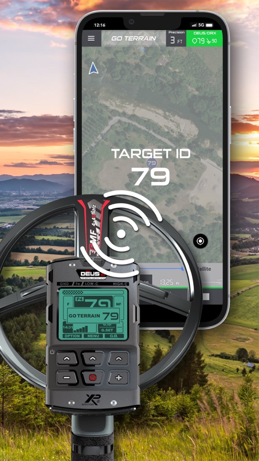
• Connect your XP detector to GO TERRAIN with Bluetooth to display your targets in real time on your route with their ID!
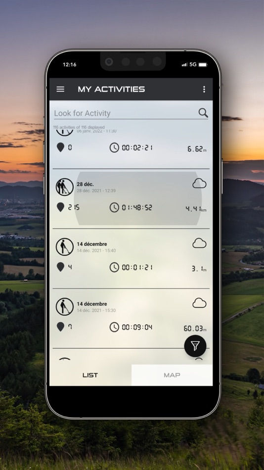
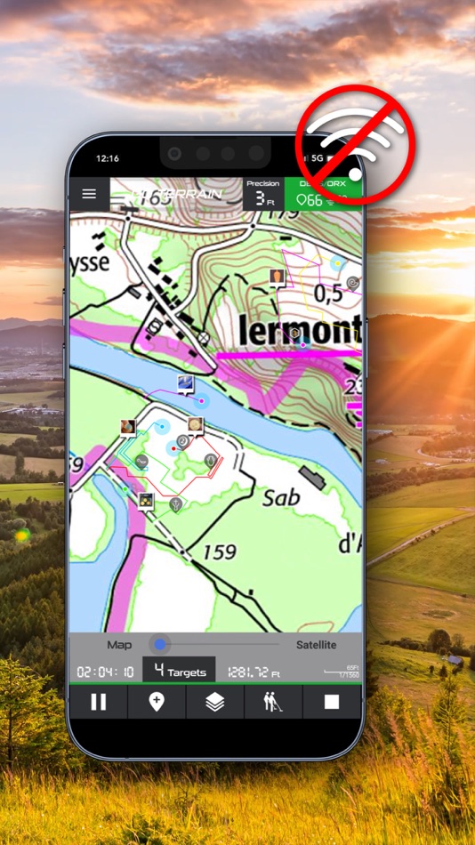
• Save and consult all your routes, alone or networked (group mode)
• See your colleagues' positions, routes and finds in real time
• Share and expand your database for a terrain over time
• Connect your DEUS II/DEUS/ORX to GO TERRAIN and access a large amount of information: GPS position, target ID and ground strength.
Terms of Use : https://www.apple.com/legal/internet-services/itunes/dev/stdeula/
スクリーンショット


新機能
- バージョン: 3.0.0
- アップデート:
- - Import of activities in GPKG format (PREMIUM only).
- Import of activities and detection zones in KML format created with Google Earth.
- Redesigned activity/target management interface.
- New feature to automatically import detection zones from major partner rallies.
- Strengthened user data security.
- Various improvements (adding activity tag, adding weight, UTM, miles, etc.)
価格
- 今日: フリー
- 最小値: フリー
- 最大: フリー
料金のチェック
デベロッパー
ポイント
0 ☹️
ランキング
0 ☹️
リスト
0 ☹️
レビュー
最初のクチコミを書こう 🌟
情報
- バージョン: 3.0.0
- ID: com.xplorer.goterrain
- カテゴリ:
iOS アプリ›ナビゲーション - オペレーティング システム:
iPad,iPhone,iOS 17.0 以上 - サイズ:
68 Mb - サポートされる言語:
Arabic,Bulgarian,Chinese,Czech,Danish,Dutch,English,French,German,Greek,Hebrew,Italian,Polish,Portuguese,Russian,Spanish,Turkish,Ukrainian - コンテンツのレーティング:
4+ - App Store 評価:
3.8(33) - アップデート:
- リリース日:
あなたも好きかも
-
- Terrain Radar Altimeter
- iOS アプリ: ナビゲーション 作者: Nestele Engineering
- フリー
- リスト: 0 + 0 ランキング: 0 レビュー: 0
- ポイント: 0 + 712 (4.7) バージョン: 2.8.0 Measure the elevation of each location within a radius of 500 meter. With Terrain Radar Altimeter you can discover the height of hills in front of you or take a look at further away ... ⥯
-
- Mapitare Terrain and Sea map
- iOS アプリ: ナビゲーション 作者: Mapitare Oy
- * フリー
- リスト: 0 + 0 ランキング: 0 レビュー: 0
- ポイント: 0 + 0 バージョン: 1.2.36 Now you can try all the maps free for seven days (except Swedish nautical charts for three days)! Mapitare is the first offline mapping software on the market that can be downloaded at ⥯
-
- planlauf/TERRAIN
- iOS アプリ: ナビゲーション 作者: planlauf GmbH
- * フリー
- リスト: 0 + 0 ランキング: 0 レビュー: 0
- ポイント: 0 + 2 (2.5) バージョン: 2.0.0 planlauf/TERRAIN's app for iOS displays 2D and 3D LiDAR maps that you can create with the desktop version of planlauf/TERRAIN. You can also purchase 2D LiDAR maps for some regions in ... ⥯
-
- onX Hunt: GPS Hunting Maps
- iOS アプリ: ナビゲーション 作者: onXmaps, Inc.
- フリー
- リスト: 0 + 0 ランキング: 0 レビュー: 0
- ポイント: 1 + 250,317 (4.9) バージョン: 25.39.0 Navigate your next hunt and view species distribution, topo maps, hunting units, and more. Whether you re a private or public land hunter, know where you stand with land ownership ... ⥯
-
- HuntWise: A Better Hunting App
- iOS アプリ: ナビゲーション 作者: Sportsman Tracker
- フリー
- リスト: 0 + 0 ランキング: 0 レビュー: 0
- ポイント: 0 + 65,410 (4.7) バージョン: 9.3.2 HuntWise provides the ultimate hunting advantage that optimizes your outdoor experience and increases your odds of filling your tag and your freezer every season. Here s how: WEATHER ... ⥯
-
- Geocaching®
- iOS アプリ: ナビゲーション 作者: Groundspeak Inc.
- フリー
- リスト: 0 + 0 ランキング: 0 レビュー: 0
- ポイント: 0 + 62,016 (4.8) バージョン: 9.87.0 Join the world s largest treasure-hunting community with the official app for geocaching. Whether you are off to find your first geocache or your ten-thousandth, this app is your ... ⥯
-
- Gaia GPS: Mobile Trail Maps
- iOS アプリ: ナビゲーション 作者: TrailBehind
- フリー
- リスト: 0 + 1 ランキング: 0 レビュー: 0
- ポイント: 2 + 31,552 (4.8) バージョン: 2025.10 Welcome the warm weather with the ultimate collection of hiking trails and camping sites around you Gaia GPS. Find amazing adventures with topographic maps while spending less time ... ⥯
-
- BaseMap: Hunting GPS Maps
- iOS アプリ: ナビゲーション 作者: BaseMap Inc
- フリー
- リスト: 0 + 0 ランキング: 0 レビュー: 0
- ポイント: 0 + 8,961 (4.6) バージョン: 6.1.7 Guaranteed land ownership maps, mobile hunt planner with draw odds, industry leading GPS tools for hunters and outdoorsmen. OFFLINE GPS and TRACKING Cache maps for offline use without ... ⥯
-
- TacticMap – Battle map
- iOS アプリ: ナビゲーション 作者: Yaroslav Sherstyuk
- * フリー
- リスト: 1 + 0 ランキング: 5 (1) レビュー: 0
- ポイント: 17 + 5 (3.6) バージョン: 1.9.0 TacticMap is a multifunctional app, specially designed for military personnel and professionals working with maps and coordinates. Our app simplifies navigation and task planning on ... ⥯
-
- GOHUNT: Research & Maps
- iOS アプリ: ナビゲーション 作者: GOHUNT, LLC
- フリー
- リスト: 0 + 0 ランキング: 0 レビュー: 0
- ポイント: 1 + 7,889 (4.8) バージョン: 9.1.8 The only all-in-one hunting app where you can find, filter, navigate, and succeed on your next hunt. Trusted by diehard hunters like Randy Newberg, Remi Warren, and Ryan Lampers, ... ⥯
-
- Air Navigation - VFR & IFR
- iOS アプリ: ナビゲーション 作者: Flygo-Aviation Ltd
- フリー
- リスト: 0 + 0 ランキング: 0 レビュー: 0
- ポイント: 2 + 26 (4.5) バージョン: 2.44 Air Navigation - VFR & IFR is the ultimate flight planning and navigation app for pilots. Plan VFR or IFR flights with worldwide charts, real-time weather (METAR/TAF), radar, NOTAMs, ... ⥯
-
- Lenzmark Hunt Hunting App, GPS
- iOS アプリ: ナビゲーション 作者: Lenzmark LLC
- フリー
- リスト: 0 + 0 ランキング: 0 レビュー: 0
- ポイント: 2 + 27 (4.4) バージョン: 3.6 Are you excited to bag your big game trophy this hunting season? Tracking and stalking trophy big game is now easy! Lenzmark Hunt is the best big game hunting app available for the ... ⥯
-
- WingX®
- iOS アプリ: ナビゲーション 作者: Hilton Software LLC
- フリー
- リスト: 0 + 0 ランキング: 0 レビュー: 0
- ポイント: 1 + 180 (3.6) バージョン: 9.2.6.206 WingX® Pro7's simple subscription model: VFR Free! and MilitaryFree! - only VFR flying or Active or Retired Military? Subscription is free. $74.95 annual subscription (or $199.95 for 3 ⥯
-
- Argo - Boating Navigation
- iOS アプリ: ナビゲーション 作者: Argo Navigation, LLC
- * フリー
- リスト: 0 + 1 ランキング: 0 レビュー: 0
- ポイント: 0 + 5,915 (4.9) バージョン: 2.13.2 Argo™ is an easy-to-use navigation and social boating app FREE to download and FREE to use! Find and route to new destinations anywhere in North America, track your boat trips, see ... ⥯