| Desarrollador: | NavX Studios LLC (1) | ||
| Precio: | * Gratis | ||
| Clasificaciones: | 0 | ||
| Opiniones: | 0 Escribir una opinión | ||
| Listas: | 0 + 0 | ||
| Puntos: | 7 + 18,519 ¡ | ||
| Puntos + 1 | |||
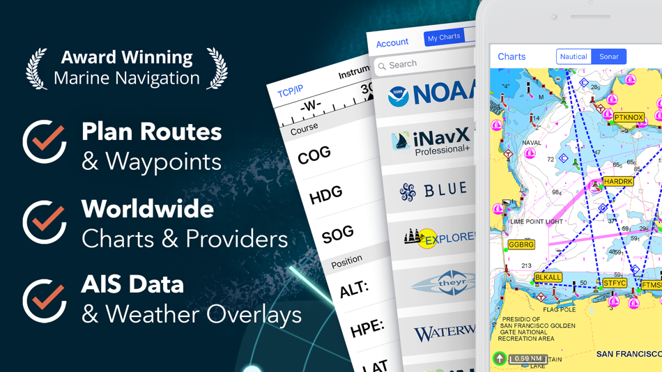
Descripción
")
iNavX is the only app to give you complete worldwide chart coverage, from all your favorite charts providers, including the ALL NEW iNavX Professional+ Chart series! Fully enabled with one-touch access, iNavX gives users access to the broadest set of marine charts and maps from multiple providers including:
• iNavX Professional+ Charts
• Blue Latitude
• CHS
• Explorer
• Theyr Weather
• Waterway Guide
• … and more
How does iNavX take handheld marine navigation to the next level?
• Sailors - Plan sailing routes with waypoint and route management. Get proactive sail management with GRIB weather forecasts and then keep watch with AIS overlays and integration with your onboard systems. Plus, you can remember your great sailing locations by geotagging photos.
• Boaters - Stay up to date on boating conditions with forecasts that include currents, winds, and swells. Manage your boating equipment with nautical instrument integration and then save great boating routes to share with the track log.
• Anglers - Discover new fishing spots by scouting out holes and inlets. Locate the best fishing conditions by identifying cold fronts and save your best fishing spots with unlimited markers.
Advanced features - iNavX is the most feature rich app available for all sailing and boating needs at a great price:
Advanced Chart Plotter
• Plot your position in real-time using your device's built-in GPS
• Pan, zoom, and rotate charts (including course up)
• Print detailed charts to use in combination with the app
Advanced Navigation
• Create waypoints and plan routes to navigate between them
• Track log allows you to record your route
• Import/export data in KML (Google Earth) or GPX format
Advanced Instrumentation
• Supports NMEA data over TCP/IP (using Wifi)
• Integrates with external GPS, AIS receivers & transponders
• Connect nautical instruments: Depth, Speed, Wind, Engine, Batteries, etc.
Essential Toolkit
• GRIB weather forecast
• Tides/currents
• Anchor alarm
• AIS integration
• Port/navaid search
Download iNavX TODAY and automatically receive a complimentary copy of the official and up-to-date high-resolution NOAA RNC United States marine raster charts.
REVIEWS
“iNavX is the original and still one of the best navigation apps.”
– Practical Sailor
“The most full-featured navigation app around and viewed by many as the standard”
– Sail Magazine
"The #1 recommended marine charting app"
- iMarineApps
iNavX is Compatible with: Theyr Weather, Waterway Guide, AIS, Brookhouse, DigitalYacht, ShipModul, vYacht, Vesper Marine, NMEA 2000, Chetco and more.
NEW CHART STORE
Purchase all your favorite charts. Chart subscriptions vary by chart and provider from $9.99 to $199.99 annually, charged to your iTunes Account, which will automatically renew unless cancelled at least 24 hours before the end of the current period. Auto-renew can be turned off anytime by going to your Account Settings in iTunes after purchase. No cancellation of the current subscription is allowed during active subscription period.
NOTE: Continued use of GPS running in the background can dramatically decrease battery life.
MORE INFO
Website: http://inavx.com/
User's Guide: http://inavx.com/help/
Terms of Use: http://inavx.com/terms
Privacy Policy: http://inavx.com/privacy
Capturas...


Novedades
- Versión: 5.6.32
- Actualizado:
- New Indonesia chart and bug fixes.
Precio
-
*Compras en la aplicación - Hoy: Gratis
- Mínimo: Gratis
- Máximo: $14.99
Realizar un seguimiento de los precios
Desarrollador
- NavX Studios LLC
- Plataformas: iOS Aplicaciones (1)
- Listas: 0 + 0
- Puntos: 7 + 18,519 ¡
- Clasificaciones: 0
- Opiniones: 0
- Descuentos: 0
- Vídeos: 0
- RSS: Suscribirse


Clasificaciones
No encontrada ☹️
Listas
No encontrada ☹️
Opiniones
Sé el primero en escribir una reseña!
Información adicional
- Categoría:
iOS Aplicaciones›Navegación - Sistemas operativos:
iPad,iPhone,iOS 13.0 y versiones posteriores - Tamaño:
292 Mb - Idiomas admitidos:
Dutch,English,French,German,Italian,Spanish,Swedish - Clasificación de contenido:
4+ - App Store Puntuación:
4.8(18,519) - Actualizado:
- Fecha de lanzamiento:
Contactos
- Sitio:
 http://inavx.com
También te puede interesar
-
- PRO CHARTS - Marine Navigation
- iOS Aplicaciones: Navegación De: MiraTrex, Inc.
- Gratis
- Listas: 0 + 0 Clasificaciones: 0 Opiniones: 0
- Puntos: 0 + 7,912 Versión: 5.70 MiraTrex PRO CHARTS™ is a powerful, yet easy-to-use marine navigation system. Whether you re a fisherman, weekend cruiser, sailor, diver, jet-skier, or an offshore captain needing to ...
-
- TZ iBoat – Marine Navigation
- iOS Aplicaciones: Navegación De: Nobeltec, Inc.
- * Gratis
- Listas: 0 + 0 Clasificaciones: 0 Opiniones: 0
- Puntos: 0 + 490 Versión: 3.0.9 Navigate the seas with the most complete marine charts for coastal boating, sailing, and fishing with or without internet. GPS, anchoring, radar, AIS, tides & tidal currents... This ...
-
- Argo - Boating Navigation
- iOS Aplicaciones: Navegación De: Argo Navigation, LLC
- * Gratis
- Listas: 0 + 0 Clasificaciones: 0 Opiniones: 0
- Puntos: 0 + 5,403 Versión: 1.51.1 Argo™ is an easy-to-use navigation and social boating app FREE to download and FREE to use! Find and route to new destinations anywhere in North America, track your boat trips, see ...
-
- i-Boating: Marine Charts & Gps
- iOS Aplicaciones: Navegación De: Bist LLC
- * Gratis
- Listas: 0 + 0 Clasificaciones: 0 Opiniones: 0
- Puntos: 0 + 11,063 Versión: 141.0.0 This App offers access to Marine Charts for USA,Canada,UK/Ireland,Germany,Netherlands/Holland & Europe Rivers (Danube,Drava,Rhein etc). Coverage includes NOAA marine vector ...
- Nueva
- Wavve Boating: Marine Boat GPS
- iOS Aplicaciones: Navegación De: Wavve Boating INC
- * Gratis
- Listas: 0 + 0 Clasificaciones: 0 Opiniones: 0
- Puntos: 0 + 1,702 Versión: 4.9.5 Ever have a stressful day navigating on the water? Wanted to know more about the conditions you are about to head into? Are you looking for exciting places to explore, the best place ...
-
- TomTom GO Navigation
- iOS Aplicaciones: Navegación De: TomTom
- * Gratis
- Listas: 0 + 0 Clasificaciones: 0 Opiniones: 0
- Puntos: 1 + 2,012 Versión: 3.9.6 Join +10 million drivers to get a tailored GPS navigation experience with TomTom GO Navigation. Enjoy a reliable sat nav app for both cars and trucks with regular updated maps stored ...
-
- Wikiloc Outdoor Navigation GPS
- iOS Aplicaciones: Navegación De: Wikiloc Outdoor SL
- * Gratis
- Listas: 0 + 0 Clasificaciones: 0 Opiniones: 0
- Puntos: 0 + 3,956 Versión: 3.21.1 Discover millions of outdoor trails around the world. Choose between hiking, running, bike, MTB, kayak, ski or up to 80 different types of activities. Record your own routes on a map, ...
-
- Sygic Truck & RV Navigation
- iOS Aplicaciones: Navegación De: Sygic a. s.
- * Gratis
- Listas: 0 + 0 Clasificaciones: 0 Opiniones: 0
- Puntos: 1 + 2,017 Versión: 24.0.1 High-quality GPS navigation designed for professional drivers & their large vehicles. Trusted by 5+ million drivers & many of the world's leading delivery fleets. Smart route planning ...
-
- savvy navvy: Boat Navigation
- iOS Aplicaciones: Navegación De: savvy navvy
- * Gratis
- Listas: 0 + 0 Clasificaciones: 0 Opiniones: 0
- Puntos: 0 + 5,330 Versión: Version 2.2.11780 Everything you need to get out on the water, if you are a boater, sailor, paddleboarder, Jet skier, Kayaker or just going fishing, we ve got you covered. Free Features - All USA ...
-
- Karta GPS - Offline Maps Nav
- iOS Aplicaciones: Navegación De: Karta
- * Gratis
- Listas: 0 + 0 Clasificaciones: 0 Opiniones: 0
- Puntos: 0 + 1,763 Versión: 2.46.07 "Get to your destination. Bigly." - Huffington Post "it s damn good at finding tacos." - The Next Web Free, offline, content-rich maps that allow you to explore new places and drive ...
-
- BRP GO!: Maps & Navigation
- iOS Aplicaciones: Navegación De: BRP Inc.
- * Gratis
- Listas: 0 + 0 Clasificaciones: 0 Opiniones: 0
- Puntos: 0 + 1,376 Versión: 3.6.0 EXPERIENCE THE FUTURE OF RIDING WITH BRP GO! Your one-stop source for a connected riding experience. > A ride on water? Explore locations using detailed maps and save your trips, ...
-
- MapQuest GPS Navigation & Maps
- iOS Aplicaciones: Navegación De: MapQuest Holdings LLC
- Gratis
- Listas: 1 + 0 Clasificaciones: 5 (1) Opiniones: 0
- Puntos: 1 + 18,159 Versión: 6.6.0 Get where you need to go with the MapQuest turn-by-turn GPS Navigation app. Whether it s using voice navigation for walking or driving directions or exploring points of interests on ...
-
- Mapy.cz: maps & navigation
- iOS Aplicaciones: Navegación De: Seznam.cz a.s.
- Gratis
- Listas: 0 + 0 Clasificaciones: 0 Opiniones: 0
- Puntos: 2 + 631 Versión: 6.40.1 PLAN YOUR ROUTE - hiking and cycling trails - cross-country skiing and ski-alpine trails - unique travel tips feature plans a trip through the most interesting places in the area - ...
-
- CoPilot GPS Navigation
- iOS Aplicaciones: Navegación De: Trimble Maps Ltd.
- * Gratis
- Listas: 0 + 0 Clasificaciones: 0 Opiniones: 0
- Puntos: 0 + 1,769 Versión: 10.27.0.2921 Built for you, the driver. Whether you are behind the wheel of a car, a professional truck driver with profits tied to your time on the road or an RVer exploring the country - CoPilot ...
También te puede interesar
- iOS Aplicaciones
- Nuevas iOS Aplicaciones
- Navegación iOS Aplicaciones : Nuevas
- Vídeos iOS Aplicaciones
- Populares iOS Aplicaciones
- Navegación iOS Aplicaciones : Populares
- Descuentos iOS Aplicaciones
- Navegación iOS Aplicaciones : Descuentos
- Clasificaciones iOS Aplicaciones
- Opiniones iOS Aplicaciones
- Listas iOS Aplicaciones
- Puntos iOS Aplicaciones