| 開發人員: | JOMO Solutions Ltd (17) | ||
| 價錢: | $1.99 | ||
| 排名: | 0 | ||
| 評測: | 0 寫評論 | ||
| 清單: | 0 + 0 | ||
| 點數: | 0 + 1 (5.0) ¡ | ||
| App Store | |||
描述
")
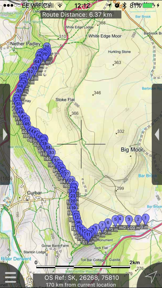
Beautifully detailed maps supplied by Ordnance Survey.
Peak District Maps provides a useful offline mapping reference and navigation aid whilst travelling throughout the Peak District by footpath, road, rail, canal, lake and river. Intuitive route and waypoint management features are implemented enabling creation, modification, deletion, import and export of routes. A powerful offline search facility can locate places, roads, post codes and hills within the region. Worldwide online Apple maps (Standard, Satellite and Hybrid). Map features that you are used to with Apple maps are available on both offline and online maps as well as providing 3D buildings on Apple maps (where available).
Maps
7 different levels of offline 2014/5 Ordnance Survey map detail from national overview to street view within the region. (No data connection required)
Progressively more detailed maps are automatically loaded as the map view is zoomed. The OS recommended viewing scales for the more detailed maps are approximately as follows:
1:1000,000 (Whole of GB is covered)
1:250,000
1:50,000
1:25,000
1:10,000 ( Roads/streets are labelled)
The map region of the more detailed maps covers a rectangular region around the national park boundary (ref. http://jomosolutions.com/Maps)
- Contours with height information and annotated height points
- Extensive footpaths from ©OpenStreetMap contributors
- National Park boundary demarkation
App
- Route/Waypoint management.
- Offline search functionality with searchable locations (places, roads, post codes and hills). (For the place search a location's latitude and longitude is accurate to 0.1 of a minute of the centre point of the 1x1 km National Grid square in which the name falls)
- Detailed hill information, including height, OS Grid Ref, latitude and longitude, region, parent, classification, drop and hill specific links to Streetmap, Geograph and Hill Bagging web sites
- Display of current GPS position as OS Grid Reference or WGS84 latitude and longitude
- "Share My Location" allowing users to share an image of their current location and location references. Buttons are provided to share location information by Facebook, Twitter, iMessage/SMS and e-mail
- Online access to worldwide Apple Standard, Satellite and Hybrid maps
- Apple 3D Buildings are displayed on Apple Standard maps
- Apple maps contain Points of Interest
- User location can be tracked with or without heading on all online and offline maps (GPS capable devices only)
- Display of scale bar in either metric or imperial units
- Display of current speed
- Zoom, pan, rotation of all maps
- Pitch of Apple Standard and Ordnance Survey maps
- Selection of current location annotation for display of speed and location data
- User setting for speed display in Miles per Hour (mph) or Kilometres per Hour (kph)
- Selection of search result pin annotations to display location information
- Collective deletion of search result annotation pins
- A user guide is provided within the app information
The OS search data was published by Ordnance Survey in 2014.
Extracts from "The Database of British and Irish Hills" v14 published 22/04/2014 (ref. http://www.hills-database.co.uk/index.html )
No warranty
The data is supplied by Apple, Ordnance Survey, contributors to OpenStreetMap and Database of British and Irish Hills.
The Information is licensed 'as is' and the Information Provider and/or Licensor excludes all representations, warranties, obligations and liabilities in relation to the Information to the maximum extent permitted by law.
The Information Provider and/or Licensor are not liable for any errors or omissions in the Information and shall not be liable for any loss, injury or damage of any kind caused by its use.
This app is not a substitute for a paper map and compass.
螢幕擷取畫面


新功能
- 版本: 2.1.1
- 發佈日期:
- Fixed intermittent failures within the search functionality.
If you like the app please leave an app review.
價錢
- 今天: $1.99
- 最小值: $1.99
- 最大值: $1.99
追蹤票價
開發人員
- JOMO Solutions Ltd
- 平台: iOS 應用程式 (17)
- 清單: 1 + 1
- 點數: 0 + 16 ¡
- 排名: 0
- 評測: 0
- 折扣: 0
- 影片: 0
- RSS: 訂閱
點數
0 ☹️
排名
0 ☹️
清單
0 ☹️
評測
成為第一個評論 🌟
其他資訊
- 版本: 2.1.1
- 類別 :
iOS 應用程式›地圖與導航 - OS:
Apple Watch,iPad,iPhone,iOS 8.0 以上版本 - 大小:
422 Mb - 支援的語言 :
English - 內容分級:
4+ - App Store 評分:
5.0(1) - 發佈日期:
- 發行日期:
聯絡人
- 🌟 分享
- App Store
你可能還喜歡
-
- Organic Maps: Offline Map
- iOS 應用程式: 地圖與導航 由: Organic Maps
- 免費
- 清單: 1 + 1 排名: 0 評測: 0
- 點數: 3 + 916 (4.8) 版本: 2025.11.26 Organic Maps is a fast, detailed offline map and GPS navigation app for travel, hikes, and rides. Plan, import, and record routes, and enjoy smooth guidance without draining your ... ⥯
-
- Avenza Maps: Offline Mapping
- iOS 應用程式: 地圖與導航 由: Avenza Systems Inc.
- 免費
- 清單: 0 + 1 排名: 0 評測: 0
- 點數: 0 + 122,784 (4.8) 版本: 262 Avenza Maps, #1 app for hiking, biking and all trails. Featuring maps from National Geographic, national parks and more! On your next adventure, stay on track with GPS using offline ... ⥯
-
- Offline GPS Converter
- iOS 應用程式: 地圖與導航 由: Artur Pahasian
- 免費
- 清單: 0 + 0 排名: 0 評測: 0
- 點數: 0 + 1 (3.0) 版本: 1.0 Offline GPS Converter helps you instantly convert geographic coordinates no internet needed. Whether you're a field worker, radio operator, or outdoor enthusiast, this app delivers ... ⥯
-
- Offline gps maps: Mapy.com
- iOS 應用程式: 地圖與導航 由: Seznam.cz a.s.
- 免費
- 清單: 0 + 0 排名: 0 評測: 0
- 點數: 4 + 1,150 (4.8) 版本: 6.61.0 PLAN YOUR ROUTE - hiking and cycling trails - cross-country skiing and ski-alpine trails - unique travel tips feature plans a trip through the most interesting places in the area - ... ⥯
-
- maps.earth
- iOS 應用程式: 地圖與導航 由: Michael Kirk
- 免費
- 清單: 0 + 0 排名: 0 評測: 0
- 點數: 0 + 4 (3.5) 版本: 1.13 Explore the world and get low stress directions powered by OpenStreetMap. maps.earth is built on open source. We never show you ads or sell your data. We just want a nice map. ⥯
-
- Maps My Location
- iOS 應用程式: 地圖與導航 由: Rohit Bhayani
- 免費
- 清單: 0 + 0 排名: 0 評測: 0
- 點數: 0 + 1 (1.0) 版本: 1.0 A Map My Location app for iOS is a software application designed to assist You in navigating from one location to another using the Global Positioning System (GPS) technology. Key ... ⥯
-
- Offline Maps: GPS Tracker GPX
- iOS 應用程式: 地圖與導航 由: SERGEI BEZDENEZHNYKH
- $7.99
- 清單: 2 + 1 排名: 0 評測: 0
- 點數: 23 + 44 (4.7) 版本: 3.3.9 Create, import, export tracks with waypoints. Supports offline maps, no time limits, no ads, no in-app purchases. The main functions of the application: - loading and unlimited storage ⥯
-
- Topo Maps+
- iOS 應用程式: 地圖與導航 由: Glacier Peak Studios LLC
- 免費
- 清單: 0 + 0 排名: 0 評測: 0
- 點數: 0 + 9,029 (4.7) 版本: 9.6.1 Designed and tested on real dirt, Topo Maps+ is packed with the maps & tools to plan and execute your backcountry adventure. MAPS FOR EVERY ACTIVITY Setup your map based on your ... ⥯
-
- Maps 3D PRO - Hike & Bike
- iOS 應用程式: 地圖與導航 由: movingworld GmbH
- $3.99
- 清單: 1 + 4 排名: 0 評測: 0
- 點數: 0 + 202 (4.4) 版本: 6.8 Enjoy exploring the great outdoors? If you re a fan of biking, hiking and running then Maps 3D is the ideal app designed for planning your outdoor adventures. Whereas other mapping ... ⥯
-
- Peak Mileage Expenses
- iOS 應用程式: 地圖與導航 由: Proximitum
- 免費
- 清單: 0 + 0 排名: 0 評測: 0
- 點數: 0 + 0 版本: 2.0.1 Proximitum's Peak Mileage Expenses Solution (PMES) replaces the time-consuming task of manually logging all your journeys so expenses can be claimed. PMES app is free to use and is ... ⥯
-
- Peak - Altimeter GPS Barometer
- iOS 應用程式: 地圖與導航 由: Immaginet Srl
- 免費
- 清單: 0 + 0 排名: 0 評測: 0
- 點數: 4 + 3 (5.0) 版本: 5.16 Altimeter GPS with AI GPS altimeter with AI and Walkie Talkie : uses AI and POIs provided by OpenStreetMaps and weather to give useful information about the context you are in, ... ⥯
-
- Maps TV
- iOS 應用程式: 地圖與導航 由: Anass Damri
- $0.99
- 清單: 0 + 0 排名: 0 評測: 0
- 點數: 0 + 0 版本: 1.0 Transform your TV into a powerful mapping experience with Maps TV - the ultimate navigation app designed specifically for the big screen. KEY FEATURES: Full-Screen Map Experience: ... ⥯
-
- Maps Anywhere: Offline GPS
- iOS 應用程式: 地圖與導航 由: Ali Mert TUFEKCI
- 免費
- 清單: 0 + 0 排名: 0 評測: 0
- 點數: 5 + 2 (5.0) 版本: 1.0.0.8 SecureTrek Maps Anywhere - Stay Oriented in the Wild Every year, thousands of people get lost while trekking or exploring the outdoors due to poor visibility, disorientation, or losing ⥯
-
- Offline Map Navigation
- iOS 應用程式: 地圖與導航 由: VirtualMaze
- 免費
- 清單: 0 + 0 排名: 0 評測: 0
- 點數: 0 + 307 (4.3) 版本: 6.1.8 Search, Get Directions & Navigate anywhere even without internet connection Turn-by-turn route instructions & real-time navigation Find directions for car, motorbike, bicycle or walk ... ⥯