描述
")
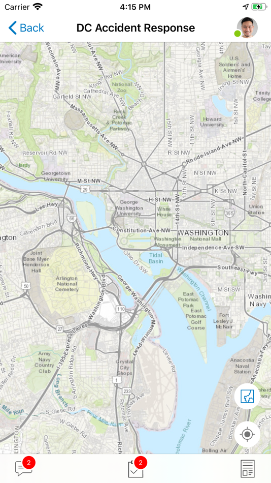
ArcGIS Mission is a focused, tactical situational awareness solution that is fully integrated with Esri’s market leading ArcGIS Enterprise product. ArcGIS Mission allows organizations to create, share, and operate in missions using integrated maps, teams, and other mission related materials like photographs, documents, map products, and other information types. ArcGIS Mission is designed to provide organizations with a real-time view of their common operating picture and provides remote, mobile users with situational understanding to be able to answer the question, “What’s going on around me right now?”.
As the mobile component of ArcGIS Mission, Responder is the mobile app that enables operators to maintain communications and collaboration with their teammates as well as others in support of, and participating in, the mission through real time messaging and reporting.
Key Features:
- Chat messages that allow text, attachments, and sketches (A map markup)
- Secure, protected connection to ArcGIS Enterprise
- View and participate in active missions of ArcGIS Enterprise
- View, interact and explore mission maps, layers and other resources
- Send instant messages to other users, teams and all mission participants
- Receive, view, and respond to user-specific tasks
- Use an optimized report form to create and view reports from the field
- Create simple map sketches to communicate and collaborate with other mission participants
Note: Continued use of GPS running in the background can dramatically decrease battery life.
螢幕擷取畫面


價錢
- 今天: 免費
- 最小值: 免費
- 最大值: 免費
追蹤票價
開發人員
- ESRI
- 平台: Android 應用程式 (26) iOS 應用程式 (30) macOS 應用程式 (1)
- 清單: 0 + 0
- 點數: 1 + 8,588 ¡
- 排名: 0
- 評測: 0
- 折扣: 0
- 影片: 2
- RSS: 訂閱
點數
0 ☹️
排名
0 ☹️
清單
0 ☹️
評測
成為第一個評論 🌟
其他資訊
- 版本: 21.2.2
- ID: com.esri.missionresponder-10-9-1
- 類別 :
iOS 應用程式›生產應用 - OS:
iPad,iPhone,iOS 13.0 以上版本 - 大小:
157 Mb - 支援的語言 :
Arabic,Catalan,Chinese,Croatian,Czech,Danish,Dutch,English,Finnish,French,German,Greek,Hebrew,Hungarian,Indonesian,Italian,Japanese,Korean,Norwegian,Polish,Portuguese,Romanian,Russian,Slovak,Spanish,Swedish,Thai,Turkish,Ukrainian,Vietnamese - 內容分級:
4+ - App Store 評分:
0 - 發佈日期:
- 發行日期:
你可能還喜歡
-
- ArcGIS Responder 11.1
- iOS 應用程式: 生產應用 由: ESRI
- 免費
- 清單: 0 + 0 排名: 0 評測: 0
- 點數: 0 + 0 版本: 23.1 ArcGIS Mission Responder is the mobile app that enables users in the field to participate in active missions as part of Esri s ArcGIS Mission product. ArcGIS Mission is a focused, ... ⥯
-
- AI Routine Assistant Responder
- iOS 應用程式: 生產應用 由: Ruben Avanesov
- 免費
- 清單: 0 + 0 排名: 0 評測: 0
- 點數: 2 + 5 (5.0) 版本: 1.0.23 Do you want to download an app to create quick responses and use them for quick replies? Are you looking for an AI responder that helps you with writing emails and social media ... ⥯
-
- BYO Responder
- iOS 應用程式: 生產應用 由: BYO Buzzer Pte. Ltd.
- * 免費
- 清單: 0 + 0 排名: 0 評測: 0
- 點數: 0 + 0 版本: 1.3.0 We have made it easier for everyone to create your very own contactless call button system. Create your buttons using this BYO Responder app, and then deploy your buttons using either ... ⥯
-
- Control Center Responder
- iOS 應用程式: 生產應用 由: Everbridge, Inc.
- 免費
- 清單: 0 + 0 排名: 0 評測: 0
- 點數: 0 + 0 版本: 1.0.6 Control Center Responder by Everbridge allows security personnel to respond in real-time to threats identified through Everbridge Control Center. ⥯
-
- DLAN Mobile Responder
- iOS 應用程式: 生產應用 由: Buffalo Computer Graphics, Inc.
- 免費
- 清單: 0 + 0 排名: 0 評測: 0
- 點數: 0 + 7 (5.0) 版本: 16.02.04 BCG s Mobile Responder App adds offline functionality, personnel tracking, and quick form entry to our DisasterLAN (DLAN) emergency management software and other BCG software. IDEAL ... ⥯
-
- SimplyHome Responder
- iOS 應用程式: 生產應用 由: SimplyHome LLC
- 免費
- 清單: 0 + 0 排名: 0 評測: 0
- 點數: 0 + 4 (5.0) 版本: 1.6.13 Empower those you care for through technology. The SimplyHome System is an assistive care technology platform that is revolutionizing the way we give care to the aging and disabled ... ⥯
-
- CommandCentral Responder
- iOS 應用程式: 生產應用 由: Motorola Solutions, Inc
- 免費
- 清單: 0 + 0 排名: 0 評測: 0
- 點數: 0 + 17 (4.1) 版本: 1.23.62 Accelerate the front lines with a purpose-built digital experience for first responders that connects the right information, at the right time, to get the job done and keep officers in ⥯
-
- Responserack Responder
- iOS 應用程式: 生產應用 由: Neukadye
- 免費
- 清單: 0 + 0 排名: 0 評測: 0
- 點數: 0 + 0 版本: 1.0.6 Browse and review reports, view upcoming and past events, and access other data. ⥯
-
- The Argis® Lens
- iOS 應用程式: 生產應用 由: Argis Technologies, LLC
- 免費
- 清單: 0 + 0 排名: 0 評測: 0
- 點數: 0 + 2 (5.0) 版本: 3.1.4.2 The Argis® Lens helps field operators overcome the limitations of two-dimensional mapping technology when working with underground assets. This app brings ArcGIS data into the ... ⥯
-
- GIS2AR
- iOS 應用程式: 生產應用 由: VERO ADVANCED SOLUTIONS AND SOFTWARE
- $49.99
- 清單: 0 + 0 排名: 0 評測: 0
- 點數: 5 + 0 版本: 1.0 Give teams in the field the data they need, where and when it matters. - Augmenting visualizations of 3D features from ArcGIS over the real World in Realtime. - Retrieve attribute data ⥯
-
- AI Spy Potholes
- iOS 應用程式: 生產應用 由: AI Spy
- 免費
- 清單: 0 + 0 排名: 0 評測: 0
- 點數: 0 + 0 版本: 1.0 The AI Spy Potholes App leverages image object detection capabilities in a mounted mobile app, to automatically detect road defects in the field and record and transmit road defect ... ⥯
-
- LatLonGO
- iOS 應用程式: 生產應用 由: nfoldROI Pty Ltd
- 免費
- 清單: 0 + 0 排名: 0 評測: 0
- 點數: 0 + 0 版本: 7.1.5 LatLonGO provides users with a system for distributing GIS information seamlessly to any mobile tablet. The simple user interface is ideal for mobile workers who require access to an ... ⥯
-
- Zeno Mobile One
- iOS 應用程式: 生產應用 由: Leica Geosystems AG
- 免費
- 清單: 0 + 0 排名: 0 評測: 0
- 點數: 0 + 2 (3.0) 版本: 2.2 Leica Zeno Mobile One simplifies data collection by providing an intuitive and user-friendly app, meaning surveying tasks can be performed by non-surveying specialists. The app ... ⥯
-
- MyFieldTracker
- iOS 應用程式: 生產應用 由: MyShoppingHelper, LLC
- 免費
- 清單: 0 + 0 排名: 0 評測: 0
- 點數: 0 + 5 (5.0) 版本: 2.30 MyFieldTracker is your frontline for forestry management. - Supports ArcGIS Maps and GeometryArcGIS Support Use your existing ArcGIS map data, including layers, boundaries, and ... ⥯