| Προγραμματιστής: | VisTech.Projects LLC (17) | ||
| Τιμή: | $6.99 | ||
| Κατατάξεις: | 0 | ||
| Κριτικές: | 0 Γράψτε μια κριτική | ||
| Λίστες: | 0 + 1 | ||
| Βαθμοί: | 4 + 482 ¡ | ||
| Βαθμοί + 1 | |||
Περιγραφή
")
This measurement app is useful for outdoor activities and can be used as land surveyor by amateurs and professionals in various industries like sport, farming, landscaping, paving and construction, road building and repairing, real estate business, hiking and travel, fencing, lot building and planning, solar panel installation (roof area estimation), object mapping, lawn design, and many other where land area and distance / length calculations, land survey or maps are involved.
If you have any question about Planimeter and its functionality, please check How To Use Quick Guide:
http://ios.vistechprojects.com/Planimeter_iOS_QuickGuide.pdf
Video Demo:
http://youtu.be/unjYbPCIYM0
http://youtu.be/QQMilHVD5e8
Features:
Accurate distance and area calculation
Metric and Imperial units (m, km, feet, yards, miles, ha, acres)
Angle between lines
Bearings To and From the point
Forth and Back navigation through points by touch on Info Panel
GPS coordinates of a point
GPS accuracy settings (if GPS available)
Manage previously saved projects: open, save, share KML files
KML files created by Planimeter can be imported to GEarth and GMaps to view on a desktop
Send data by email: picture, coordinates as text message, KML file
Save KML or TXT in local storage
Map/Satellite View
Zoom and Edit points
Current location search
Text (address) search
Delete selected/last/all points
Zoom to Fit-in and center points on a screen - quick points search
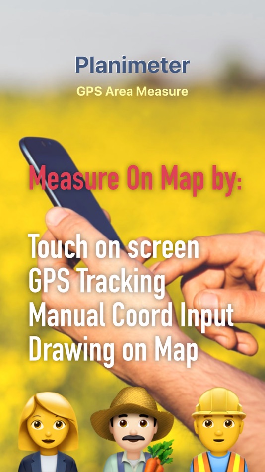
Add points by touch
Add current location as a point
Show location with Latitude and Longitude coordinates
Add points by Geo-coordinates: Lat and Lng
Option to center last point added
Option to show/hide lines
Preferences: location accuracy, tracking time interval, delete points confirmation, sound option for tracking
Separate units settings for distance, area, perimeter
Target Mode for accurate pin placement
Show current coordinates in Target Mode
Stylus Draw Mode
Full-screen option
GPS TRACKING
Manual pin placement in GPS Tracking
The app has been successfully used in different areas:
- outdoor activities: sports, golf (distance between two points or holes), bike tours, trail planning, travelling, quick path measure
- garden and yard: landscape planning, grass cutting, lawn care and mowing, fencing, grass seeding.
- agriculture, poultry and farming: harvesting, fertilizing, crops (corn, wheat, maize, beet, etc.) planning and estimation, field area measure, paddocks and area fencing for cows, horses, chickens, rabbits, etc.
- solar energy: area estimation for solar panels, flat roof area estimation
- construction: land survey, road sealing, parking lot repairing
- forestry: objects and tree mapping, damage area estimation, measure land area
- other: ponds size and are measure; pole lines planning; movement tracking; get exact GPS coordinates of way-points; fence calculation; geocaching.
Note: Continued use of GPS running in the background can dramatically decrease battery life.
If you like the app and find it useful please support us with your feedback and comment.
Feel free to contact support@vistechprojects.com with any questions, comments or bug reports.
Στιγμιότυπα οθόνης


βίντεο
Τι νέο υπάρχει
- Εκδοχή: 2.1.14
- Ενημερώθηκε:
- - settings to hide notes in the Note mode for better pins placement
- improvements in PDF report
- stability improvements
Τιμή
- Σήμερα: $6.99
- Ελάχιστο: Δωρεάν
- Μέγιστο: $9.99
Παρακολούθηση τιμών
Προγραμματιστής
- VisTech.Projects LLC
- Πλατφόρμες: iOS Εφαρμογές (17)
- Λίστες: 2 + 3
- Βαθμοί: 54 + 1,004 ¡
- Κατατάξεις: 0
- Κριτικές: 0
- Εκπτώσεις: 0
- Βίντεο: 3
- RSS: Εγγραφή
Βαθμοί
-

- 20 U
-
- 2,476 Johonson
-
- 655 holy_braveheart
-
- 246 nicolas


Κατατάξεις
Δεν βρέθηκε ☹️
Λίστες
Δεν βρέθηκε ☹️
Κριτικές
Γίνε ο πρώτος που θα αξιολογήσει!
Πρόσθετες πληροφορίες
- Κατηγορία:
iOS Εφαρμογές›Παραγωγικότητα - Λειτουργικό σύστημα:
iPad,iPhone,iOS 10.0 και νεότερες εκδόσεις - Μέγεθος:
15 Mb - Υποστηριζόμενη γλώσσα:
English - Αξιολόγηση περιεχομένου:
4+ - App Store Εκτίμηση:
4.2(482) - Ενημερώθηκε:
- Ημερομηνία έκδοσης:
Επαφές
- Ιστοσελίδα:
 https://www.vistechprojects.com/
Μπορεί επίσης να σας αρέσει
-
- Field Area MeasureーLand Parcel
- iOS Εφαρμογές: Παραγωγικότητα Με: Irina Metelkina
- * Δωρεάν
- Λίστες: 0 + 0 Κατατάξεις: 0 Κριτικές: 0
- Βαθμοί: 0 + 220 Εκδοχή: 1.5 The area measurement app helps you to measure areas of any size. The app has 4 options of measurement: - Measurement on the map allows you to get the rough size of the field or another
-
- Planimeter — Measure Land Area
- iOS Εφαρμογές: Παραγωγικότητα Με: Core Signals
- $7.99
- Λίστες: 1 + 1 Κατατάξεις: 0 Κριτικές: 0
- Βαθμοί: 1 + 2,075 Εκδοχή: 4.3 Planimeter measures distances and land areas on maps. Measure your outdoor projects - lawns, fences, paving, or anything else visible on the satellite map. Quickly measure lot sizes ...
-
- GPS Trackit Cloud
- iOS Εφαρμογές: Παραγωγικότητα Με: Nimbo Labs
- Δωρεάν
- Λίστες: 0 + 0 Κατατάξεις: 0 Κριτικές: 0
- Βαθμοί: 0 + 18 Εκδοχή: 2.0.33 GPS Trackit Cloud allows registered users of our fleet management platform to track any vehicle on their account from a mobile device. Our easy-to-use interface gives you access to the
-
- GPS Measure - Area & Length
- iOS Εφαρμογές: Παραγωγικότητα Με: Arthur Eduardo Skaetta Alvarez Desenvolvimento de Software LTDA.
- * Δωρεάν
- Λίστες: 1 + 0 Κατατάξεις: 0 Κριτικές: 0
- Βαθμοί: 2 + 189 Εκδοχή: 1.0.149 Have you ever needed to measure a terrain or extract it's area? GPS Measure allows you to easily take accurate distance and area measurements using satellite images so you don't need ...
-
- Measure App - 10 Tools to Go
- iOS Εφαρμογές: Παραγωγικότητα Με: Jens Rieckhof
- * Δωρεάν
- Λίστες: 0 + 0 Κατατάξεις: 0 Κριτικές: 0
- Βαθμοί: 0 + 35 Εκδοχή: 3.06 Multitool is the toolbox with the most precise and essential tools for your iPhone or iPad! 10 Super-accurate Professional Measurement Tools: All in one app The toolbox ready for your ...
- Νέα
- GPS Any Go - Change GPS Exif
- iOS Εφαρμογές: Παραγωγικότητα Με: QME Corporation
- * Δωρεάν
- Λίστες: 0 + 0 Κατατάξεις: 0 Κριτικές: 0
- Βαθμοί: 0 + 18 Εκδοχή: 2.506 Unleash the potential of your photos with GPS Any Go. Key Features: - Change GPS Exif Data: Seamlessly modify location information in your photos with our intuitive iOS tool. Whether ...
-
- Fields Area Measurement
- iOS Εφαρμογές: Παραγωγικότητα Με: Bhavik Savaliya
- * Δωρεάν
- Λίστες: 0 + 0 Κατατάξεις: 0 Κριτικές: 0
- Βαθμοί: 0 + 357 Εκδοχή: 3.1 Fields area Measure is a smart tool for measuring areas on the map. Once you place your points on the map and then calculate area between all point. you can also calculate total Area ...
-
- Distance Measure, GPS Camera
- iOS Εφαρμογές: Παραγωγικότητα Με: Pravin Gondaliya
- * Δωρεάν
- Λίστες: 0 + 0 Κατατάξεις: 0 Κριτικές: 0
- Βαθμοί: 1 + 766 Εκδοχή: 4.0 GPS Area Measurements is a free GPS voice navigation app to find the fastest route anywhere in the world. Using measurement you can find actual measures. The GPS Area Measurements app ...
-
- Tape Measure Camera AR Ruler
- iOS Εφαρμογές: Παραγωγικότητα Με: Christian Neubauer
- * Δωρεάν
- Λίστες: 0 + 0 Κατατάξεις: 0 Κριτικές: 0
- Βαθμοί: 1 + 760 Εκδοχή: 2.62 Easily measure the floor area of rooms with our completely rewritten 'AR Tape Measure Camera' app or measure dimensions like height, length, width, size, rectangular areas and distance
-
- Tape Measure: AR Measuring
- iOS Εφαρμογές: Παραγωγικότητα Με: Fuentech Company Limited
- Δωρεάν
- Λίστες: 0 + 0 Κατατάξεις: 0 Κριτικές: 0
- Βαθμοί: 1 + 47 Εκδοχή: 1.6 Tape Measure: AR Measuring app is a smart and easy to use electronic ruler that delivers the same accurate and precise results as a traditional measuring tool. Measure objects or ...
-
- Land Measure Pro
- iOS Εφαρμογές: Παραγωγικότητα Με: Pendlebury Software LLC
- $1.99
- Λίστες: 0 + 1 Κατατάξεις: 0 Κριτικές: 0
- Βαθμοί: 0 + 21 Εκδοχή: 2.8 Measure area, lengths and angles on a map. Using an interactive cross hair you can trace the outline of any feature visible on the map, creating a series of connected points the area ...
-
- AR Ruler 3d: Tape Measure App
- iOS Εφαρμογές: Παραγωγικότητα Με: Grymala sp. z o.o.
- * Δωρεάν
- Λίστες: 0 + 0 Κατατάξεις: 0 Κριτικές: 0
- Βαθμοί: 2 + 825 Εκδοχή: 2.0.3 AR Ruler measurement app uses AR technology. Using the measuring app, you can measure a room and the height of walls, estimate the distance in meters, determine the area and the scale ...
-
- 3D Snap: Tape Measure & Ruler
- iOS Εφαρμογές: Παραγωγικότητα Με: BPMobile
- * Δωρεάν
- Λίστες: 0 + 0 Κατατάξεις: 0 Κριτικές: 0
- Βαθμοί: 0 + 90 Εκδοχή: 1.4 Do it the smart way, not the hard way! Making a room plan and taking measurements has never been easier. Whether you re a real estate agent or want to remodel your kitchen, you can ...
-
- My GPS Coordinates
- iOS Εφαρμογές: Παραγωγικότητα Με: TappiApps
- Δωρεάν
- Λίστες: 0 + 0 Κατατάξεις: 0 Κριτικές: 0
- Βαθμοί: 0 + 58 Εκδοχή: 2.16 Easily share your GPS location via email, text messaging, Twitter, Facebook, WhatsApp, etc. The recipient receives a link to an online map with your position on it. Please note that ...
Μπορεί επίσης να σας αρέσει
- iOS Εφαρμογές
- Νέο iOS Εφαρμογές
- Παραγωγικότητα iOS Εφαρμογές : Νέο
- Βίντεο iOS Εφαρμογές
- Δημοφιλές iOS Εφαρμογές
- Παραγωγικότητα iOS Εφαρμογές : Δημοφιλές
- Εκπτώσεις iOS Εφαρμογές
- Παραγωγικότητα iOS Εφαρμογές : Εκπτώσεις
- Κατατάξεις iOS Εφαρμογές
- Κριτικές iOS Εφαρμογές
- Λίστες iOS Εφαρμογές
- Βαθμοί iOS Εφαρμογές