| Geliştirici: | HAN WEI WANG (15) | ||
| Fiyat: | Ücretsiz | ||
| Sıralamalar: | 0 | ||
| Yorumlar: | 0 Yorum Yazın | ||
| Listeler: | 0 + 0 | ||
| Puanlar: | 0 + 3 (3.7) ¡ | ||
| App Store | |||
Açıklama
")
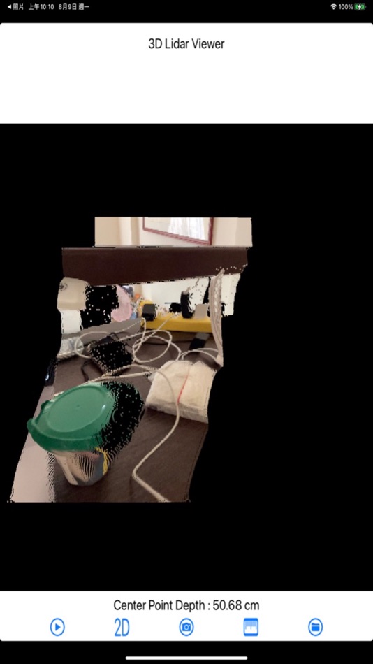
Press bottom button to stop/start image update from LiDAR.
This application only suitable for iOS device with LiDAR! (For example: iPad Pro or iPhone Pro)
Ekran görüntüleri


Yenilikler
- Sürüm: 2.1
- Güncellendi:
- Show unsupported messages for devices that do not have LiDAR capabilities.
Fiyat
- Bugün: Ücretsiz
- En az: Ücretsiz
- Maksimum: Ücretsiz
Fiyatları takip et
Geliştirici
- HAN WEI WANG
- Platformlar: iOS Uygulamalar (15)
- Listeler: 0 + 0
- Puanlar: 0 + 25 ¡
- Sıralamalar: 0
- Yorumlar: 0
- İndirimler: 0
- Video: 0
- RSS: Abone ol
Puanlar
0 ☹️
Sıralamalar
0 ☹️
Listeler
0 ☹️
Yorumlar
İnceleme yazan ilk kişi siz olun 🌟
Ek Bilgi
- Sürüm: 2.1
- ID: com.hereyouare.3DLidarViewer
- Kategori:
iOS Uygulamalar›Kamu hizmetleri - İşletim Sistemleri:
iPad,iPhone,iOS 15.6 ve sonrası - Boyut:
4 Mb - Desteklenen diller:
English - İçerik Derecelendirmesi:
4+ - App Store Kullanıcı Oyu:
3.7(3) - Güncellendi:
- Satışa çıkış tarihi:
Kişiler
- Web sitesi:
 http://hereyouare1981.blogspot.com
Şunları da beğenebilirsiniz
-
- 3D File Viewer: OBJ STP & more
- iOS Uygulamalar: Kamu hizmetleri Göre: Andeesh Mehdi Syed
- Ücretsiz
- Listeler: 0 + 0 Sıralamalar: 0 Yorumlar: 0
- Puanlar: 0 + 17 (4.4) Sürüm: 1.1 3D File Viewer is the easiest way to open and view 3D model files on your iPhone or iPad. Whether you're a designer, engineer, architect, or student, this app helps you explore 3D ... ⥯
-
- 3D Model Viewer - eZWalker
- iOS Uygulamalar: Kamu hizmetleri Göre: DMS Corporation Co., Ltd.
- Ücretsiz
- Listeler: 0 + 0 Sıralamalar: 0 Yorumlar: 0
- Puanlar: 0 + 2 (3.0) Sürüm: 1.0.6 Why eZWalker? Welcome to eZWalker: A Powerful 3D Model Viewer and an Asset Management Cloud Platform, the practical, everyday solution for engineering and construction experts. Drive ... ⥯
-
- 3D LiDAR Scanner
- iOS Uygulamalar: Kamu hizmetleri Göre: Evgeny Zhukov
- Ücretsiz
- Listeler: 0 + 0 Sıralamalar: 0 Yorumlar: 0
- Puanlar: 0 + 76 (4.6) Sürüm: 2.0.2 Turn the Real World into 3D with LiDAR Unlock the power of your device s LiDAR sensor to capture and create stunning 3D models in seconds. Whether you're scanning an object or your ... ⥯
-
- RTAB-Map - 3D LiDAR Scanner
- iOS Uygulamalar: Kamu hizmetleri Göre: Mathieu Labbe
- Ücretsiz
- Listeler: 0 + 0 Sıralamalar: 0 Yorumlar: 0
- Puanlar: 0 + 34 (4.7) Sürüm: 0.22.0 RTAB-Map (Real-Time Appearance-Based Mapping) is an Open Source LiDAR / RGB-D / Stereo Graph-Based SLAM (Simultaneous Localization and Mapping) approach based on an online incremental ... ⥯
-
- AR Capture - 3D LiDAR Scan
- iOS Uygulamalar: Kamu hizmetleri Göre: Baptiste DAJON
- $2.99
- Listeler: 0 + 0 Sıralamalar: 0 Yorumlar: 0
- Puanlar: 0 + 0 Sürüm: 1.2.0 Bring real-world objects into the digital world with Object Capture, the ultimate tool for generating accurate 3D models using your iPhone or iPad s LiDAR sensor. Whether you re a ... ⥯
-
- Emb3D 3D Model Viewer
- iOS Uygulamalar: Kamu hizmetleri Göre: Netfarm s.r.l.
- Ücretsiz
- Listeler: 0 + 0 Sıralamalar: 0 Yorumlar: 0
- Puanlar: 0 + 245 (4.4) Sürüm: 2041 Emb3D will let you use the most appropriate visual clues and rendering styles to fully show the potential of your creations - High Performance Rendering - Intuitive Gestures - Multiple ⥯
-
- 3D Room Scanner & Modeling AI
- iOS Uygulamalar: Kamu hizmetleri Göre: Starhive Concept Srl
- Ücretsiz
- Listeler: 0 + 0 Sıralamalar: 0 Yorumlar: 0
- Puanlar: 1 + 55 (4.6) Sürüm: 3.00 Scan, measure, save and export rooms for free. Get precise measurements and 3D imagery. Must-have LiDAR room scanner app to easily manage projects. Scan and measure rooms, then create ... ⥯
-
- Artisans 3D SoundKit
- iOS Uygulamalar: Kamu hizmetleri Göre: Artisans 3D EOOD
- Ücretsiz
- Listeler: 0 + 0 Sıralamalar: 0 Yorumlar: 0
- Puanlar: 0 + 0 Sürüm: 1.0 A versatile toolkit for musicians, creators, and audio enthusiasts. Artisans 3D SoundKit brings together a powerful set of audio tools in one clean, intuitive app. Whether you're ... ⥯
-
- Lidar Scan Interior
- iOS Uygulamalar: Kamu hizmetleri Göre: NANO ELECTRONICS RESEARCH MUHENDISLIK ARASTIRMA GELISTIRME LIMITED SIRKETI
- Ücretsiz
- Listeler: 0 + 0 Sıralamalar: 0 Yorumlar: 0
- Puanlar: 8 + 0 Sürüm: 1.1 Lidar Scan Interior App is a professional tool for scanning interior area of places such as rooms and buildings and generating 3D floor plan. It utilizes Apple RoomPlan as well as its ... ⥯
-
- LiDAR View
- iOS Uygulamalar: Kamu hizmetleri Göre: HAN WEI WANG
- Ücretsiz
- Listeler: 0 + 0 Sıralamalar: 0 Yorumlar: 0
- Puanlar: 0 + 12 (4.0) Sürüm: 2.1 LiDAR View provides a real-time image display of both LiDAR and camera outputs. Users can select images from either the LiDAR, the camera, or a combination of both. - When choosing an ... ⥯
-
- LiDAR Pointer
- iOS Uygulamalar: Kamu hizmetleri Göre: Goldgewicht Consulting
- Ücretsiz
- Listeler: 0 + 0 Sıralamalar: 0 Yorumlar: 0
- Puanlar: 0 + 8 (3.3) Sürüm: 1.2 LiDAR Pointer can perform the following functions: - Measuring distance between your device and a surface; - Indicating the angle of inclination of your device; - Obtaining oral ... ⥯
-
- 3d modeling-Design 3d Sculpt
- iOS Uygulamalar: Kamu hizmetleri Göre: 施皓 王
- Ücretsiz
- Listeler: 0 + 0 Sıralamalar: 0 Yorumlar: 0
- Puanlar: 1 + 3 (4.0) Sürüm: 1.2 3D Modeling Pro offers AI-powered generation, material editing, camera scanning import, and complete modeling workflow with multilingual support and community sharing features for ... ⥯
-
- 3D Configurator
- iOS Uygulamalar: Kamu hizmetleri Göre: B.PRO GmbH
- Ücretsiz
- Listeler: 0 + 0 Sıralamalar: 0 Yorumlar: 0
- Puanlar: 0 + 0 Sürüm: 2.1.2 3D Configurator Configure your product to your precise preferences and requirements. Choose between equipment variants, combine products and configure them individually to your tasks ... ⥯
-
- 3D地球-satellite and 3D terrain
- iOS Uygulamalar: Kamu hizmetleri Göre: 家会 黎
- Ücretsiz
- Listeler: 0 + 0 Sıralamalar: 0 Yorumlar: 0
- Puanlar: 0 + 3 (3.7) Sürüm: 2.7 3D Earth is a global satellite mapping software that integrates terrain, contour lines, geographic measurements, markers, altitude, compass, and more. Here, you can view real-time ... ⥯