
已儲存
選擇要顯示在你的已儲存選單中的名稱。
完成!
| 開發人員: | Kalimex-Consulting s.r.o. @Blocoware & Stanislav Dvoychenko (5) | ||
| 價錢: | 免費 | ||
| 評價: | 37,300 傳奇 | ||
| 排名: | 0 | ||
| 註釋: | 0 發表評論 | ||
| 清單: | 1 + 1 | ||
| 點數: | 1 + 2,683 (4.7) ¡ | ||
| +1 點數 | |||
描述

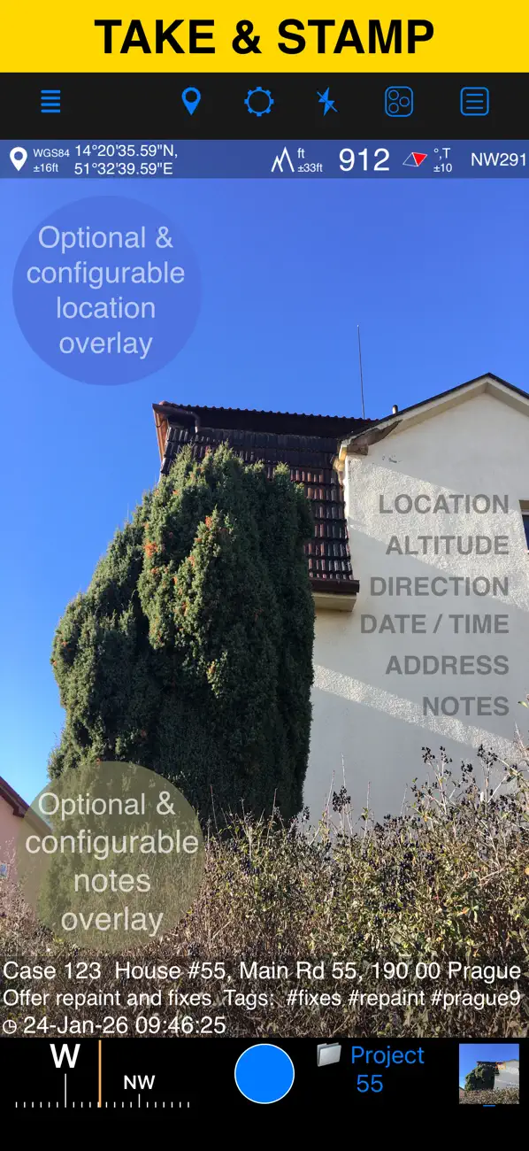
LOCATION OVERLAY
Supports decimal, DM, DMS, UTM, and MGRS coordinate formats.
True or magnetic heading, in degrees or mils.
Accuracy and altitude in feet or meters.
CAMERA AND CAPTURE SETTINGS
Save photos automatically or open in preview to annotate before saving.
Option to save a copy to the photo library — original, stamped, or both.
ANNOTATE AND COMMENT
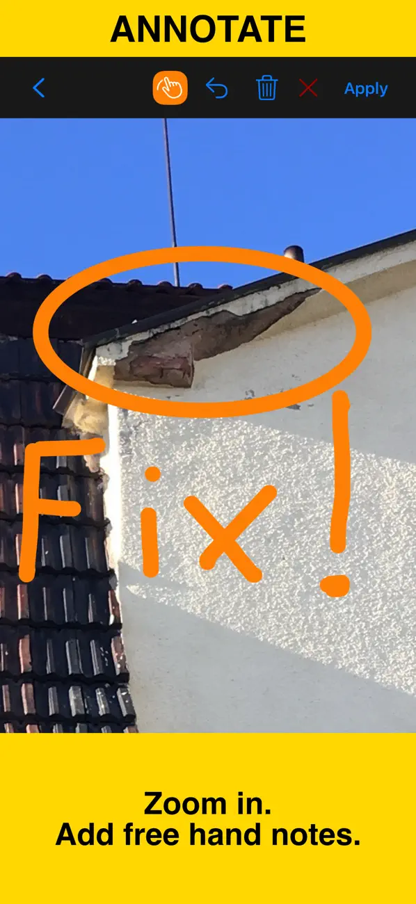
Before or after saving, zoom in/out and draw directly on the photo using your finger or Apple Pencil.
Crop, resize, rotate, or tilt the photo before or after saving.
Notes overlay supports Title, Note, Tags/Folder, and Address.
Address can be auto-filled from GPS or entered manually.
Edit notes and add annotations later (MENU > POINTS > tap an image).
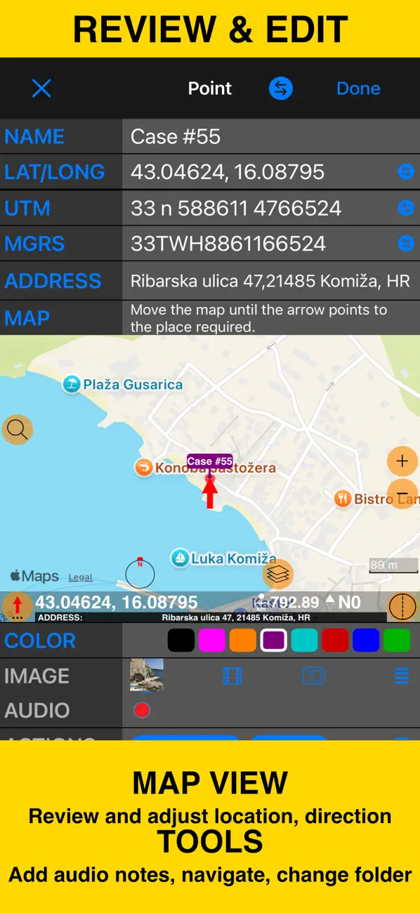
Tapping a point row opens the editor, where you can add an audio note.
Timestamp support many formats and languages.
Scan QR codes, barcodes, or text and use the result for the title or note field.
WATERMARK
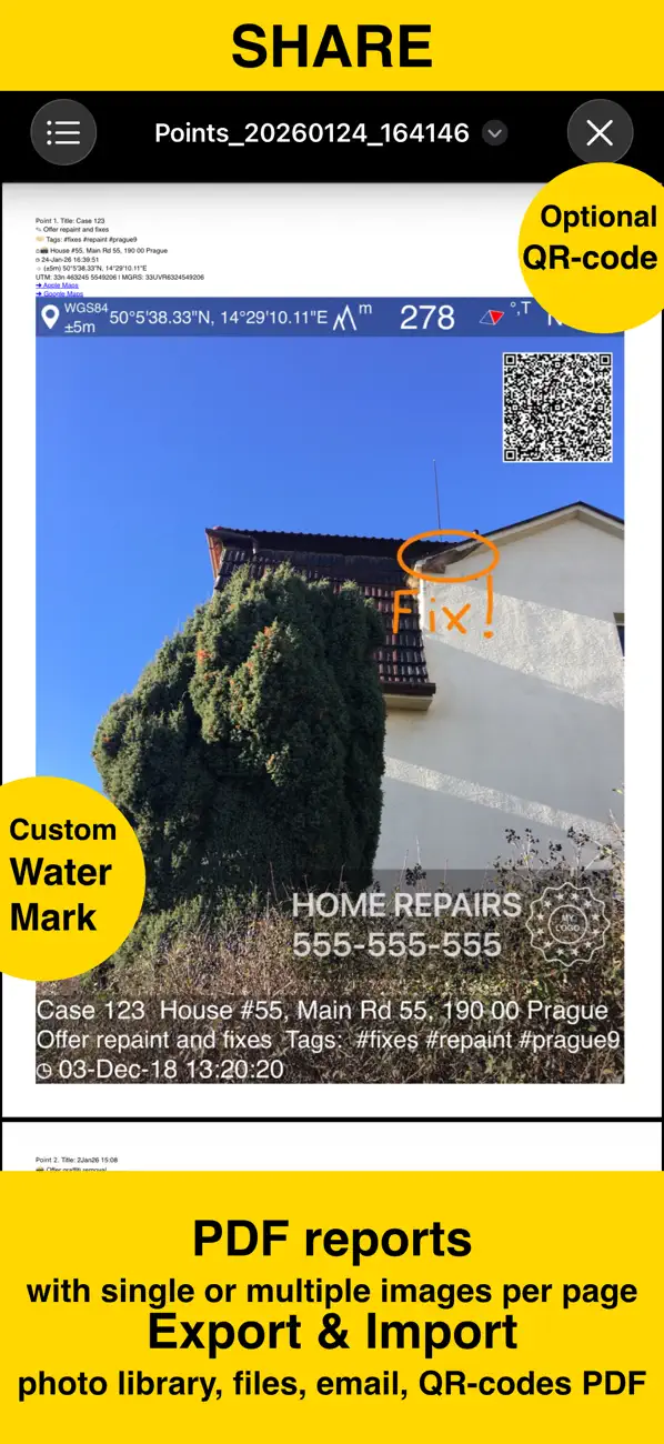
The Pro Pack upgrade removes the basic version watermark and allows you to set up a watermark with your own image, text, and colors, if needed.
SHARE AND EXCHANGE
Share multiple points via MENU > POINTS, or entire collections via MENU > POINT COLLECTIONS.
Images can be shared with or without location/notes text, and with or without overlays.
Photo filenames can include title, note, address, tags/folder name, collection, coordinates, altitude, heading, or capture date.
To transfer complete points and images to another device, use KMZ (Google Earth archive) — includes photos, notes, annotations, and audio.
PDF REPORTS
Generate and share PDF documents for the selected photos/points or whole collection/folder, with options for the number of images per page and photo descriptions.
ORGANIZE, SEARCH & SORT
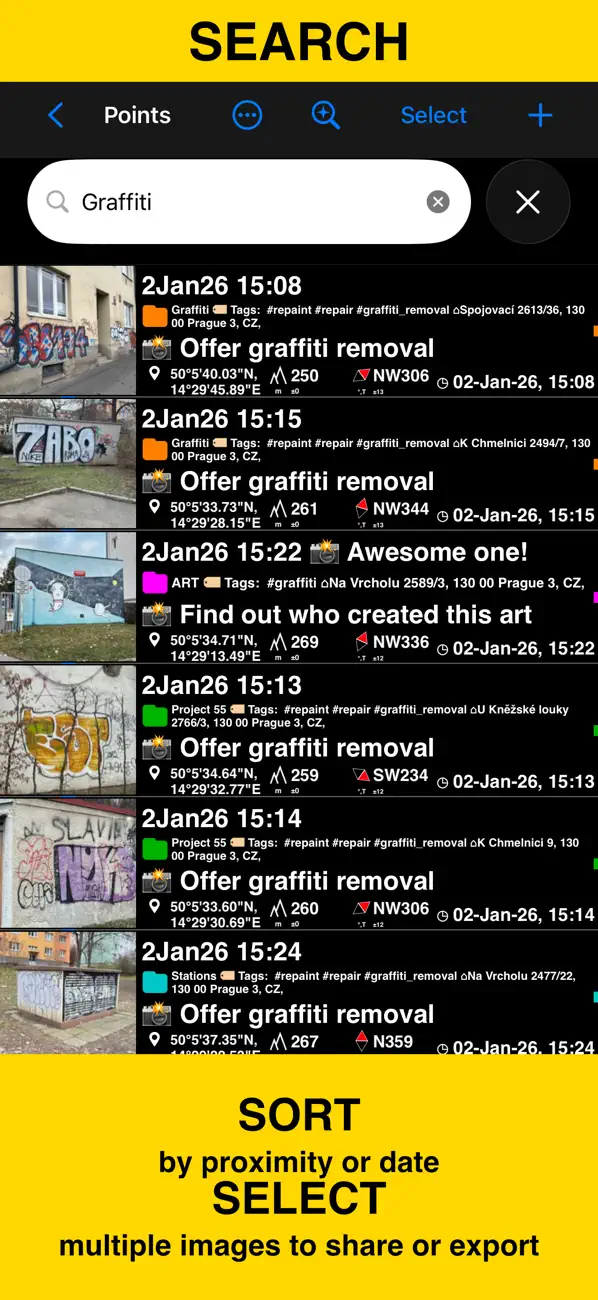
You can organize images into collections/folders. Existing images/points can be moved between collections.
The MENU > POINTS screen enables you to search by point/image notes, address, or tags fields, filter by creation month, sort by proximity, or show points/images only for a specific collection.
IMPORT
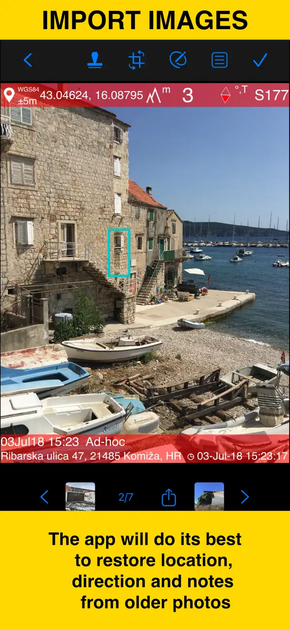
MENU > IMPORT FROM LIBRARY will allow you to pick and import a photo from the photo library. The app will do its best to parse TIFF/EXIF/GPS/IPTC data in the photo to restore location, direction, and notes for the stamp.
NAVIGATE
You can navigate to a point/image by opening it via MENU > POINTS and using the Navigate button in the point editor screen.
MAP VIEW
An image/point’s location on a map can be reviewed by tapping on the MAP button in the point editor screen (MENU > POINTS > tap on a point row).
== PRO PACK UPGRADE ==
You can do a lot with the basic functions in the app. The PRO PACK upgrade adds:
- Ability to create additional point/image collections.
- Enables sharing of more than 5 points/images at once.
- Export/import capabilities — in particular, KMZ export/import enables transfer of collections or selected waypoints between devices.
- Ability to save hand-drawn annotations for the image.
- Crop, resize, rotate, or tilt the photo before or after saving.
- Extra protection of your work and privacy with PIN code or biometric-based access options.
- Removes the basic version watermark and allows you to apply a custom watermark with your image, text, and colors.
Terms of Use: https://www.apple.com/legal/internet-services/itunes/dev/stdeula/
螢幕擷取畫面
Ad
價格歷史
- 目前價格: 免費
- 最小值: 免費
- 最大值: 免費
追蹤票價
AppAgg 評價
37,300
AppAgg 預估評價:
GPS Camera 55. Field Survey
37,300 傳奇
評價越高,通常代表在 AppAgg 上的信號越強。
基於: 人氣 · 使用者評分 · 新鮮度 · 優惠 · 商店資料 · 社群活躍度
根據最新 AppAgg 資料每日重新計算。
縮短網址: 已複製!
新功能
- 版本: 5.1.1
- 最後更新:
- ■ Improved toolbars for compact screens on iOS 26
‣ Paint and selection tools now stay within easy reach on very narrow iPhone layouts and small iPad app windows. They move to the bottom toolbar instead of being tucked away in an overflow menu, making drawing, selecting, and applying changes faster on iOS 26 and iPadOS 26.
‣ Camera and preview actions now also have clear names when iOS 26 places them in the overflow menu, so Save, Notes, Drawing tools, Crop, Flash, Settings, and camera switching remain easy to find.
‣ Huge thanks to Ed for reporting the compact-screen toolbar issue and sharing screenshots.
Don't miss the major version updates:
■ Draw More Freely
‣ Add double-headed arrows, dimension lines, and text labels to call out details more clearly.
‣ You’re no longer limited to 8 fixed colors. Choose your own stroke and fill colors to match your style and needs.
‣ Adjust stroke and fill transparency separately for clearer overlays.
■ Edit Drawings Later
‣ Starting with version 5.1, drawings are saved in photo metadata instead of being baked into the saved photo, so you can select, edit, or delete them later.
‣ Use the new arrow button in the paint toolbar to enter selection mode.
‣ Tap a drawing’s border to select it, then use the Style button to change stroke, fill, transparency, or colors.
‣ Use the Text button to attach text to a drawing or edit the attached text.
‣ The trash button in the paint toolbar now removes all drawings, letting you return to the photo without drawings. If the photo was cropped or resized, the result is the cropped or resized photo, not the original uncropped image.
■ Share and Restore More Reliably
‣ Photos can still be shared with drawings applied, with or without location and note stamps, just like before.
‣ KMZ export still supports the previous presentation-style option that exports photos with drawings applied.
‣ A new KMZ export option now includes both the rendered photo and the original image with drawing metadata, so imports can restore your drawings for later editing.
‣ Please note: this rework only applies to drawings created in version 5.1 and later.
■ Quality of Life Improvements
‣ The automatically resolved address shown in the camera viewfinder now displays a warning indicator when the address is stale or when address resolution failed.
‣ Fixed the HTML formatting warning shown in Google Earth for Mac and PC when opening exported photo popups.
Loving the app? Your rating makes a huge difference. Please take a moment to leave one — it means the world to us!
其他資訊
開發人員
- Kalimex-Consulting s.r.o. @Blocoware & Stanislav Dvoychenko
- 平台: iOS 應用程式 (5)
- 清單: 2 + 1
- 點數: 4 + 4,847 ¡
- 排名: 0
- 註釋: 0
- 折扣: 0
- 影片: 0
- RSS: 訂閱

點數 (1)
-

- 30,855 Lance Eliakim Sotto
- +1

排名 (0)
0
註釋 (0)
成為第一個發表評論的人
簡要
GPS Camera 55. Field Survey 縮短網址: 已複製!- 分享
- App Store
«GPS Camera 55. Field Survey». 平台: iOS. 類別: 地圖與導航. 開發商: «Kalimex-Consulting s.r.o. @Blocoware & Stanislav Dvoychenko». 首次發布: . 最後更新: . 目前價格: 免費. 此項目尚未在 AppAgg 上獲得評分或評論。 列表: 公開: 1, 私人: 1. 追蹤點: 已確認: 1, 間接: 2,683. 商店: App Store. 店家評價: 4.7. 投票數: 2,683. 可用語言: Chinese, English, French, German, Japanese, Korean, Polish, Portuguese, Russian, Spanish, Turkish. AppAgg 會追蹤 «GPS Camera 55. Field Survey»的價格歷史、評分和用戶回饋。 AppAgg 不託管應用程式或分發軟體。 所有商標、標誌和螢幕截圖均屬於其各自所有者。 關注未來折扣和更新: RSS
類似
-
- GPS Speedometer: Speed Tracker
- iOS 應用程式: 地圖與導航 由: Mikhail Nikitsin
- 免費
- 清單: 0 0 0
- 點數: 0 + 5,424 26K · 白金 版本: 1.8.0 GPS Speedometer is the most elegant and unique combination of speedometer and trip computer in one application. Just start the application and it will automatically record your speed, ...
-
- GPS Navigation - Live Traffic
- iOS 應用程式: 地圖與導航 由: Akhil Dholariya
- 免費
- 清單: 0 0 0
- 點數: 0 + 273 21K · 白金 版本: 2.0 GPS Navigation - Live Traffic App is a powerful and user-friendly tool designed to assist individuals in navigating their way through various locations with precision and ease. Best ...
-
- GPS & Maps: Location Tracker
- iOS 應用程式: 地圖與導航 由: Kraus und Karnath GbR 2Kit Consulting
- 免費
- 清單: 1 0 0
- 點數: 2 + 2,236 30K · 白金 版本: 4.3 GPS & Maps is a simple, yet powerful GPS app for supporting navigation and outdoor activities like geocaching, sailing, skating, trekking, biking or traveling by airplane. It measures ...
-
- GPS Navigation & Live Map
- iOS 應用程式: 地圖與導航 由: Amit Lakhani
- 免費
- 清單: 0 0 0
- 點數: 0 + 550 23K · 白金 版本: 2.8 GPS Navigation with voice navigation, live map, traffic, offline Gps & direction. GPS Navigation with voice navigation, live map, traffic, offline Gps & direction. Map GPS navigation ...
-
- GPS Speedometer HUD - SpeedAce
- iOS 應用程式: 地圖與導航 由: Changsha Liangchao Technology Co., Ltd.
- 免費
- 清單: 0 0 0
- 點數: 0 + 586 29K · 白金 版本: 1.4.8 GPS Speedometer is a comprehensive speed measurement application that integrates vehicle, bicycle, and running speed measurement. It aims to provide you with accurate real-time speed, ...
-
- GPS Data Smart
- iOS 應用程式: 地圖與導航 由: ExaMobile S.A.
- 免費
- 清單: 0 0 0
- 點數: 0 + 397 33K · 白金 版本: 2.0 GPS Data app - you can check any necessary GPS data. If you like sports, mountaineering, journey, running you can use it to check your results or external parameters like speed, ...
-
- GPS Joystick: Location Changer
- iOS 應用程式: 地圖與導航 由: Huong Thuy
- 免費
- 清單: 0 0 0
- 點數: 0 + 451 11K · 黃金 版本: 1.0.1 GPS Joystick: Location Changer is a powerful app designed to enhance your travel and photography experience. With our GPS EXIF Editor tool, you can easily modify the GPS metadata of ...
-
- GPS Data – Coordinates & Speed
- iOS 應用程式: 地圖與導航 由: Oscar Fawkes
- 免費
- 清單: 0 0 0
- 點數: 0 + 460 19K · 白金 版本: 2.1.0 GPS Data delivers all of the current location information available from your device, including GPS, compass, and barometer data. GPS Data displays the following information, in an ...
-
- GPS Tracks
- iOS 應用程式: 地圖與導航 由: David Morneault
- 免費
- 清單: 5 + 2 0 0
- 點數: 10 + 17,132 48K · 傳奇 版本: 5.1.1 "One of the better GPS apps for sporting enthusiasts for the iPhone..." - Bryan Wolfe, AppAdvice.com Do you want to track your hiking, biking, walking, running? Do you want to track ...
-
- GPS Navigation Offline
- iOS 應用程式: 地圖與導航 由: Alexander Deplov
- 免費
- 清單: 3 + 4 5 (1) 0
- 點數: 33 + 2,886 56K · 傳奇 版本: 3.0.12 Best New Navigation Apps Apple It s the compass reinvented with walking directions, navigational bookmarks, and a simple parked-car locator, all in a friendly design. App Store Editor ...
-
- GPS Speedometer, Speed Tracker
- iOS 應用程式: 地圖與導航 由: Nikhil Kumar
- 免費
- 清單: 0 0 0
- 點數: 0 + 24,898 49K · 傳奇 版本: 6.0.0 Track your speed with GPS accuracy using the ultimate GPS Speedometer & Odometer app. Whether you re driving a car, riding a bike, or hauling with a truck, this speed tracker gives you
-
- GPS Speedometer MPH Tracker
- iOS 應用程式: 地圖與導航 由: BITHAUS.TECH, UNIPESSOAL LDA
- 免費
- 清單: 0 0 0
- 點數: 1 + 12,806 41K · 傳奇 版本: 8.0.14 Transform every journey into valuable data with GPS Speedometer - the most comprehensive speed tracking app for driving, cycling, boating, and beyond. Experience professional-grade ...
-
- GPS Tracker: Offline Maps, GPX
- iOS 應用程式: 地圖與導航 由: SERGEI BEZDENEZHNYKH
- 免費
- 清單: 2 + 2 0 0
- 點數: 15 + 561 38K · 傳奇 版本: 5.3.3 Create, record, import, and export GPX tracks and waypoints. The app supports offline maps, background track recording, contains no ads, and is suitable for everything from everyday ...
-
- GPS App - Find family, friends
- iOS 應用程式: 地圖與導航 由: Shubham Kumar
- 免費
- 清單: 0 0 0
- 點數: 1 + 6,808 28K · 白金 版本: 4.0.6 Welcome to the all-in-one GPS App! Enjoy modern, advanced tools that go beyond a basic GPS phone tracker. GPS App! allows you to easily share your real-time location or locate friends ...