| ผู้พัฒนา: | applicality (6) | ||
| ราคา: | * ฟรี | ||
| การจัดอันดับ: | 0 | ||
| ความเห็น: | 0 เขียนความเห็น | ||
| ความเห็น: | 0 โพสต์ความคิดเห็น | ||
| รายการ: | 0 + 0 | ||
| แต้มแล: | 0 + 0 ¡ | ||
| Google Play | |||
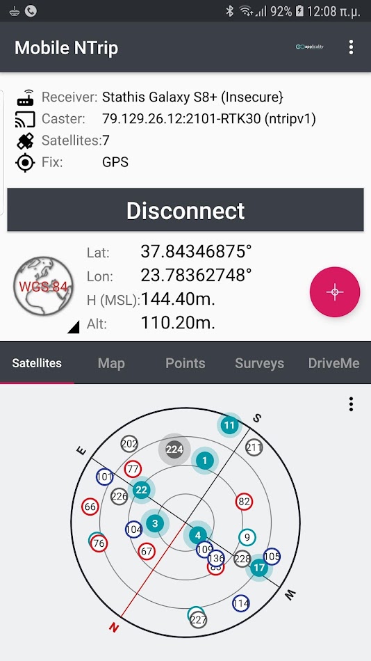
คำอธิบาย
")
- Connect your pro grade GNSS receiver via Bluetooth
- Get real-time RTK corrections over NTRIP.
- Real time IMU support (on supported receivers)
- Readings accumulation and averaging.
- Fix quality evaluation.
- Store your points in separate jobs.
- Stake out points.
- Import / export your work into .txt, .csv, .dxf, .kml, .gpx, shape files, etc.
- Local coordinates in many supported CRSs.
- Projection on map.
- WMS overlays.
- Image overlays.
- Easy jobs management.
- Backup / restore your jobs.
Ad
ภาพหน้าจอ


ราคา
-
* การซื้อภายในแอพ - วันนี้: ฟรี
- ต่ำสุด: ฟรี
- มากที่สุด: ฟรี
ติดตามราคา
Ad
ผู้พัฒนา
- applicality
- แพลตฟอร์ม: Android แอป (6)
- รายการ: 0 + 0
- แต้มแล: 0 + 4,080 ¡
- การจัดอันดับ: 0
- ความเห็น: 0
- ลดราคา: 0
- วิดีโอ: 0
- RSS: ติดตาม
แต้มแล (0)
0 ☹️
การจัดอันดับ (0)
0 ☹️
รายการ (0)
0 ☹️
- Mobile NTrip
ความเห็น (0)
แสดงรีวิวเป็นคนแรกเลย 🌟
ความเห็น (0)
เป็นคนแรกที่แสดงความเห็น 🌟
ข้อมูลเพิ่มเติม
- เวอร์ชัน: 1.38
- หมวดหมู่:
Android แอป›เครื่องมือ - ระบบปฏิบัติการ:
Android 5.0 - ขนาด:
21 Mb - การจัดประเภทเนื้อหา:
Everyone - Google Play คะแนนโดย:
0 - อัปเดต:
- วันที่วางจำหน่าย:
รายชื่อติดต่อ
- เว็บไซท์:
 http://applicality.com
- 🌟 แชร์
- Google Play
คุณอาจชอบ
-
- NTRIP Client by Bluecover
- Android แอป: เครื่องมือ โดย: Bluecover Technologies
- * ฟรี
- รายการ: 0 + 0 การจัดอันดับ: 0 ความเห็น: 0
- แต้มแล: 0 + 0 ความเห็น: 0 เวอร์ชัน: 1.5 The NTRIP Client allows to provide GNSS corrections to your RTK GNSS receiver in order to reach high precision positioning. It gets GNSS message corrections from a public or private ... ⥯
-
- Orbitas
- Android แอป: เครื่องมือ โดย: Tri-Global Technologies, LLC
- ฟรี
- รายการ: 0 + 0 การจัดอันดับ: 0 ความเห็น: 0
- แต้มแล: 0 + 0 ความเห็น: 0 เวอร์ชัน: 1.0.3 Elevate your field work with Orbitas, the essential utility for users of Asteri Xi series Bluetooth GNSS receivers. This application is engineered to bring centimeter-level RTK ... ⥯
-
- SynRTK
- Android แอป: เครื่องมือ โดย: synerex-dev
- ฟรี
- รายการ: 0 + 0 การจัดอันดับ: 0 ความเห็น: 0
- แต้มแล: 0 + 0 ความเห็น: 0 เวอร์ชัน: 17.458 This app provides GNSS RTK, Precise positioning service with RTK devices of SYNEREX, Inc. It provides connecting tablet and SynRTK terminal via USB (USB-C to USB-C). When the ... ⥯
-
- GNSS Surveyor - Centimeter Lev
- Android แอป: เครื่องมือ โดย: PoloSoftech
- * ฟรี
- รายการ: 0 + 0 การจัดอันดับ: 0 ความเห็น: 0
- แต้มแล: 0 + 160 (2.2) ความเห็น: 0 เวอร์ชัน: 2.3 App features: - Easy to use one touch previously configured commands to communicate directly with GNSS Bluetooth device. - Display location information and quality of the position data ⥯
-
- SXblue ToolBox
- Android แอป: เครื่องมือ โดย: Geneq Inc
- ฟรี
- รายการ: 0 + 0 การจัดอันดับ: 0 ความเห็น: 0
- แต้มแล: 0 + 0 ความเห็น: 0 เวอร์ชัน: New SXblue ToolBox is an application tool to configure and control the high-accuracy SXblue GNSS receivers. The Sxblue ToolBox allows the user to view and analyse the position data ... ⥯
-
- RTK camera - 3D geotag scanner
- Android แอป: เครื่องมือ โดย: REDcatch GmbH
- * ฟรี
- รายการ: 0 + 0 การจัดอันดับ: 0 ความเห็น: 0
- แต้มแล: 2 + 0 ความเห็น: 0 เวอร์ชัน: 2.1 RTK camera is an All-In-One NTRIP and Camera App, to take centimeter accurate geotagged photos and logging the path you've walked. There are 3 modes of taking photos: - automatic 3D ... ⥯
-
- Eos Tools Pro
- Android แอป: เครื่องมือ โดย: Eos Positioning Systems Inc.
- ฟรี
- รายการ: 0 + 0 การจัดอันดับ: 0 ความเห็น: 0
- แต้มแล: 1 + 81 (2.9) ความเห็น: 0 เวอร์ชัน: 2.0.0 Eos Tools Pro is a monitoring utility for the Arrow and Skadi Series High-Precision GPS / GNSS receivers from Eos Positioning Systems. It provides advanced GNSS information such as RMS ⥯
-
- GNSS Master
- Android แอป: เครื่องมือ โดย: EPS Works SL
- * ฟรี
- รายการ: 0 + 0 การจัดอันดับ: 0 ความเห็น: 0
- แต้มแล: 0 + 67 (3.5) ความเห็น: 0 เวอร์ชัน: 1.5.0.0 GNSS Master app allows you to: 1) Connect to your external GNSS receiver via USB Serial (OTG), Bluetooth, BLE and TCP/IP 2) Send corrections to your GNSS receiver from in-built NTRIP ... ⥯
-
- Agra-Toolbox
- Android แอป: เครื่องมือ โดย: Agra-GPS
- ฟรี
- รายการ: 0 + 0 การจัดอันดับ: 0 ความเห็น: 0
- แต้มแล: 0 + 0 ความเห็น: 0 เวอร์ชัน: 1.0.22 App made to support Agra-GPS official devices This app allows you to connect to your Agra-GPS CRG or bridge device via Bluetooth and Perform different actions such as: - Update your ... ⥯
-
- Archer Connect
- Android แอป: เครื่องมือ โดย: Juniper Systems, Inc.
- ฟรี
- รายการ: 0 + 0 การจัดอันดับ: 0 ความเห็น: 0
- แต้มแล: 0 + 0 ความเห็น: 0 เวอร์ชัน: 1.0.1+sha.c4b94b1f Archer Connect is a configuration and communication utility app for the Archer 4 GNSS Expansion Pod. It provides the ability to view real-time location data, change receiver settings ... ⥯
-
- Bad Elf Flex
- Android แอป: เครื่องมือ โดย: Bad Elf, LLC
- ฟรี
- รายการ: 0 + 0 การจัดอันดับ: 0 ความเห็น: 0
- แต้มแล: 0 + 30 (2.8) ความเห็น: 0 เวอร์ชัน: 1.4.2.1419 This is the free companion utility app for the Bad Elf Flex and Bad Elf Flex Mini -- our flexible, intuitive, and affordable survey-grade GNSS receivers. Designed for GIS and survey ... ⥯
-
- GNSS Survey
- Android แอป: เครื่องมือ โดย: ThucN
- ฟรี
- รายการ: 0 + 0 การจัดอันดับ: 0 ความเห็น: 0
- แต้มแล: 0 + 0 ความเห็น: 0 เวอร์ชัน: 1.0 App features: 1. Connect (via Bluetooth) and Display GNSS receiver data) 2. Coordinates management (WGS84 and VN2000) 3. NTRIP Client/Source 4. Position finding/ Route finding 5. KML ... ⥯