| Sviluppatore: | OsmAnd (8) | ||
| Prezzo: | Gratis | ||
| Classificazioni: | 0 | ||
| Recensioni: | 0 Scrivi una recensione | ||
| Listes: | 0 + 0 | ||
| Punti: | 0 + 2,148 ¡ | ||
| Punti + 1 | |||
Descrizione
")
Nautical Charts are a detailed graphical representation of oceans, seas, coastal areas, and rivers. The charts can contain various information like sailing routes, navigation lights, dangerous areas, areas where it's allowed or not allowed to sail or dock, etc.
These maps are also supplemented with the information about the depth contours and nautical depth points that add valuable layers of data to the map.
All the professional sailors are obliged to have official marine charts
on their ships. These charts are published by authorized agencies and cost quite some money. Agencies are investing a lot in keeping the charts up to date. They release updates for the charts on a regular basis, but because of the fact that reviewing the information and processing the updates takes quite some time, the nautical charts are never completely up-to-date.
Nautical charts by OsmAnd are based on the data from the OpenSeaMap project. The idea of the project is to build the detailed map by people who actually use it. Every user of the map can contribute by adding changes to it making it more detailed and more accurate.
While OpenSeaMap charts at the moment cannot compete with official nautical charts, they can be used by recreational sailors for orientation or route planning. This plugin does not provide nautical navigation but it is your offline reference tool that can be used together with other navigational programs.
Usage Instructions: it is highly recommended to download nautical basemap in order to see the maps regardless of detailed map presence. Nautical charts are provided as a map and a special style, to switch style in OsmAnd please use the menu item 'Configure Map' on the map screen.
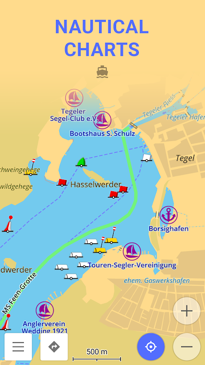
Screenshot


Novità
- Versione: 1.0
- Aggiornata:
- Update Target API Level
Prezzo
- Oggi: Gratis
- Minimo: Gratis
- Massimo: Gratis
Monitora prezzi
Sviluppatore
- OsmAnd
- Piattaforme: Android App (8)
- Listes: 7 + 5
- Punti: 8 + 232,727 ¡
- Classificazioni: 0
- Recensioni: 0
- Sconti: 0
- Video: 2
- RSS: Sottoscrivi
Punti
Non trovato ☹️
Classificazioni
Non trovato ☹️
Listes
Non trovato ☹️
Recensioni
Scrivi tu la prima recensione!
Informazioni aggiuntive
- Categoria:
Android App›Viaggi e info locali - Sistemi operativi:
Android 4.0.3 e versioni successive - Dimensioni:
15 Mb - Classificazione contenuti:
Everyone - Google Play Voto:
3.7(2,148) - Aggiornata:
- Data di uscita:
Contatti
- Sito web:
 http://osmand.net
Ti potrebbero piacere anche
-
- OsmAnd+ — Maps & GPS Offline
- Android App: Viaggi e info locali di: OsmAnd
- * $39.99
- Listes: 7 + 5 Classificazioni: 0 Recensioni: 0
- Punti: 8 + 38,571 Versione: 4.7.10 OsmAnd+ is an offline world map application based on OpenStreetMap (OSM), which allows you to navigate taking into account the preferred roads and vehicle dimensions. Plan routes based
-
- Marine Ways - Nautical Charts
- Android App: Viaggi e info locali di: Kernalite
- * * Gratis
- Listes: 0 + 0 Classificazioni: 0 Recensioni: 0
- Punti: 0 + 2,118 Versione: 1.34 Marine Ways Boating is the ultimate marine navigation and planning application! In this application you will gain access to: NAVIGATIONAL CHARTS - United States charts provided by ...
-
- Nautical Info Service Croatia
- Android App: Viaggi e info locali di: Ministarstvo pomorstva, prometa i infrastrukture
- Gratis
- Listes: 0 + 0 Classificazioni: 0 Recensioni: 0
- Punti: 0 + 410 Versione: 1.2.7 Nautical Information Service (nIS) is a free multilingual application for smartphones, intended for owners of yachts and boats, fishermen, divers, swimmers and other people who spend ...
-
- i-Boating:Marine Navigation
- Android App: Viaggi e info locali di: Gps Nautical Charts
- * Gratis
- Listes: 0 + 0 Classificazioni: 0 Recensioni: 0
- Punti: 0 + 11,876 Versione: 243.0 This Marine Charts App offers offline nautical charts, inland river navigation charts, and lake contour maps for fishing,kayaking, yachting & sailing. First marine navigation app to ...
-
- Nautics Sailmate Classic
- Android App: Viaggi e info locali di: Nautics Oy
- * Gratis
- Listes: 0 + 0 Classificazioni: 0 Recensioni: 0
- Punti: 0 + 399 Versione: 4.6.2 Nautics Sailmate is a Finnish navigation app for leisure boaters with the most reliable nautical charts on the market, provided by the Finnish Transport Agency. Sailmate offers ...
-
- LD-Log - GPS Tracker & Logbook
- Android App: Viaggi e info locali di: A.Wedemeyer - Outdoor & Sailing Apps
- $9.90
- Listes: 0 + 0 Classificazioni: 0 Recensioni: 0
- Punti: 0 + 584 Versione: 8.5.1 Multifunctional track logger for a wide range of uses Optimized for battery-efficient long-term tracking In-app travel diary / nautical logbook Maps and tools for outdoor navigation ...
-
- Sentinel - your boat, online
- Android App: Viaggi e info locali di: Sentinel Marine solutions
- * Gratis
- Listes: 0 + 0 Classificazioni: 0 Recensioni: 0
- Punti: 2 + 54 Versione: 6.4.3 Sentinel is designed for the owner of a boat to keep the cost of ownership low while maximizing security and comfort. Sentinel contstantly monitors your boat position and vital systems
-
- Dubai UAE Gold Price Today
- Android App: Viaggi e info locali di: KS Mobile Apps
- * Gratis
- Listes: 0 + 0 Classificazioni: 0 Recensioni: 0
- Punti: 0 + 679 Versione: 5.5 Are you ready to embark on a golden journey towards financial prosperity? Stay on top of the latest gold rates in the UAE with our daily/ real-time updates. Our app provides you with ...
-
- Travel Expense Manager & Trip
- Android App: Viaggi e info locali di: Evposli - Travel, Finance, Goals and Fitness apps
- * * Gratis
- Listes: 0 + 0 Classificazioni: 0 Recensioni: 0
- Punti: 0 + 355 Versione: 5.0 A FREE travel expense manager - tracker, an essential tool for a budget traveler or digital nomad, to manage the travel budget in different currencies, to organize the entries ...
-
- OruxMaps GP
- Android App: Viaggi e info locali di: jose vazquez
- * $4.49
- Listes: 2 + 2 Classificazioni: 0 Recensioni: 0
- Punti: 0 + 6,545 Versione: New You can use OruxMaps for your outdoor activities. It is an Online and offline map viewer. With this app you can use different map formats, like GeoPDF from USGS store, GeoTIFF maps, ...
-
- GPS Logger
- Android App: Viaggi e info locali di: BasicAirData
- Gratis
- Listes: 0 + 0 Classificazioni: 0 Recensioni: 0
- Punti: 0 + 2,344 Versione: New BasicAirData GPS Logger is a simple App for recording your position and your path. It's a basic and lightweight GPS tracker focused on accuracy, with an eye to power saving. It works ...
-
- MySea
- Android App: Viaggi e info locali di: Euminia GMBH
- Gratis
- Listes: 0 + 0 Classificazioni: 0 Recensioni: 0
- Punti: 0 + 122 Versione: 3.4.6 mySea is a an interactive cruising guide for Greece, Croatia and Turkey (Mediterranean coast) as well as an online reservation system for berths. Boaters can find information on almost
-
- Abu Dhabi Airport (AUH) Info
- Android App: Viaggi e info locali di: Sinecloud
- * * Gratis
- Listes: 0 + 0 Classificazioni: 0 Recensioni: 0
- Punti: 0 + 445 Versione: 15.4 Abu Dhabi International Airport is an international airport in the Emirate of Abu Dhabi, the capital of the United Arab Emirates. The airport, located 16.5 nautical miles (30.6 km; ...
-
- iFly EFB
- Android App: Viaggi e info locali di: Adventure Pilot, LLC
- * Gratis
- Listes: 0 + 0 Classificazioni: 0 Recensioni: 0
- Punti: 0 + 467 Versione: New iFly GPS has been renamed to iFly EFB! The Better Way to Navigate: iFly EFB delivers the perfect combination of value, capability, and usability for both VFR and IFR Pilots. Safely and
Ti potrebbero piacere anche
- Android App
- Nuove Android App
- Viaggi e info locali Android App : Nuove
- Video Android App
- Popolare Android App
- Viaggi e info locali Android App : Popolare
- Sconti Android App
- Viaggi e info locali Android App : Sconti
- Classificazioni Android App
- Recensioni Android App
- Listes Android App
- Punti Android App