| 개발자: | Seattle Avionics, Inc. (2) | ||
| 가격: | * 무료 | ||
| 순위: | 0 | ||
| 리뷰: | 0 리뷰 작성 | ||
| 목록: | 0 + 0 | ||
| 포인트: | 1 + 558 ¡ | ||
| 포인트 + 1 | |||
기술
")
New features such as VFR Runway Patterns and Auto Center simplify pilot workload.
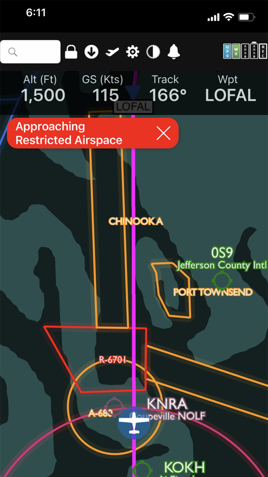
The Global Digital Map shows airports, airways, airspace, navaids, and waypoints from all around the world. Text rotates so it's always right-side up and the level of detail adapts to the zoom level.
Our exceptional "4D Predictive Weather" system uses a Timeline and Altitude Slider to help you analyze weather at different times - both past and future - and at different altitudes. 17 weather layers from both the Internet and ADS-B (e.g. Radar, Icing, Turbulence, PIREPs, Winds Aloft, Surface Winds, Surface Analysis, Satellite, and more), many tied to the Timeline and Altitude Slider, give you unprecedented pre-flight and in-flight safety.
Supports more than 20 ADS-B and in-panel devices: Stratus 3, Avidyne, Dynon, Stratux, and more.
The exclusive Augmented Reality (AR) feature provides situational awareness you'd previously only seen in sci-fi movies.
The Slingshot wireless ChartData system means FlyQ supplies maps, plates, and apt diagrams wirelessly to certified systems from BendixKing.
The Visual Logbook and Post Flight Playback / Analysis Graphs add a whole new dimension to your flying. Optionally connect with your friends to "see" and even replay their flights. CFI's can track student progress and remotely send endorsements.
Other key features include split screen, 3D synthetic vision, plates on the map, more than 4,600 airport diagrams, rich Documents support, extended runways, distance measurement, fuel prices, NOTAMS, wind-optimized flight planning, and plates for Mexico and Central America.
> Maps Your Way
+ Digital, 2D maps, 3D Syn Vis, Augmented Reality
+ Sectionals and IFR charts
+ Photo, road, terrain maps
+ 17 Weather Layers
+ Flight Track
+ Fuel Prices
+ TFRs
+ Obstacle and Terrain Avoidance
+ ADS-B Traffic and Weather
+ Extended runways with right-pattern indicators
+ Procedures on map
+ Rings / Extended Course Line
+ CAP grid
+ Heli and Gulf of Mexico charts
+ VFR Flyways
+ Syn Vis includes HITS boxes, EFIS display, TAWS, Obstacles, and AHRS support.
Night Mode preserves your night vision.
Split screen (iPad only) and single screen.
> Procedures
FlyQ includes the same Seattle Avionics geo-referenced approach plates and apt diagrams that we supply to certified avionics from BendixKing and Aspen. Split screen can show a map and a procedure simultaneously. Swipe to switch procedures or tap to list all procedures at an airport. Overlay procedures on a map. Annotate plates and diagrams with colored lines and text.
> Flight Planning that Saves Time and Money
1. Automatically uses recently cleared ATC routes (IFR only)
2. Automatically plans fuel stops based on lowest cost and uses expected winds to plot the fastest course, saving time and money on every flight.
3. CAP/SAR patterns
4. Exchange flight plans with Dynon SkyView, Avidyne, and Aspen.
5. Practice with X-Plane or MS Flight Sim / Prepar3D
> Weather
Amazing "4D Predictive Weather" uses a Timeline and Altitude slider to make detailed pre-flight and in-flight analysis easy. The Graphical Wind Optimizer uses red and green bars to show the headwind or tailwind at different altitudes. Also includes an extensive gallery of weather images.
> Airport Information
The Airport screen concisely shows key operational info, sat images, and runway diagrams on a single screen. weather, approach procedures, A/FD, and FBO info are just a tap away. Includes more than 4,600 SA Airport Diagrams.
> Data Manager
FlyQ makes it painless to download new data every month: spin and zoom a 3D globe to visually select the states you need.
> Try it before you buy it
Experience everything FlyQ EFB offers with a free 30-day subscription.
스크린샷


새로운 기능
- 버전: 6.9.1
- 업데이트:
- + FIXED: Track, MCrs and other calculations based on magnetic variation are incorrect
가격
-
*인앱 구매 - 오늘: 무료
- 최소: 무료
- 최대: 무료
가격 추적
개발자
- Seattle Avionics, Inc.
- 플랫폼: iOS 앱 (2)
- 목록: 0 + 0
- 포인트: 1 + 629 ¡
- 순위: 0
- 리뷰: 0
- 할인: 0
- 동영상: 0
- RSS: 구독
포인트
-

- 103 Lass Ben-Attia

순위
찾을 수 없음 ☹️
목록
찾을 수 없음 ☹️
리뷰
첫 번째 리뷰를 남겨보세요!
추가 정보
당신은 또한 같은 수 있습니다
-
- Fly Virga
- iOS 앱: 내비게이션 게시자: Aviation Apps, LLC
- 무료
- 목록: 0 + 0 순위: 0 리뷰: 0
- 포인트: 0 + 17 버전: 1.57 Pilots can now unleash the power of real time PIREPs for flight planning, management and safety. Virga is aviation s only app that allows pilots to submit PIREPs without the need for ...
-
- AvPlan EFB
- iOS 앱: 내비게이션 게시자: BJA Consulting Pty Ltd
- * 무료
- 목록: 0 + 0 순위: 0 리뷰: 0
- 포인트: 1 + 81 버전: 9.7.3 Get flying faster with AvPlan EFB - the premier lifetime Electronic Flight Bag that grows with you. Continuing to lead the market with unparalleled innovation and functionality, AvPlan
-
- iFly EFB
- iOS 앱: 내비게이션 게시자: Adventure Pilot, LLC
- * 무료
- 목록: 0 + 0 순위: 0 리뷰: 0
- 포인트: 2 + 113 버전: 13.0.33 iFly EFB delivers the perfect combination of affordability, capability, and usability for both VFR and IFR Pilots. Safely and quickly get the information you need so you can focus on ...
-
- TroutRoutes: Fly Fishing Maps
- iOS 앱: 내비게이션 게시자: Trout Insights, LLC
- * 무료
- 목록: 0 + 0 순위: 0 리뷰: 0
- 포인트: 0 + 3,053 버전: 5.0.13 TroutRoutes is the #1 GPS mapping tool for trout streams and fly fishing. It is the industry's first mapping tool that includes interactive GPS fishing maps for every trout stream in ...
-
- Holding Pattern Computer
- iOS 앱: 내비게이션 게시자: Aviation Mobile Apps, LLC.
- $11.99
- 목록: 0 + 0 순위: 0 리뷰: 0
- 포인트: 0 + 167 버전: 3.0.2 Fly with Confidence: Holding Pattern App Elevate your flying skills with Version 3.0 of the Holding Pattern App, meticulously crafted by aerospace experts. Ideal for both new and ...
-
- Stratus Horizon Pro
- iOS 앱: 내비게이션 게시자: Appareo Systems, LLC
- * 무료
- 목록: 0 + 0 순위: 0 리뷰: 0
- 포인트: 0 + 33 버전: 3.0.1 Backup Glass Cockpit on your iPad Stratus Horizon Pro displays a complete Attitude Heading Reference System (AHRS) for supplemental attitude information in your cockpit. Driven by a ...
-
- Jeppesen FliteDeck Pro
- iOS 앱: 내비게이션 게시자: Jeppesen
- 무료
- 목록: 0 + 0 순위: 0 리뷰: 0
- 포인트: 0 + 16 버전: 4.7.3 Jeppesen FliteDeck Pro is the latest offering for the commercial airline market and represents the coming together of Jeppesen and ForeFlight technologies into the industry's leading ...
-
- Aero App
- iOS 앱: 내비게이션 게시자: National Geospatial-Intelligence Agency
- 무료
- 목록: 0 + 0 순위: 0 리뷰: 0
- 포인트: 1 + 37 버전: 1.2402.7840 The NGA Aeronautical Application (Aero App) is an Electronic Flight Bag (EFB) mobile application developed by and for the DOD and FAA flight crews. The Application provides flight ...
-
- AltitudeAlert
- iOS 앱: 내비게이션 게시자: Raymond Chase
- * 무료
- 목록: 0 + 0 순위: 0 리뷰: 0
- 포인트: 0 + 25 버전: 3.3.2 Advanced Altitude Management for Pilots. Integrated with a pilot designed flexible alerting system and VNAV (Vertical Navigation), AltitudeAlert is the first App to bring advanced ...
-
- Xavion
- iOS 앱: 내비게이션 게시자: X-Avionics, LLC
- * 무료
- 목록: 0 + 0 순위: 0 리뷰: 0
- 포인트: 0 + 98 버전: 3.41 In flight, Xavion constantly imagines engine-failed glides to every runway in gliding range, and then shows you the safest-possible route as a Highway-In-The-Sky to take to an airport ...
-
- Nav Trainer Pro
- iOS 앱: 내비게이션 게시자: FLEMINGER MEDIA LLC
- $8.99
- 목록: 0 + 0 순위: 0 리뷰: 0
- 포인트: 0 + 35 버전: 3.5.0 Selected by AOPA.org readers as number one of five aviation apps you can't live without! * Reached No. 4 in the Navigation category of the U.S. app store for iPad! Make IFR flight ...
-
- Truck Parking Europe
- iOS 앱: 내비게이션 게시자: Truckparking B.V.
- 무료
- 목록: 0 + 0 순위: 0 리뷰: 0
- 포인트: 0 + 63 버전: 4.0.2 Looking for a (secure) truck parking or truck stop? The Truck Parking Europe app offers you the largest free app for truck parking facilities. Find your next truck parking location in ...
-
- Air Navigation Pro
- iOS 앱: 내비게이션 게시자: Xample Sarl
- * 무료
- 목록: 0 + 1 순위: 0 리뷰: 0
- 포인트: 2 + 550 버전: 8.3.370 Discover our flight planning & real-time navigation app for free for 28 days! - Everything you need to fly around the world - Plan your flight in a few minutes - Fly relaxed with ...
-
- DroneSense
- iOS 앱: 내비게이션 게시자: DroneSense INC
- 무료
- 목록: 0 + 0 순위: 0 리뷰: 0
- 포인트: 0 + 29 버전: 2023.10.1 For UAS Pilots - Fly a wide range of professional drones with DroneSense! Simply download this app directly onto your iPad and plug directly into any drone remote. Incorporating the ...