| Developer: | Tech Maven GeoSpatial LLC (10) | ||
| Price: | Free | ||
| Rankings: | 0 | ||
| Reviews: | 0 Write a Review | ||
| Lists: | 0 + 0 | ||
| Points: | 0 + 0 ¡ | ||
| Points +1 | |||
Description
")
Core main features part of app subscription:
Download online mapping URL’s for offline use (dynamic and cached mapping services and tile layers)
ESRI MapServer URL as Raster Tiles MBTILES and as GeoJSON (use in-app converter if you need it as KML or other format)
ESRI FeatureServer URL as GeoJSON (use in-app converter if you need it as KML or other format)
ESRI ImageServer URL as Raster Tiles MBTILES
ESRI VectorTileServer URL as Vector Tiles MBTILES
PBF/MVT XYZ Vector Tile URL as Vector Tiles MBTILES
OGC API Tiles/XYZ/TMS URL as Raster Tiles MBTILES
XYZ Terrain/Elevation Tiles URL as Raster Tiles MBTILES
Future Versions will include downloading from other providers (OGC WFS/OGC API Features, OGC WMS/OGC API Maps, OGC WMTS)
Support for some pre-configured Tile Layers
Users are responsible for the terms of use/service and access to the data they are downloading from the URL’s they are adding.
In-app Vector Data Converter
Converts GIS Vector Data to optimized formats (Build MBTILES Vector Tiles, Build GPKG Vector Features or build GeoJSON or Build KML) - Convert an ESRI FileGDB, ESRI PersonalGDB, ESRI Shapefile, MapInfo, GPX, CSV and others.
Live Event Driven Data Feeds Downloader
ESRI FeatureServer
Network Link KML Downloader Module
GeoRSS Feeds
downloads the data at a set frequency and converts to GeoJSON (can be converted in-app to KML for use in other apps like ATAK or iTAK).
Share Downloaded Data
Visualize downloaded Data and user loaded data in the integrated Map Viewer
Supports the offline formats - GeoJSON,Raster tiles from MBTILES and GPKG and vector tiles from MBTILES.
(MAP Viewer DOES NOT View ESRI Tile Package formats TPKX and VTPK Plesae use an ESRI app like ArcGIS Earth to view them)
Premium API Access as additional in-app purchases
Pre-Staged (Ready to Go) Basemaps and Overlays in TPKX and VTPK
Tech Maven Geospatial has a prepared foundational basemaps and overlays that include: basemaps osm vector tiles, hillshade raster tiles, contour line vector tiles, low res satellite raster tiles, reference lines and reference labels raster tiles, for some regions and areas high res satellite raster tiles, MapZen Terrarium RGB encoded Elevation Terrain tiles PNG.
This Ready-to-go Data immediately available by Regions, Countries, US States, Canadian Provinces. We have a high performance data distribution server and the data is delivered in VTPK and TPKX ESRI Tile Package Format.
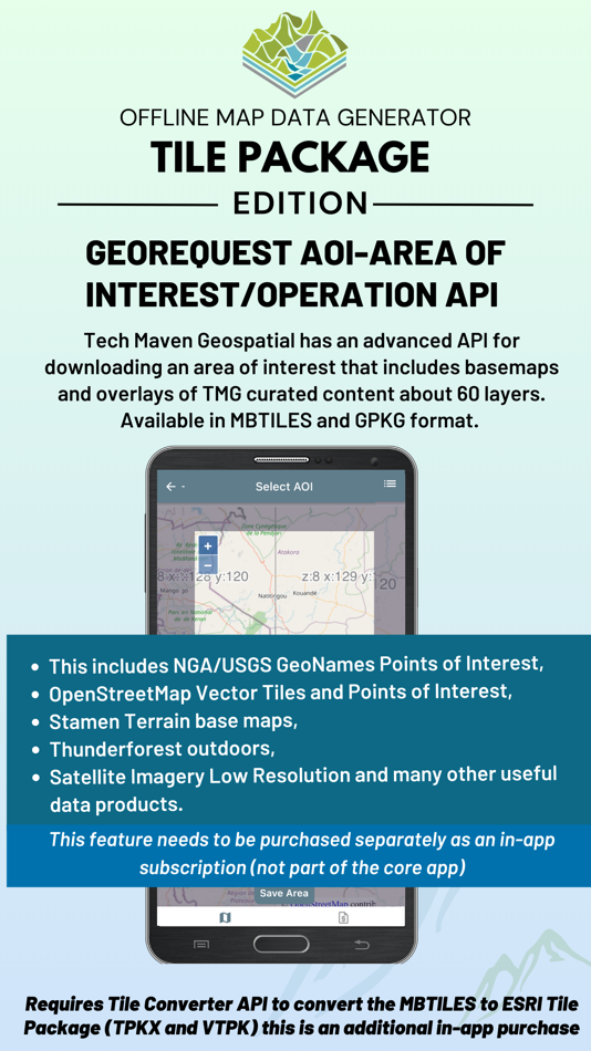
GeoRequest AOI-Area of Interest/Operation API
Tech Maven Geospatial has an advanced API for downloading an area of interest that includes basemaps and overlays of TMG curated content about 60 layers. Available in MBTILES and GPKG format. This includes NGA/USGS GeoNames Points of Interest, OpenStreetMap Vector Tiles and Points of Interest, Stamen Terrain basemaps, Thunderforest outdoors, Satellite Imagery Low Resolution and many other useful data products.(to use these products it requires purchase of tile converter API to have them converted to VTPK and TPKX ESRI Tile Packages)
Tile Converter API
Convert MBTILES to ESRI Tile Package forma t Raster tiles TPKX and Vector Tiles VTPK
Elevate API - get MGRS, GARS, What3Words, PlusCode, PlaceKey and Elevation for a Point GeoJSON or SQLite or GPKG Points
$24.99/year for unlimited use
Vector Conversion API - convert GIS Vector Formats - (Convert Data to GPKG Vector Features, MBTILES Vector Tiles)
$24.99/year for unlimited use
EULA: https://offlinedatadownloader.techmaven.net/eula-tilepackage/
Screenshots


What's new
- Version: 1.0
- Updated:
Price
- Today: Free
- Minimum: Free
- Maximum: Free
Track prices
Developer
- Tech Maven GeoSpatial LLC
- Platforms: iOS Apps (9) Windows Apps (1)
- Lists: 0 + 0
- Points: 2 + 1 ¡
- Rankings: 0
- Reviews: 0
- Discounts: 0
- Videos: 0
- RSS: Subscribe
Points
Not found ☹️
Rankings
Not found ☹️
Lists
Not found ☹️
Reviews
Be the first to review 🌟
Additional Information
- Version: 1.0
- ID: com.techmaven.mapgeneratortilepackage
- Category:
iOS Apps›Navigation - OS:
iPad,iPhone,iOS 14.0 and up - Size:
181 Mb - Supported Languages:
English - Content Rating:
17+ - App Store Rating:
0 - Updated:
- Release Date:
Contacts
You may also like
-
- Offline Map Data Generator
- iOS Apps: Navigation By: Tech Maven GeoSpatial LLC
- * Free
- Lists: 0 + 0 Rankings: 0 Reviews: 0
- Points: 0 + 0 Version: 1.1 Discover the Ultimate Mapping Experience with Tech Maven Geospatial Unleash the power of geospatial data with Tech Maven Geospatial, your all-in-one mapping solution available now on ... ⥯
-
- MineAR: Augmented Reality Map
- iOS Apps: Navigation By: Map Life, LLC
- * Free
- Lists: 0 + 0 Rankings: 0 Reviews: 0
- Points: 0 + 5 (5.0) Version: 2.40.15 Data you can grasp. As a geoscience professional, we know you want an easier way to see your GIS data while you re in the field. MineAR allows you to do exactly that. Our app ... ⥯
-
- Memory-Map for All
- iOS Apps: Navigation By: Memory-Map
- Free
- Lists: 0 + 0 Rankings: 0 Reviews: 0
- Points: 0 + 5 (5.0) Version: 1.3.1 Download maps for Offline GPS Navigation. No mobile data connection required. Your favorite maps and charts from OS, Hema, NOAA, and many more. Fully customizable map, data display and ⥯
-
- Map LT
- iOS Apps: Navigation By: Taylan Atasoy
- Free
- Lists: 0 + 0 Rankings: 0 Reviews: 0
- Points: 0 + 0 Version: 4.0 Map LT is a cutting-edge navigation and mapping application designed for users who want to easily find their way around World. With its user-friendly interface and comprehensive ... ⥯
-
- Map Map - Your Map on a Map
- iOS Apps: Navigation By: Ben Roberts
- * Free
- Lists: 0 + 0 Rankings: 0 Reviews: 0
- Points: 0 + 2 (5.0) Version: 2.3 Welcome to Map Map Your Personal Cartographer! Ever wished you could see where you were on a trail map, building diagram, or any other visual reference? How about knowing where a trail ⥯
-
- Map MateAI- Navigate with Chat
- iOS Apps: Navigation By: Ahmet Erkin Arıkan
- Free
- Lists: 0 + 0 Rankings: 0 Reviews: 0
- Points: 0 + 0 Version: 1.0.3 Struggling to decide where to go? Let our app guide you! Whether you're searching for a cozy café, an exciting spot to explore, or a pharmacy on duty, we ve got you covered. Simply ... ⥯
-
- Map Tells...!
- iOS Apps: Navigation By: Yuriko Kimura
- Free
- Lists: 0 + 0 Rankings: 0 Reviews: 0
- Points: 0 + 0 Version: 3.4 "Map Tells...! is an app that shares your location with your companion by providing a Google Maps link and photo. The mail receiver follows the directions (on the map or through a ... ⥯
-
- Map It Realtour
- iOS Apps: Navigation By: DKP Productions LLC
- Free
- Lists: 0 + 0 Rankings: 0 Reviews: 0
- Points: 0 + 3 (5.0) Version: 2.0.2 Map It Realtour® / Mobile Application for Realtors With New Map It Client Version for Their Clients Map It Realtour® is a new and unique Real Estate App for Agents worldwide, that was ... ⥯
-
- Map Tools
- iOS Apps: Navigation By: Modular Machines LLC
- $1.99
- Lists: 0 + 0 Rankings: 0 Reviews: 0
- Points: 0 + 1 (5.0) Version: 6.1 Map Tools supports coordinate systems and map projections for 232 datums, including WGS84, NAD27, NAD83, ED50, OSGB36, EGSA87, AGD66, AGD84, GDA94, NZGD2000, NZGD1949, and many more. ... ⥯
-
- Map Points
- iOS Apps: Navigation By: Sachin Deshpande
- $0.99
- Lists: 0 + 0 Rankings: 0 Reviews: 0
- Points: 0 + 0 Version: 1.2 Map Points is an app to store your favorite map locations. You can use it while hiking to mark pinpoint locations that you want to remember. Or you can drop a pin to mark the secret ... ⥯
-
- Map Snapper
- iOS Apps: Navigation By: Mark Malone
- * Free
- Lists: 0 + 0 Rankings: 0 Reviews: 0
- Points: 0 + 0 Version: 2.1 Plan orienteering events by placing and fine tuning control locations in the field. Create your own instant offline maps. Create geolocated maps from photos and pictures, either with ... ⥯
-
- Map Plus
- iOS Apps: Navigation By: Miocool Inc.
- * Free
- Lists: 1 + 1 Rankings: 0 Reviews: 0
- Points: 0 + 552 (4.6) Version: 2.9.0 The most powerful and versatile tool for viewing and editing custom maps, surveying, editing or managing mass of your geography data. You can use Map Plus as a professional GIS tool ... ⥯
-
- Map Paint
- iOS Apps: Navigation By: Kouichi INAFUKU
- $0.99
- Lists: 1 + 0 Rankings: 0 Reviews: 0
- Points: 1 + 0 Version: 1.0.1 It is an application that you can paint on the map Note The position of the map may shift slightly when reloading the saved data The map when edited is slightly different from the ... ⥯
-
- WV OIL AND GAS MAP
- iOS Apps: Navigation By: WV OIL AND GAS MAP, INC.
- * $39.99
- Lists: 0 + 0 Rankings: 0 Reviews: 0
- Points: 0 + 0 Version: 1.0 Welcome to WV Oil and Gas Map your premier mobile resource for navigating the dynamic energy landscape of West Virginia! We're here to revolutionize your understanding of the state's ... ⥯