| 개발자: | MapGears inc. (34) | ||
| 가격: | 무료 | ||
| 순위: | 0 | ||
| 리뷰: | 0 리뷰 작성 | ||
| 목록: | 0 + 0 | ||
| 포인트: | 0 + 1 (5.0) ¡ | ||
| App Store | |||
기술
")
Designed for both professional trail managers and volunteer users, the mobile app empowers you to manage, inspect, and maintain your trails, infrastructure and more, anytime, anywhere even offline.
Key Features
► Cross-platform compatibility
Access and interact with your Mapgears Trails web apps seamlessly on your mobile device.
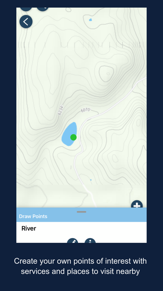
► Mobile data collection
Add and edit points, lines, and polygons using intuitive mobile-friendly forms. Collect data offline and sync automatically when back online.
► Offline-first design
Work confidently without a network connection. All changes are saved locally and synchronized when connectivity is restored.
► Track recording
Record your GPS track in the field for work or personal use, and visualize your breadcrumbs on the web platform.
► Robust editing tools
Draw and edit lines, add new points, and update data on your mobile device, ideal for field inspections and on-the-go management.
► Field-ready for clubs and volunteers
Empower club members and volunteers to contribute with easy-to-use tools, offline mode, and automatic syncing.
With the Mapgears Trails mobile app, you’re ready to take your trail management operations to the next level.
스크린샷


가격
- 오늘: 무료
- 최소: 무료
- 최대: 무료
가격 추적
개발자
- MapGears inc.
- 플랫폼: iOS 앱 (34)
- 목록: 0 + 0
- 포인트: 5 + 567 ¡
- 순위: 0
- 리뷰: 0
- 할인: 0
- 동영상: 0
- RSS: 구독
포인트
0 ☹️
순위
0 ☹️
목록
0 ☹️
리뷰
첫 번째 리뷰를 남겨보세요 🌟
추가 정보
주소록
- 🌟 공유하기
- App Store
당신은 또한 같은 수 있습니다
-
- Trails Offroad: Offline Maps
- iOS 앱: 내비게이션 게시자: TRAILS OFFROAD LLC
- * 무료
- 목록: 0 + 0 순위: 0 리뷰: 0
- 포인트: 2 + 612 (4.7) 버전: 3.7.0 Explore with Confidence. Go Beyond the Pavement. Trails Offroad is the #1 app for discovering, planning, and navigating off-road adventures whether you're behind the wheel of a Jeep, ... ⥯
-
- MAPGEARS Streets
- iOS 앱: 내비게이션 게시자: MapGears inc.
- 무료
- 목록: 0 + 0 순위: 0 리뷰: 0
- 포인트: 1 + 2 (5.0) 버전: 2.0.2 Streets Assistant give you a bird's eye view of your operations, simplify your management tasks, and provide a direct communication channel with drivers and customers. The Operations ... ⥯
-
- Bay Ridge Trails
- iOS 앱: 내비게이션 게시자: Bay Ridge Civic Association
- 무료
- 목록: 0 + 0 순위: 0 리뷰: 0
- 포인트: 0 + 5 (3.6) 버전: 1.1.1 The Bay Ridge Trails App is a hiking trail app that uses GPS to map out Bay Ridge trails. Users can use the app to find the trails and navigate around Bay Ridge. The app provides a ... ⥯
-
- As-Salt Walking Trails
- iOS 앱: 내비게이션 게시자: Llama Digital
- 무료
- 목록: 0 + 0 순위: 0 리뷰: 0
- 포인트: 0 + 0 버전: 1.0 Soak in the beauty of As-Salt and experience this magical town by taking a walking trail. These self-guided trails will give you an authentic experience of life in the town, and take ... ⥯
-
- Wikiloc - Trails of the World
- iOS 앱: 내비게이션 게시자: Wikiloc Outdoor SL
- 무료
- 목록: 0 + 0 순위: 0 리뷰: 0
- 포인트: 0 + 4,948 (4.8) 버전: 3.26.0 Discover millions of outdoor trails around the world. Choose between hiking, running, bike, MTB, kayak, ski or up to 80 different types of activities. Record your own routes on a map, ... ⥯
-
- Park City Trails
- iOS 앱: 내비게이션 게시자: ECO Systems
- 무료
- 목록: 0 + 0 순위: 0 리뷰: 0
- 포인트: 0 + 0 버전: 2024.9.8 Park City Trails allows you to see all of the summer and winter trails available in Park City (no more need of multiple apps). You can explore and discover trails, whether you have ... ⥯
-
- Topographic Maps & Trails
- iOS 앱: 내비게이션 게시자: LW Brands, LLC
- $4.99
- 목록: 1 + 0 순위: 0 리뷰: 0
- 포인트: 1 + 2,781 (4.6) 버전: 1.6 DOWNLOAD ALL MAPS FOR OFFLINE USE MAIN FEATURES INCLUDE: - USGS Topographic Maps - Satellite + Topo Maps - Hiking Tracker USGS TOPO MAP USGS Topo is a tile cache base map service that ... ⥯
-
- GNodeTo: Toronto Trails Map
- iOS 앱: 내비게이션 게시자: QI.AI Inc
- 무료
- 목록: 0 + 0 순위: 0 리뷰: 0
- 포인트: 5 + 0 버전: v1.1.13 GnodeTo is your go-to app for planning and tracking biking or hiking trips in the Great Toronto Area (GTA). Whether you're an experienced adventurer or just starting out, GnodeTo makes ⥯
-
- OnPoint Trails: OHV Trail Map
- iOS 앱: 내비게이션 게시자: Brenda Leon
- * 무료
- 목록: 0 + 0 순위: 0 리뷰: 0
- 포인트: 0 + 12 (4.7) 버전: 1.3 OnPoint Trails: Your Ultimate Offline Off-Road Navigator Discover the freedom of off-roading with OnPoint Trails, the all-in-one app designed for adventurers who seek to explore CA OHV ⥯
-
- Art Trails
- iOS 앱: 내비게이션 게시자: Jonathan McKenna
- * 무료
- 목록: 0 + 0 순위: 0 리뷰: 0
- 포인트: 1 + 2 (2.5) 버전: 1.1.0 Turn Your Movement Into GPS Art Whether you re running city streets, walking in nature, cycling quiet roads, or paddling open water, Art Trails helps you transform your routes into ... ⥯
-
- Bread Crumbs Trails
- iOS 앱: 내비게이션 게시자: YOURFULLSTACK, LLC
- $1.99
- 목록: 0 + 0 순위: 0 리뷰: 0
- 포인트: 3 + 3 (4.7) 버전: 2.3.3 Bread Crumbs Trail is a location pinging app. All location data is stored within the app and stored on your local device. App is designed for educational research, fun, recreation, ... ⥯
-
- TrailAware: Bike & Hike Trails
- iOS 앱: 내비게이션 게시자: TrailAware, Inc.
- 무료
- 목록: 0 + 0 순위: 0 리뷰: 0
- 포인트: 0 + 31 (5.0) 버전: 2.6 Experience a groundbreaking way to discover and view all types of trails with TrailAware. Powered by our patented dynamic geospatial mapping technology, TrailAware provides the ... ⥯
-
- Bell Mountain Ranch Trails
- iOS 앱: 내비게이션 게시자: Sean Molloy
- 무료
- 목록: 0 + 0 순위: 0 리뷰: 0
- 포인트: 0 + 3 (4.7) 버전: 1.51 The BMR Trails app helps users of the BMR trail system to navigate the trails with ease. Your current location is shown on a satellite map of the trail system, with every trail marked ... ⥯
-
- Collie Wambenger Trails
- iOS 앱: 내비게이션 게시자: Government of Western Australia - Department of Parks and Wildlife
- 무료
- 목록: 0 + 0 순위: 0 리뷰: 0
- 포인트: 0 + 0 버전: 9.0.376 Located in South West Western Australia, Wambenger Trails offer mountain biking, walking and paddling trails, camping and water sports. This app is your go to guide for discovering all ⥯