| 개발자: | Florian Chrometz (4) | ||
| 가격: | 무료 | ||
| 순위: | 0 | ||
| 리뷰: | 0 리뷰 작성 | ||
| 목록: | 0 + 0 | ||
| 포인트: | 0 + 47 (4.1) ¡ | ||
| App Store | |||
기술
")
Uncover the World of Open Street Map (OSM): With OpenStreetMap, a , of the world, rich in details about locations both near and distant. Navigate through an extensive network of roads, trails, and points of interest - all meticulously crowd-sourced by a global community of map enthusiasts.
Find the right cycling path with CyclOSM: Beautifuly designed, yet highly functional map to guide you on the best cycling paths around the globe.
Transport Network with Open Transport Map: Dive into the intricate infrastructure of transportation, encompassing airports, railway lines, stations, bus routes, and stops. Mapply's integration with OpenTransportMap is your indispensable resource for navigating the intricacies of modern transportation.
Embark on Marine Journeys with Open Sea Map: OpenSeaMap opens the door to your nautical adventures, offering intricate details about harbors, buoys, and more. It's the perfect tool for sailors, explorers, and maritime enthusiasts to navigate with confidence.
Unleash Outdoor Adventures with Waymarked Trails: Mapply brings the outdoor world to your fingertips, providing specialized maps for a myriad of activities such as hiking, cycling, mountain biking, and skiing. From easy-going cycling routes to challenging mountain biking trails, and from serene hiking paths to exhilarating ski slopes - all your outdoor adventures begin with Mapply.
Discover Topography with Open Topo Map: Mapply leverages OpenTopoMap to provide users with precise topographical information. Understand the height profiles of specific areas, and plan your journeys with in-depth knowledge of the terrain.
Unravel Railways with Open Railway Map: Mapply is a treasure trove for railway enthusiasts. OpenRailwayMap offers comprehensive data on global train tracks, and further layers reveal specifics about maximum speeds, signals, electrification, and track gauge. It's a comprehensive guide to the world's railways, all on your device.
Enhanced User Experience with Offline Caching: Mapply ensures your adventures are uninterrupted with its offline caching feature. Once you've explored an area, Mapply caches it on your device.
Mapply is built on open-source data for map data and overlay styles, displaying attributions in-app. We're always eager to enhance your Mapply experience and welcome suggestions for additional maps to be included in future updates. Start your journey with Mapply, and open up a world of exploration.
Maps included:
- OpenStreetMap: The collaborative project that offers a free, editable map of the world
- CyclOSM: The go to open map for cycling paths and trails
- OpenTransportMap: Your go-to resource for transportation details
- OpenSeaMap: The ultimate marine cartography platform
- Waymarked Trails - Hiking: Comprehensive hiking trail maps
- Waymarked Trails - Cycling: Detailed cycling route maps
- Waymarked Trails - Mountain Biking: Expert mountain biking trail maps
- Waymarked Trails - Slopes: Extensive skiing slope maps
- OpenTopoMap: Your source for detailed topographic maps
- OpenRailwayMap - Standard: Comprehensive train track maps
- OpenRailwayMap - Max Speed: Speed limit details for train tracks
- OpenRailwayMap - Signals: Signal locations on train tracks
- OpenRailwayMap - Electrification: Electrification data for train tracks
- OpenRailwayMap - Track Gauge: Track gauge information for train tracks
- NASA GIBS - CityLights - The earth by night with beautiful dark satellite imagery
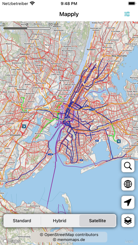
스크린샷


가격
- 오늘: 무료
- 최소: 무료
- 최대: 무료
가격 추적
개발자
- Florian Chrometz
- 플랫폼: iOS 앱 (4)
- 목록: 0 + 1
- 포인트: 11 + 675 ¡
- 순위: 0
- 리뷰: 0
- 할인: 0
- 동영상: 0
- RSS: 구독
포인트
0 ☹️
순위
0 ☹️
목록
0 ☹️
리뷰
첫 번째 리뷰를 남겨보세요 🌟
추가 정보
주소록
- 🌟 공유하기
- App Store
당신은 또한 같은 수 있습니다
-
- OpenStreets 4 Open Street Map
- iOS 앱: 내비게이션 게시자: KicksApps GmbH
- 무료
- 목록: 0 + 0 순위: 0 리뷰: 0
- 포인트: 0 + 16 (4.8) 버전: 4.0.3 Get OpenStreets today! The smart social mapping tool is your all-in-one mapping solution based on Open Street Map data, collected by millions of volunteers worldwide: * enjoy great ... ⥯
-
- Open Charge Map
- iOS 앱: 내비게이션 게시자: Webprofusion Pty Ltd
- 무료
- 목록: 0 + 0 순위: 0 리뷰: 0
- 포인트: 0 + 1 (5.0) 버전: 8.5.7 Powered by data from Open Charge Map, you can use this app to: - update listings for charging locations - find charging equipment locations near you or in a place you are planning to ... ⥯
-
- Cardiff Travel Guide with Offline City Street Map
- iOS 앱: 내비게이션 게시자: eTips LTD
- 무료
- 목록: 0 + 0 순위: 0 리뷰: 0
- 포인트: 0 + 1 (1.0) 버전: 1.0.2 SPECIAL FEATURES - STOP CARRYING BOOK GUIDES!!! - 100% OFFLINE TRAVEL GUIDE - ZOOMABLE 100% REGIONAL OFFLINE MAPS - PICS GALLERY - GPS CAPABLE - INTERACTIVE POINTS OF INTEREST on the ... ⥯
-
- MineAR: Augmented Reality Map
- iOS 앱: 내비게이션 게시자: Map Life, LLC
- * 무료
- 목록: 0 + 0 순위: 0 리뷰: 0
- 포인트: 0 + 5 (5.0) 버전: 2.40.15 Data you can grasp. As a geoscience professional, we know you want an easier way to see your GIS data while you re in the field. MineAR allows you to do exactly that. Our app ... ⥯
-
- Open Sea OpenSeaMap Browser
- iOS 앱: 내비게이션 게시자: Mobile Geographics
- 무료
- 목록: 0 + 0 순위: 0 리뷰: 0
- 포인트: 0 + 5 (3.2) 버전: 1.1 Open Sea is a browser for the maps produced by the OpenSeaMap project. OpenSeaMap is a subproject of OpenStreetMap, and generates freely usable nautical chart data and map image ... ⥯
-
- Open GPX Tracker
- iOS 앱: 내비게이션 게시자: Juan Manuel Merlos
- 무료
- 목록: 1 + 0 순위: 0 리뷰: 0
- 포인트: 1 + 119 (4.3) 버전: 1.9.0 Create GPS traces with waypoints. Offline map support, no time restrictions, no ads, no in-app-purchases, and all the data is private. Open GPX Tracker is ideal for: * Traveling and ... ⥯
-
- Street View 3D Live Google Map
- iOS 앱: 내비게이션 게시자: Ekta Undhad
- 무료
- 목록: 0 + 1 순위: 0 리뷰: 0
- 포인트: 1 + 206 (4.7) 버전: 1.1 Street View on Live Google Map brings 360-degree street-level exploration to your fingertips. Instantly view real-time maps, live GPS locations, satellite images, and high-quality ... ⥯
-
- Street View Map: Near by Tour
- iOS 앱: 내비게이션 게시자: Kaneki Ken
- 무료
- 목록: 0 + 0 순위: 0 리뷰: 0
- 포인트: 0 + 166 (4.7) 버전: 2.0.0 Street View Map Tour is an app that allows you to explore your surroundings in 360 degrees. It uses Apple's Look Around technology to provide street view for nearby places, so you can ... ⥯
- 새로운
- Street View 360° Travel Guide
- iOS 앱: 내비게이션 게시자: AppCrafters
- * 무료
- 목록: 0 + 0 순위: 0 리뷰: 0
- 포인트: 1 + 1 (5.0) 버전: 1.0 Street View 360° - Guide Along Explore the World Smarter Street View 360° is your smart travel companion for exploring cities and landmarks through immersive Street View with ... ⥯
-
- Map LT
- iOS 앱: 내비게이션 게시자: Taylan Atasoy
- 무료
- 목록: 0 + 0 순위: 0 리뷰: 0
- 포인트: 0 + 0 버전: 4.0 Map LT is a cutting-edge navigation and mapping application designed for users who want to easily find their way around World. With its user-friendly interface and comprehensive ... ⥯
-
- Map Link Converter
- iOS 앱: 내비게이션 게시자: POORNA S JAYASINGHE
- $4.99
- 목록: 0 + 0 순위: 0 리뷰: 0
- 포인트: 0 + 0 버전: 1.0 Seamlessly open any map link in your preferred navigation app. Map Link Converter is the ultimate tool for converting and opening map URLs across different mapping platforms. Whether ... ⥯
-
- Street View Maps
- iOS 앱: 내비게이션 게시자: Amit Lakhani
- 무료
- 목록: 0 + 0 순위: 0 리뷰: 0
- 포인트: 0 + 482 (4.3) 버전: 2.6 3D Street View Allow you to find your location and show real time street panorama view with 3D Panorama 360 degree & Street Panorama View. Street view search world landmarks, discover ... ⥯
-
- Street View Map - Live 360°
- iOS 앱: 내비게이션 게시자: Sumit Kukadiya
- 무료
- 목록: 0 + 0 순위: 0 리뷰: 0
- 포인트: 0 + 100 (3.9) 버전: 1.6 3D Street View Allow you to find your location and show real time street panorama view with 3D Panorama 360 degree & Street Panorama View. Live Satellite View GPS Map app gives the ... ⥯
-
- Street View 360°
- iOS 앱: 내비게이션 게시자: Ravi Munjani
- 무료
- 목록: 0 + 0 순위: 0 리뷰: 0
- 포인트: 0 + 6 (3.7) 버전: 1.4 3D Street View Allow you to find your location and show real time street panorama view with 3D Panorama 360 degree & Street Panorama View. Search world landmarks, discover natural ... ⥯