| Developer: | Vietnam Posts and Telecommunications Group (134) | ||
| Price: | Free | ||
| Rankings: | 0 | ||
| Reviews: | 0 Write a Review | ||
| Lists: | 0 + 0 | ||
| Points: | 0 + 0 ¡ | ||
| App Store | |||
Description
")
Screenshots
Price History
- Today: Free
- Minimum: Free
- Maximum: Free
Track prices
Developer
- Vietnam Posts and Telecommunications Group
- Platforms: iOS Apps (134)
- Lists: 0 + 0
- Points: 1 + 293 ¡
- Rankings: 0
- Reviews: 0
- Discounts: 0
- Videos: 0
- RSS: Subscribe
Points
0 ☹️
Rankings
0 ☹️
Lists
0 ☹️
Reviews
Be the first to review 🌟
Additional Information
- Version: 1.1.7
- Category:
iOS Apps›Utilities - OS:
iPad,iPhone,iOS 15.0 and up - Size:
125 Mb - Supported Languages:
English,Vietnamese - Content Rating:
4+ - App Store Rating:
0 - Updated:
- Release Date:
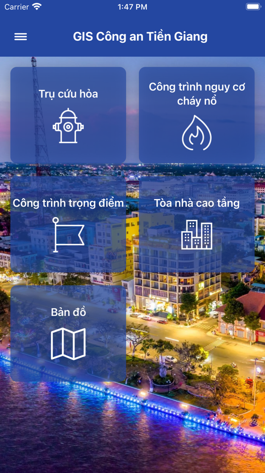
«GIS CATG» is a Utilities app for iOS, developed by «Vietnam Posts and Telecommunications Group». It was first released on and last updated on . This app is currently free. This app has not yet received any ratings or reviews on AppAgg. Available languages: English, Vietnamese. AppAgg continuously tracks the price history, ratings, and user feedback for «GIS CATG». Subscribe to this app or follow its RSS feed to get notified about future discounts or updates.
- 🌟 Share
- App Store
You may also like
-
- GIS Camera Reporter
- iOS Apps: Utilities By: Metropolitan Waterworks Authority
- Free
- Lists: 1 + 0 Rankings: 0 Reviews: 0
- Points: 0 + 1 (5.0) Version: 7.1.7 GIS camera reporter เป็นแอพพลิเคชั่นที่ใช้ในการส่งพิกัด พร้อมรูปถ่าย และข้อความ บนแผนที่ GIS ที่ใช้งานด้านวิศวกรรมและบริการ ของการประปานครหลวง เช่น งานแจ้งตำแหน่งท่อแตกรั่ว ... ⥯
-
- Foto-GIS
- iOS Apps: Utilities By: NGN IT-Solutions GmbH
- Free
- Lists: 0 + 0 Rankings: 0 Reviews: 0
- Points: 0 + 0 Version: 2.41 Foto-GIS application allows you to conveniently and professionally automate your construction site foto documentation. Save up to 80% of your time and energy. Images are automatically ... ⥯
-
- GMapper GIS GPS & Area Measure
- iOS Apps: Utilities By: Suphawadee Yaprasat
- * Free
- Lists: 0 + 0 Rankings: 0 Reviews: 0
- Points: 0 + 5 (4.4) Version: 1.13.3 Explore and Manage Maps with Precision with GMapper Gis Mapper Surveys Experience unparalleled accuracy in land surveying and management with GMapper Gis Mapper Surveys! Designed for ... ⥯
-
- GNIDA GIS
- iOS Apps: Utilities By: NIC
- Free
- Lists: 0 + 0 Rankings: 0 Reviews: 0
- Points: 0 + 0 Version: 1.0 Citizen Centric One Map Greater Noida Mobile GIS App to get Information of Plots & Nearby Facilities based on User's Location. Geo-Spatial Technology & Services Division, NIC has ... ⥯
-
- עיריית ירושלים GIS
- iOS Apps: Utilities By: Municipality of Jerusalem
- Free
- Lists: 0 + 0 Rankings: 0 Reviews: 0
- Points: 0 + 0 Version: 1.1 מערכת מיפוי GIS של עיריית ירושלים ⥯
-
- My GIS Agent
- iOS Apps: Utilities By: GLOBAL INSURANCE SERVICE INC
- Free
- Lists: 0 + 0 Rankings: 0 Reviews: 0
- Points: 0 + 0 Version: 1.0.22 The My GIS Agent app helps Global Insurance Services, Inc customers stay in touch with their GIS agent from anywhere they are. Ever wondered how much you need to pay upon renewal? Or ... ⥯
-
- GeoSearch Thailand
- iOS Apps: Utilities By: GIS Co., Ltd.
- Free
- Lists: 0 + 0 Rankings: 0 Reviews: 0
- Points: 0 + 0 Version: 1.6.0 Our Geosearch API helps turn your addresses in Thailand into geographic coordinates, find POIs or the other way round. Run batch queries, store the results, and display them on a map ... ⥯
-
- Pro Vision AR
- iOS Apps: Utilities By: Virtual GIS LLC
- Free
- Lists: 0 + 0 Rankings: 0 Reviews: 0
- Points: 0 + 4 (5.0) Version: 1.53 ProVision AR allows users to experience a real-world display of geographically referenced 3D data on their iOS device. Data are projected onto the real world in augmented reality ... ⥯
-
- VECMAP
- iOS Apps: Utilities By: Avia-GIS
- Free
- Lists: 0 + 0 Rankings: 0 Reviews: 0
- Points: 0 + 0 Version: 3.2.2 The VECMAP® mobile app is a complimentary app only for users granted access via the VECMAP® software package. This app is used for field data entry into your VECMAP® data collection ... ⥯
-
- GTRPlus
- iOS Apps: Utilities By: SIGIS Soluciones Integrales GIS, C.A.
- Free
- Lists: 0 + 0 Rankings: 0 Reviews: 0
- Points: 0 + 1 (5.0) Version: 1.82.0 GTRPlus ® is a tracking system that allows continuous monitoring and immediate location of private vehicles. It provides several tools related to the safe operation of the car; cruise ... ⥯
-
- VerdeComo
- iOS Apps: Utilities By: R3 GIS Srl
- Free
- Lists: 0 + 0 Rankings: 0 Reviews: 0
- Points: 0 + 0 Version: 1.3.4 La presente applicazione consente ai Cittadini di Como di segnalare eventuali necessità manutentive nelle aree verdi pubbliche in manutenzione all'Ufficio Parchi e Giardini ... ⥯
-
- Ruty
- iOS Apps: Utilities By: América Gis
- Free
- Lists: 0 + 0 Rankings: 0 Reviews: 0
- Points: 0 + 0 Version: 1.0.1 Ruty - Seguimiento y monitoreo vehicular ⥯
-
- GEM - PRADAN
- iOS Apps: Utilities By: Laxmiprasad Putta
- Free
- Lists: 0 + 0 Rankings: 0 Reviews: 0
- Points: 0 + 0 Version: 1.2.2 GIS Engagement in MGNREGS (GEM) application provides an interface to collect data for all watershed development components. The mobile application also captures geo tagged images in ... ⥯
-
- Hyper Cleaner: Clean Up Photos
- iOS Apps: Utilities By: Gismart Limited
- Free
- Lists: 0 + 0 Rankings: 0 Reviews: 0
- Points: 0 + 8,296 (4.6) Version: 2.10 Hyper Cleaner is the ultimate storage cleaner to optimize and organize your phone gallery. Clear up redundant stuff. Compress videos. Crystallize memories. Imagine opening your phone ... ⥯