| 개발자: | Intergraph Corporation (29) | ||
| 가격: | 무료 | ||
| 순위: | 0 | ||
| 리뷰: | 0 리뷰 작성 | ||
| 목록: | 0 + 0 | ||
| 포인트: | 0 + 1 (5.0) ¡ | ||
| Windows Store | |||
기술
")
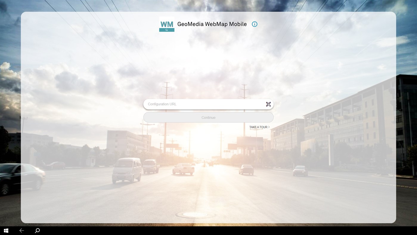
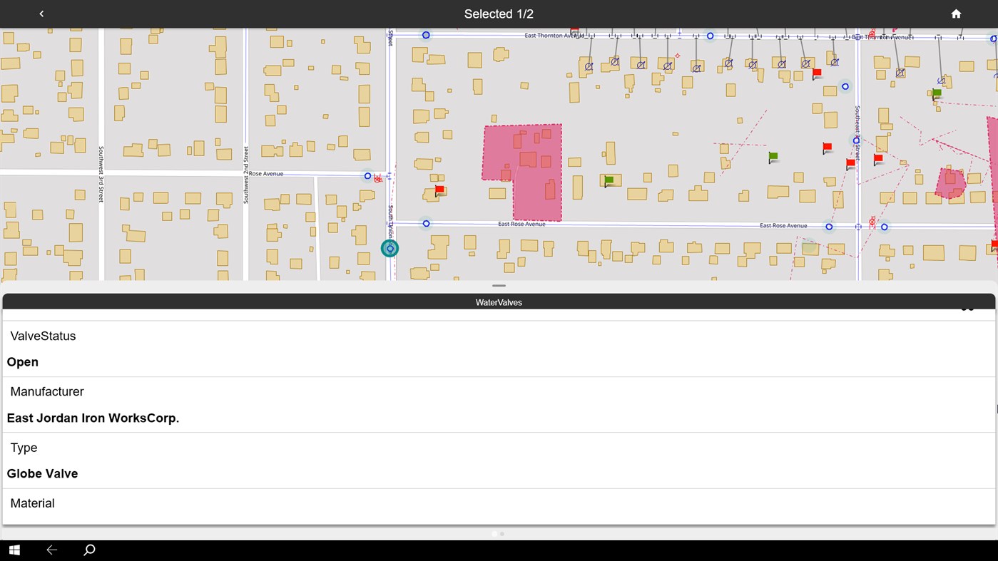
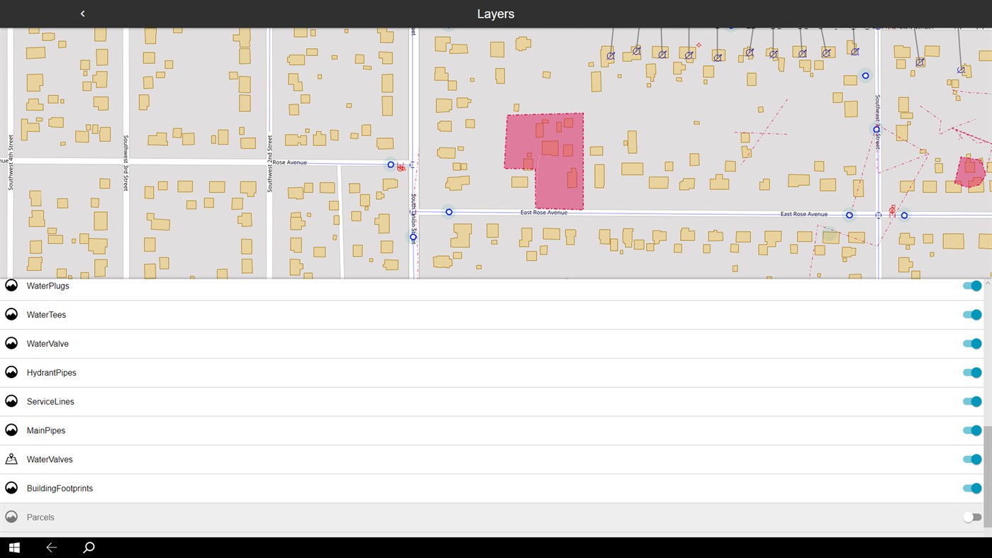
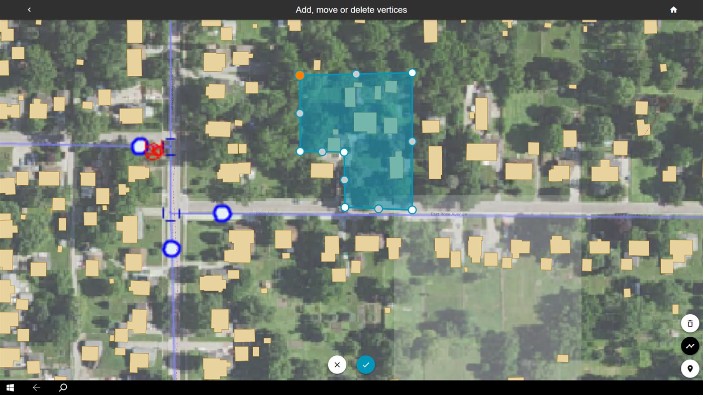
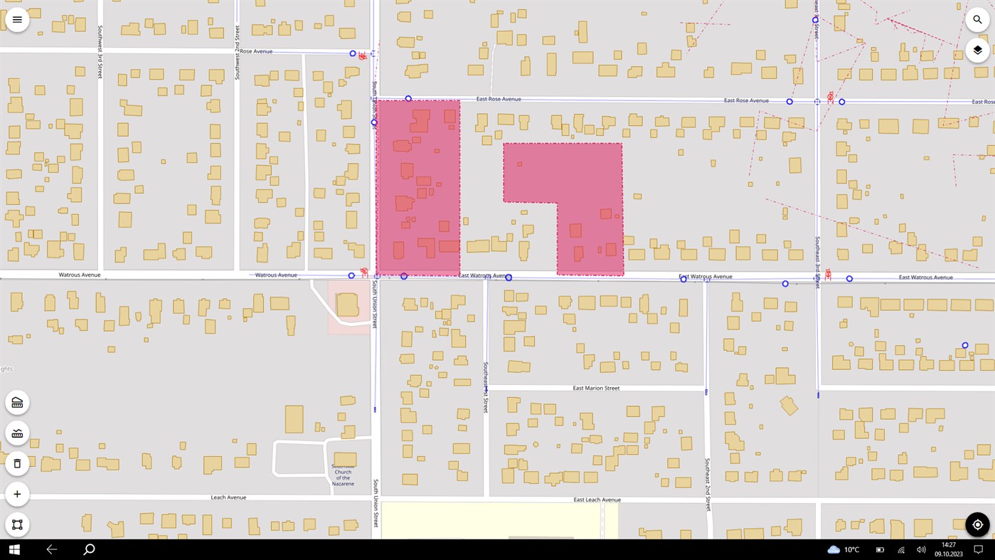
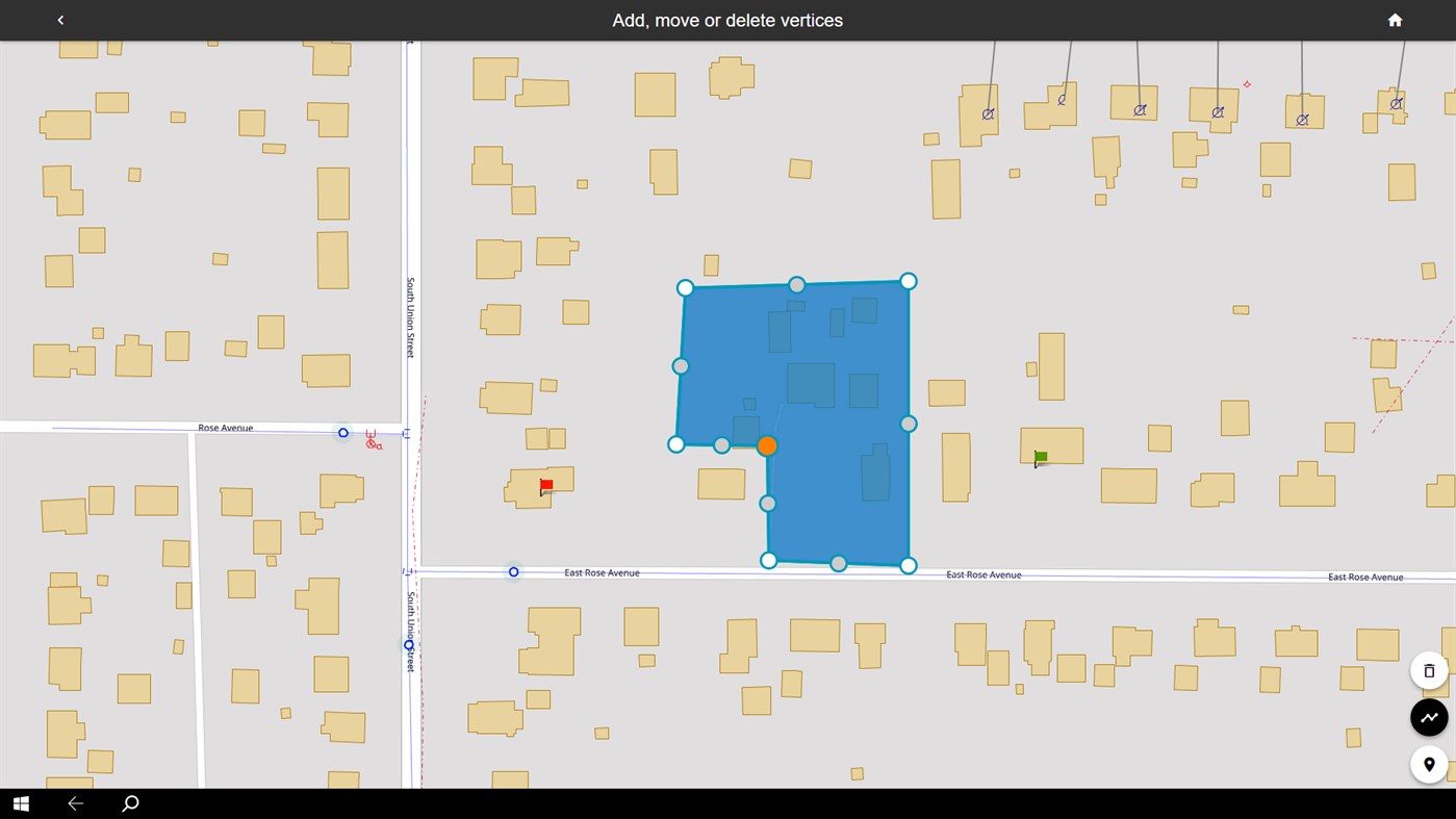
GeoMedia WebMap Mobile provides quick navigation and map display including precise GPS location. With this application, you can view, edit, and update enterprise data from the field, in real time. Feature attributes and geometries modified on the mobile device are available instantly on the GIS platform used by your organization.
GeoMedia WebMap Mobile uses WMS and WFS OGC services for GIS data viewing, and WFS-T OGC service for updating GIS data.
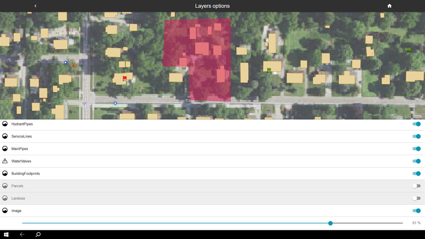
The application can be configured to serve selected data to individual users within a pre-defined area and configured to run in offline mode to support field work with weak or no internet access. The server side of the GeoMedia WebMap Mobile is responsible for serving data. The user configurations is offered as part of GeoMedia WebMap Advantage and Professional.
스크린샷
새로운 기능
- 버전: PC
- 업데이트:
가격
- 오늘: 무료
- 최소: 무료
- 최대: 무료
가격 추적
개발자
- Intergraph Corporation
- 플랫폼: iOS 앱 (24) Windows 앱 (5)
- 목록: 0 + 0
- 포인트: 1 + 73 ¡
- 순위: 0
- 리뷰: 0
- 할인: 0
- 동영상: 0
- RSS: 구독
포인트
0 ☹️
순위
0 ☹️
목록
0 ☹️
리뷰
첫 번째 리뷰를 남겨보세요 🌟
추가 정보
- 버전: PC
- 카테고리:
Windows 앱›내비게이션 및 지도 - 운영체제:
HoloLens,Mobile,PC,Surface Hub - 크기:
30 Mb - 지원되는 언어:
Arabic,Basque,Bulgarian,Catalan,Czech,Danish,Dutch,English,French,Galician,German,Greek,Hebrew,Hindi,Hungarian,Indonesian,Italian,Japanese,Kannada,Latvian,Malay,Marathi,Polish,Portuguese,Romanian,Russian,Serbian,Slovak,Spanish,Swedish,Thai,Turkish,Ukrainian,Vietnamese - 콘텐츠 등급:
EVERYONE - Windows Store 개의 평가:
5.0(1) - 업데이트:
- 출시일:
- 🌟 공유하기
- Windows Store
당신은 또한 같은 수 있습니다
-
- Geo Elevation: Map Elevation Chart Creator
- Windows 앱: 내비게이션 및 지도 게시자: ObjectGraph
- $4.99
- 목록: 0 + 0 순위: 0 리뷰: 0
- 포인트: 1 + 4 (4.0) 버전: PC Geo Elevation is a powerful tool to build a cross-sectional elevation chart from any paths/points on the map with a few clicks. Simply create a path and click on "Get Elevation" you ... ⥯
-
- Geo Data Explorer Lite
- Windows 앱: 내비게이션 및 지도 게시자: Tech Maven Geospatial, LLC
- 무료
- 목록: 0 + 0 순위: 0 리뷰: 0
- 포인트: 0 + 1 (5.0) 버전: PC Geo Data Explorer is an innovative GIS mapping app and enables rapid data visualization, data collection, editing and analysis of internet map data and web services and local offline ... ⥯
-
- IP Geo Location
- Windows 앱: 내비게이션 및 지도 게시자: DDual.com
- * 무료
- 목록: 0 + 0 순위: 0 리뷰: 0
- 포인트: 0 + 4 (3.5) 버전: PC Forget about cloud. Now you can locate physical location for any domain, website or IP address. Pairing of IP address to a geographical location is called geolocation. There are times ... ⥯
-
- Firenze dove, cosa... Km4city
- Windows 앱: 내비게이션 및 지도 게시자: Universita degli Studi di Firenze
- 무료
- 목록: 0 + 0 순위: 0 리뷰: 0
- 포인트: 0 + 0 버전: PC A personal assistant that shows the services that are close to your location, browse in the city, located restaurants, bathrooms, free WiFi, bicycle, parks, digital location, delays on ⥯
-
- GPS Maps Navigation
- Windows 앱: 내비게이션 및 지도 게시자: Cidade
- * 무료
- 목록: 0 + 1 순위: 0 리뷰: 0
- 포인트: 1 + 1,378 (4.0) 버전: PC Keep track of your real time locations everywhere you go using the advanced GPS locator with coordinated and time saving utilities for your touch devices. Tutorial: ... ⥯
-
- Nachrichten EU-Schwerbehinderung Alert Monitor
- Windows 앱: 내비게이션 및 지도 게시자: TheAssimilator
- * 무료
- 목록: 0 + 0 순위: 0 리뷰: 0
- 포인트: 0 + 0 버전: PC This client serves as a geo-monitor for objects to be monitored within a given radius. In addition, the monitor can be used as a "receiving center" for SMS emergency alarms from the ... ⥯
-
- Trackus 10
- Windows 앱: 내비게이션 및 지도 게시자: Reactor.fr
- 무료
- 목록: 0 + 0 순위: 0 리뷰: 0
- 포인트: 0 + 0 버전: PC Trackus 10 is the Windows 10 version that can track anyone using Trackus application of Geo location. ⥯
-
- MarinePlotter
- Windows 앱: 내비게이션 및 지도 게시자: DJM Questor Software
- 무료
- 목록: 0 + 0 순위: 0 리뷰: 0
- 포인트: 0 + 9 (1.4) 버전: PC Version 8.5.14.0 Free software for displaying Electronic Nautical Charts (ENC), Raster Nautical Charts (RNC), and Geo-referenced images (IMG) as charts. The program supports the ... ⥯