기술
")
https://www.microsoft.com/en-us/store/apps/gps-navigator-recorder/9nblggh2vvj3
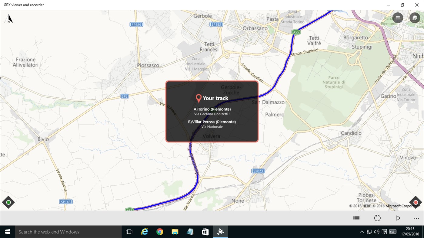
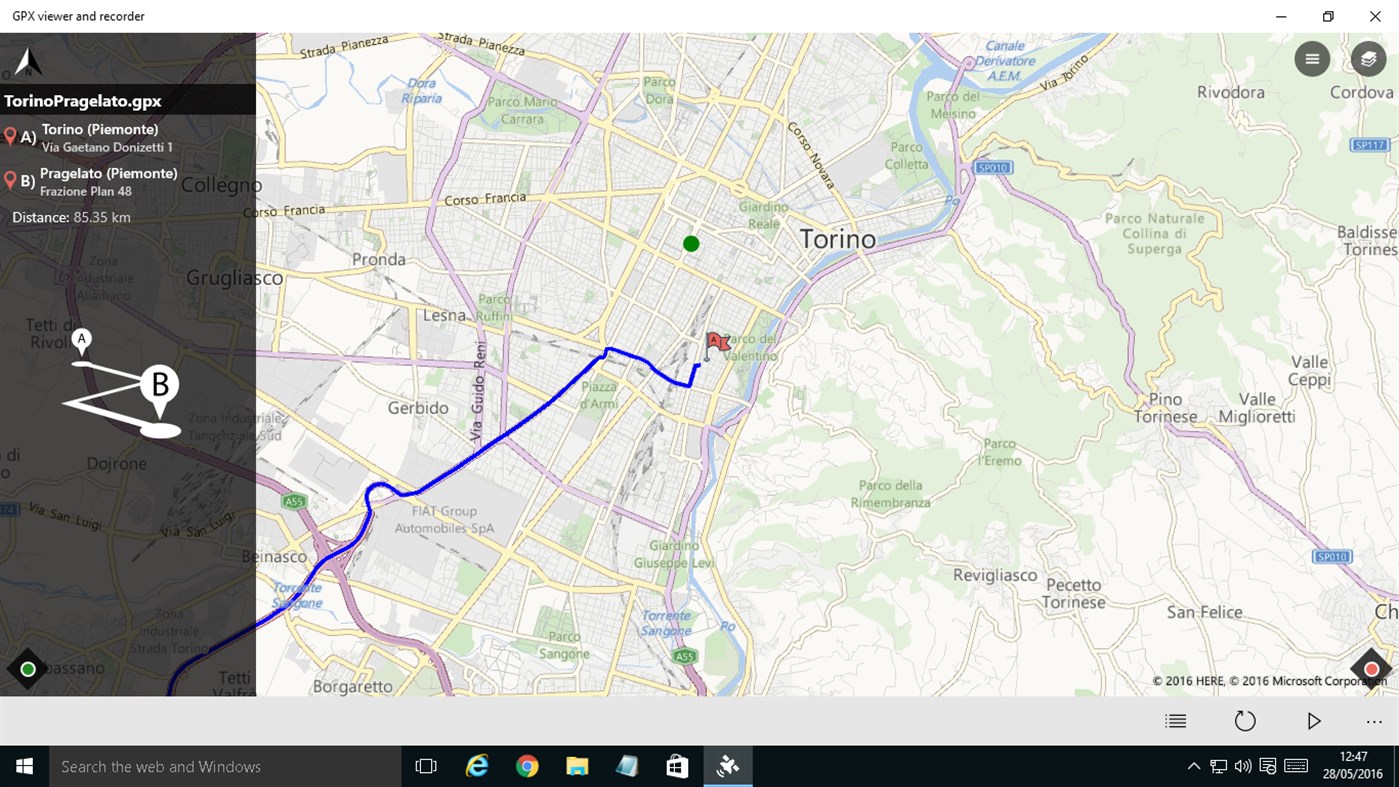
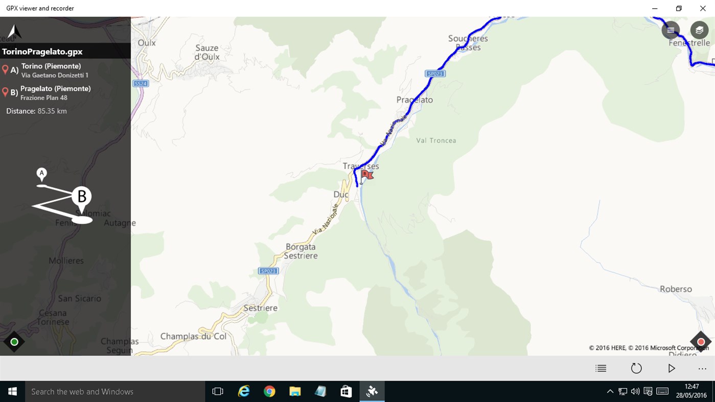
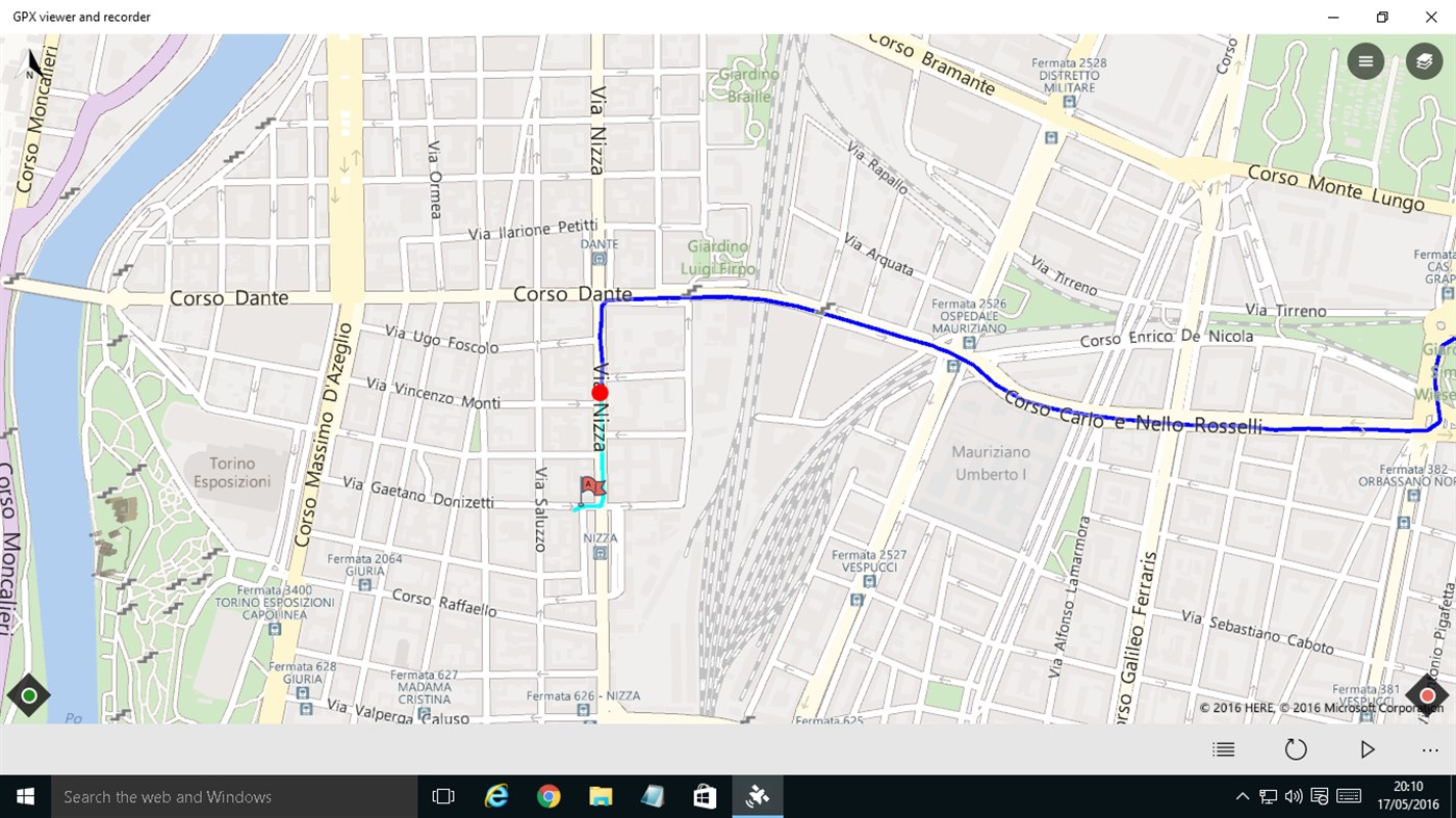
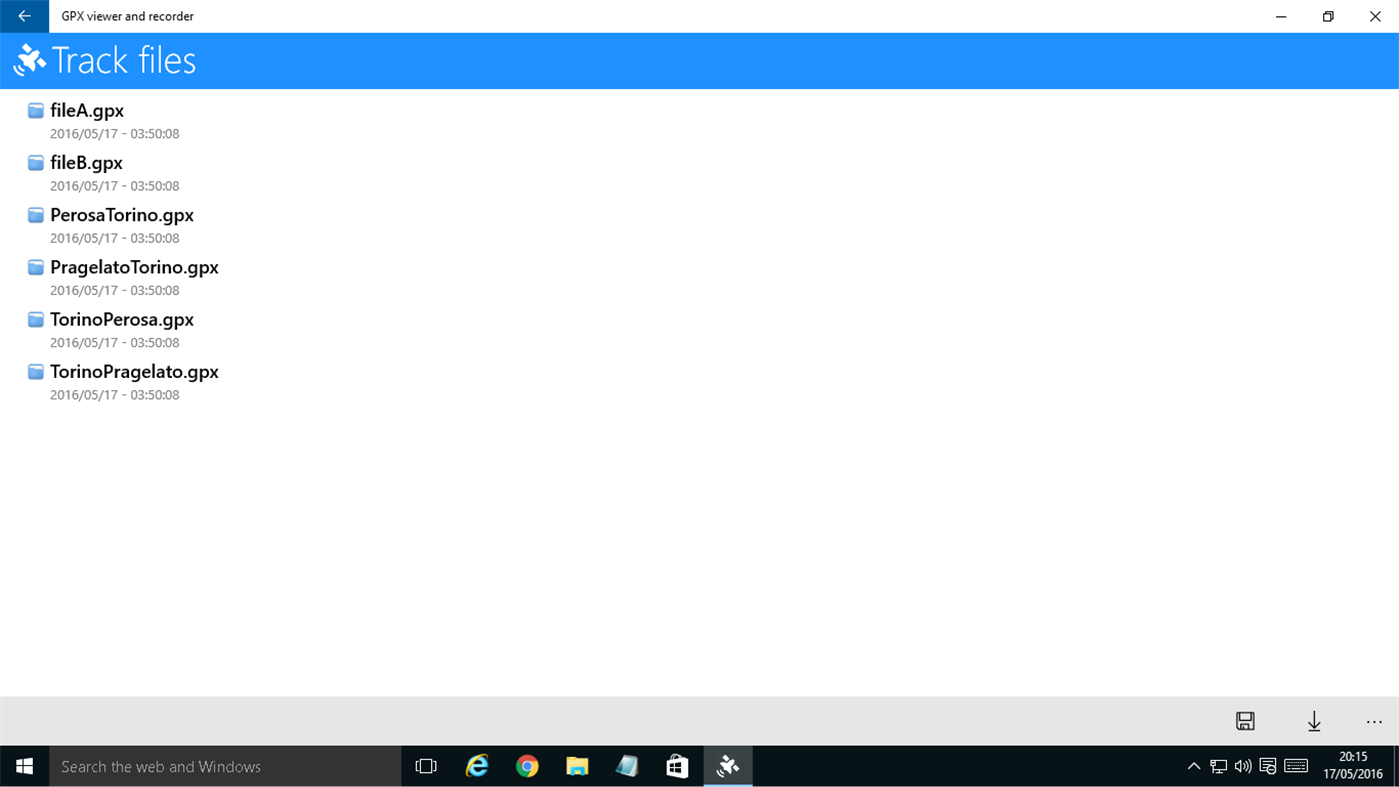
With this app you can view GPX files (routes, tracks, point of interest) on a Windows 10 pc. If you use a smartphone, you can also follow you and draw the route on the map, then save it in the device. THIS WAY YOU CAN RECORD A TRACK THROUGH YOUR SMARTPHONES, AND THEN VIEW IT ON YOUR PC LARGE SCREEN. You can import/export a local file (track route) in the documents folder of the device. You can also view a previously recorded GPX file or create a new one.
You have four modes of operation.
1) The first is a simple compass synchronized with map. You can disable this feature in the settings page "Synchronize map with compass (when follow or play is unactive)". If the option is checked the map rotate with you, otherwise the map is always facing north.
2) Follow me and draw route on the map. In the menu you must click on "Start follow me / Stop follow me". This feature is enabled when the option "Enable track route on map" in the settings menu is checked. When you stop the function clicking on "Stop follow me" , the route will be stored in the device. This way, if you go from point A to point B, you can record the route.
3) Follow me and don't draw route on the map. In the menu you must click on "Start follow me / Stop follow me". This feature is enabled when the option "Enable track route on map" in the settings menu is not checked. When you stop the function clicking on "Stop follow me", the route will not be stored in the device. This way, if you go from point B to point A, you can follow a route on map previously stored and loaded (follow back).
4) Replay route on the map (a route previously stored in step 2). In this way, when you are at home, you can replay a travel. Seeing the params as (course, speed, altitude).
If you are a tourist, this app will be useful to the holidays and leisure time. Or on your travels to discover places or touristic city. Or car tracks gps - cycle tracks gps - running tracks gps ☺
Version 2.0.0.0 - Bug fix
Version 1.7.1.0 - Bug fix
Version 1.7.0.0 - In the page map you have a slider, and through it you can select the position on map. You have also a button to show Panoramio Photo (if it is present). Bug fix
Version 1.6.0.0 - In the page map you have a slider, and through it you can select the position on map. You have also a button to show Google Street View (if it is present). Bug fix
Version 1.5.1.0 - Bug fix
Version 1.5.0.0 - On the map page (if you are on a desktop device), you have also an altitude chart. When you replay a route, you have an indicator of the current altitude. You can enable / disable in the settings page. Bug fix
Version 1.4.0.0 - Added altitude charts. In detail page added: elevation gain departure / arrival, elevation gain min / max. In the map page (on desktop device and screen more than 1150px) you can see also some altitude data. Bug fix
Version 1.3.0.0 - Upload a GPX file on STRAVA. Bug fix
Version 1.2.0.0 - Improved support for file "multi-segments". Added maps: OpenStreetMap, OpenCycleMap, HikeBike. Traffic information on map. Added language Spanish and Portuguese. Bug fix
Version 1.1.0.0 - Bug fix
Features
1) .gpx files viewer
2) Gps navigation
3) Track your route on map
4) Follow me on map
5) Replay a route previously stored
6) Save the route in your device
7) Import/export a local file in Documents folder
8) Car tracks gps / Cycle tracks gps / Running tracks gps
9) Motion data
10) Traffic map layer
11) Maps: OpenStreetMap, OpenCycleMap, HikeBike
12) Upload a GPX file on STRAVA
스크린샷


새로운 기능
- 버전: PC
- 업데이트:
가격
- 오늘: 무료
- 최소: 무료
- 최대: 무료
가격 추적
포인트
0 ☹️
순위
0 ☹️
목록
0 ☹️
리뷰
첫 번째 리뷰를 남겨보세요 🌟
추가 정보
- 버전: PC
- 카테고리:
Windows 앱›내비게이션 및 지도 - 운영체제:
Mobile,PC,Surface Hub - 크기:
15 Mb - 지원되는 언어:
English,Italian,Portuguese,Spanish - 콘텐츠 등급:
EVERYONE - Windows Store 개의 평가:
4.8(4,691) - 업데이트:
- 출시일:
- 🌟 공유하기
- Windows Store
당신은 또한 같은 수 있습니다
-
- GPX Player
- Windows 앱: 내비게이션 및 지도 게시자: Heptazane
- 무료
- 목록: 0 + 0 순위: 0 리뷰: 0
- 포인트: 0 + 9 (3.4) 버전: PC GPX Player is a tool for you to load one or more GPX (GPS Exchange Format) files and play them back in a 3D environment. GPX files are typically generated by GPS devices or GPS ... ⥯
-
- GPS-GPX Logger
- Windows 앱: 내비게이션 및 지도 게시자: Ben Byer
- * 무료
- 목록: 0 + 0 순위: 0 리뷰: 0
- 포인트: 0 + 35 (4.0) 버전: PC Over 100000 downloads. This is a great mapping and trip logging app. Use an external USB GPS device connected to your Windows 10/11 PC. View the travelled path on the map in real time ... ⥯
-
- Nogarder Location Viewer
- Windows 앱: 내비게이션 및 지도 게시자: nogarder
- 무료
- 목록: 0 + 0 순위: 0 리뷰: 0
- 포인트: 0 + 2 (5.0) 버전: PC Nogarder Location Viewer is a simple location test application. ⥯
-
- PoiViewer10
- Windows 앱: 내비게이션 및 지도 게시자: Bjorn Holmstedt
- * 무료
- 목록: 0 + 0 순위: 0 리뷰: 0
- 포인트: 0 + 115 (4.5) 버전: PC This program can open files with your Point Of Interests and present them on map. You can open files from the disk or SD card or from any other file source as downloaded from Internet ... ⥯
-
- i-Boating:Marine Navigation Maps & Nautical Charts
- Windows 앱: 내비게이션 및 지도 게시자: Bist LLC
- * 무료
- 목록: 1 + 0 순위: 0 리뷰: 0
- 포인트: 0 + 235 (4.0) 버전: PC This App offers offline nautical charts, lake & river navigation maps for fishing, kayaking, boating, yachting & sailing. Marine navigation coverage includes marine vector charts, ... ⥯
-
- Easy Map 3D
- Windows 앱: 내비게이션 및 지도 게시자: Ivan Fuligni
- 무료
- 목록: 0 + 0 순위: 0 리뷰: 0
- 포인트: 1 + 15 (3.5) 버전: PC With Easy Map 3D installed on your PC, you can view street and satellite 3D maps of the whole world (Bing Maps, OpenStreetMap and Mapbox). You can move around, widen, narrow, zoom in ... ⥯
-
- NaviComputer
- Windows 앱: 내비게이션 및 지도 게시자: M. Bitzer
- 무료
- 목록: 0 + 0 순위: 0 리뷰: 0
- 포인트: 0 + 0 버전: PC ** Now with live tile, showing your track stats live on your startscreen ** NaviComputer is a GPS offline maps and tracking app designed for hiking, biking and other outdoor ... ⥯
-
- GPS Routes
- Windows 앱: 내비게이션 및 지도 게시자: Kathy Grobbelaar
- 무료
- 목록: 0 + 0 순위: 0 리뷰: 0
- 포인트: 1 + 8 (3.2) 버전: PC GPS Routes lets you download GPX and KML Route files into the app from your device. Display the downloaded route and your current position on Bing Maps while walking/driving the route. ⥯
-
- Maps Pro
- Windows 앱: 내비게이션 및 지도 게시자: Nicollet Fabien
- * $4.99
- 목록: 0 + 0 순위: 0 리뷰: 0
- 포인트: 1 + 221 (3.1) 버전: PC Maps Pro is the most advanced mapping application on the Windows Store. Directions, Street View, geolocation, Points of Interest, offline maps and a powerful search engine in one ... ⥯
-
- GPS Maps Navigation
- Windows 앱: 내비게이션 및 지도 게시자: Cidade
- * 무료
- 목록: 0 + 1 순위: 0 리뷰: 0
- 포인트: 1 + 1,378 (4.0) 버전: PC Keep track of your real time locations everywhere you go using the advanced GPS locator with coordinated and time saving utilities for your touch devices. Tutorial: ... ⥯
-
- Hiking Assistant Pro
- Windows 앱: 내비게이션 및 지도 게시자: Bouncing light trap
- $0.99
- 목록: 0 + 0 순위: 0 리뷰: 0
- 포인트: 0 + 0 버전: PC While hiking, sometimes one would have questions like, "How far have we walked? How far are we from starting point? Are we on the right trail?" This tool can provide you with all these ⥯
-
- GPSLogger Pro
- Windows 앱: 내비게이션 및 지도 게시자: Patrick Mortara
- $1.49
- 목록: 0 + 0 순위: 0 리뷰: 0
- 포인트: 0 + 1 (3.0) 버전: PC GPSLoggerPro is an allround-outdoor-gps-tool. It offers features like gps position recording, gpx-export, a compass, weather forecasts, maps, Sunrise/Sunset times and many more. With ... ⥯
-
- Cartograph Maps Pro
- Windows 앱: 내비게이션 및 지도 게시자: teq-IT
- $17.49
- 목록: 1 + 0 순위: 0 리뷰: 0
- 포인트: 0 + 0 버전: PC The Cartograph 2 app views Mapsforge offline vector maps, offline raster maps, and online/WMS maps. It supports tracking, route search, overlays, hillshading, reliefs, track drawing, ... ⥯
-
- New Jersey Rail
- Windows 앱: 내비게이션 및 지도 게시자: Jolly Code
- 무료
- 목록: 0 + 1 순위: 0 리뷰: 0
- 포인트: 1 + 2 (5.0) 버전: PC DepartureVision viewer for the NJ Transit Rail system. Pin and favorite your stations for quick and easy access. ⥯