| Utvecklare: | XDivide Geospatial (82) | ||
| Pris: | * Gratis | ||
| Betyg: | 0 | ||
| Recensioner: | 0 Skriv en recension | ||
| Listor: | 0 + 0 | ||
| Poäng: | 0 + 0 ¡ | ||
| Google Play | |||
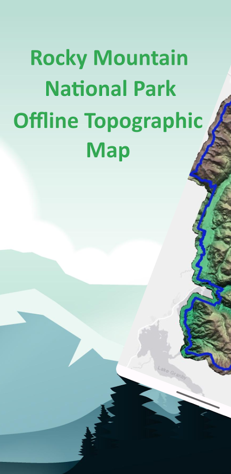
Beskrivning
")
Key Features:
Complete offline topographic maps of Rocky Mountain National Park-no internet required
Accurate elevation and terrain data from the 3D Elevation Program (3DEP) and Land Resources Division
Intuitive, easy-to-use interface for all experience levels
GPS-enabled maps to track your location
Property boundaries and land status for administrative reference (not for legal use)
Powered by the advanced Leaflet JavaScript library for smooth, reliable map browsing
Explore Park Highlights:
Traverse the Continental Divide and experience world-renowned scenery from over 60 peaks above 12,000 feet, including Longs Peak at 14,259 feet-the park’s highest summit
Visit more than 100 alpine and subalpine lakes, and hike through montane meadows, evergreen forests, and alpine tundra
Discover U-shaped glacial valleys, snow-fed streams, and dramatic mountain passes like Trail Ridge Road-the highest paved road in any U.S. national park
Watch for abundant wildlife such as elk, bighorn sheep, moose, and marmots in diverse ecosystems
Enjoy scenic drives, backcountry adventures, and panoramic vistas in one of the highest national parks in the country
Rocky Mountain National Park spans elevations from 7,860 to 14,259 feet, with the Continental Divide running north to south through the park, shaping its climate and ecology. From wildflower meadows to rugged alpine heights, the park offers unforgettable experiences for hikers, climbers, photographers, and families alike.
Rocky Mountain Offline Map is your reliable guide for exploring, navigating, and discovering all the natural wonders of Rocky Mountain National Park-navigate confidently, even offline.
Skärmbilder


Pris
-
* Innehåller annonser - Idag: Gratis
- Minsta: Gratis
- Maximalt: $2.99
Bevaka priser
Utvecklare
- XDivide Geospatial
- Plattformar: Android Appar (82)
- Listor: 0 + 0
- Poäng: 23 + 0 ¡
- Betyg: 0
- Recensioner: 0
- Rabatter: 0
- Videor: 2
- RSS: Prenumerera
Poäng
0 ☹️
Betyg
0 ☹️
Listor
0 ☹️
Recensioner
Var den första att granska 🌟
Ytterligare information
- Version: 3.0
- Kategori:
Android Appar›Kartor och vägbeskrivningar - OS:
Android 7.0 - Storlek:
24 Mb - Innehållsrankning:
Everyone - Google Play Betyg:
0 - Uppdaterad:
- Utgivningsdatum:
Kontakter
- Webbplats:
 https://jca57ac46.app-ads-txt.com
- 🌟 Dela
- Google Play
Du kanske också gillar
-
- Guadalupe Mountain Offline Map
- Android Appar: Kartor och vägbeskrivningar Av: XDivide Geospatial
- * Gratis
- Listor: 0 + 0 Betyg: 0 Recensioner: 0
- Poäng: 0 + 0 Version: 3.0 Designed with simplicity in mind, this app offers an intuitive user interface that enables you to quickly and easily find information about surroundings, without any prior technical ... ⥯
-
- Offline Map Navigation
- Android Appar: Kartor och vägbeskrivningar Av: VirtualMaze
- * * Gratis
- Listor: 0 + 0 Betyg: 0 Recensioner: 0
- Poäng: 2 + 89,253 (4.2) Version: New Ever found yourself lost with no cellphone tower signal ? Use our offline maps to locate yourself, search for places and get accurate turn-by-turn driving directions to navigate safely ⥯
- Nytt
- Map 47 Independent Offline Map
- Android Appar: Kartor och vägbeskrivningar Av: MI Division
- $4.99
- Listor: 0 + 0 Betyg: 0 Recensioner: 0
- Poäng: 0 + 0 Version: 1.0.1 Map 47 is an essential tool for group hikes or military operations in areas where the internet is unavailable or must be disabled. This isn t just another data-gathering app it's an ... ⥯
-
- Sri Lanka Offline Map
- Android Appar: Kartor och vägbeskrivningar Av: KV Maps
- * Gratis
- Listor: 0 + 0 Betyg: 0 Recensioner: 0
- Poäng: 0 + 0 Version: 3.5.3 A MAPS APP FOR YOUR TRAVEL NEEDS EXPLORE TAB Search most of the points of interest within the map area. Click on the map to see the points of interest around that area. Filter ... ⥯
-
- Exmoor Outdoor Offline Map
- Android Appar: Kartor och vägbeskrivningar Av: jonathan shutt
- Gratis
- Listor: 0 + 0 Betyg: 0 Recensioner: 0
- Poäng: 1 + 0 Version: 4.0.2 An offline map of the Exmoor National Park in England, ideal for hiking, running, mountain biking / cycling. Being offline means unlike other map apps, you don't need a signal to ... ⥯
-
- Mountain Maps: Hiking & Maps
- Android Appar: Kartor och vägbeskrivningar Av: Mountain Maps
- * Gratis
- Listor: 0 + 0 Betyg: 0 Recensioner: 0
- Poäng: 0 + 0 Version: 4.15.1 Mountain Maps: Truly tailor-made routes and offline maps for your hikes Love hiking, trekking or exploring the mountains? With Mountain Maps you ll find routes that fit you perfectly, ... ⥯
-
- Map of Rome offline
- Android Appar: Kartor och vägbeskrivningar Av: Map Apps
- * * Gratis
- Listor: 0 + 0 Betyg: 0 Recensioner: 0
- Poäng: 0 + 682 (4.7) Version: 2.4 Map of Rome offline works without connecting to the Internet. No need to pay for internet in roaming. Benefits Map of Rome offline: - Ease of Use - Highly detailed maps are adapted to ... ⥯
-
- OutdoorCaptain 3D offline map
- Android Appar: Kartor och vägbeskrivningar Av: Moritzzzzz
- * Gratis
- Listor: 0 + 0 Betyg: 0 Recensioner: 0
- Poäng: 0 + 0 Version: 1.1.15 OutdoorCaptain navigates you through the outdoors! Be the Captain wherever you are! OutdoorCaptain is a 3D Map designed to facilitate navigation and orientation in mountainous terrain. ⥯
-
- NYC Subway: Offline Map
- Android Appar: Kartor och vägbeskrivningar Av: Spanky Global
- * Gratis
- Listor: 0 + 0 Betyg: 0 Recensioner: 0
- Poäng: 0 + 0 Version: 1.0 NYC Subway Map Offline is your essential travel companion for navigating the New York City subway system. Whether you're a local or a tourist, this app provides a detailed and ... ⥯
-
- China Subway Offline Map
- Android Appar: Kartor och vägbeskrivningar Av: Mark App Design
- * Gratis
- Listor: 0 + 0 Betyg: 0 Recensioner: 0
- Poäng: 0 + 0 Version: 4.1.39 When you take the subway and there is no internet connection, the app can provide more convenient to view the subway map offline without internet connection. Many other apps need ... ⥯
-
- Winnipesaukee Lake Offline Map
- Android Appar: Kartor och vägbeskrivningar Av: MAPITECH LTD
- $4.99
- Listor: 0 + 0 Betyg: 0 Recensioner: 0
- Poäng: 0 + 0 Version: 5.2.1.6 MapiTech launches on the market the best official up-to-date RNC (raster) combined with S57 nautical charts (digital): marinas, wrecks, fishing spots, boat ramps, POI. This app ... ⥯
-
- MAP ELOG
- Android Appar: Kartor och vägbeskrivningar Av: MAP ELOG CORP
- Gratis
- Listor: 0 + 0 Betyg: 0 Recensioner: 0
- Poäng: 0 + 0 Version: 2.200.368 Streamline Your Fleet Management with MAP ELOG - The Ultimate ELD app! Stay compliant with Hours of Service regulations effortlessly. Our app offers real-time tracking of duty ... ⥯
-
- 2GIS: Offline map & navigation
- Android Appar: Kartor och vägbeskrivningar Av: 2GIS
- * Gratis
- Listor: 0 + 0 Betyg: 0 Recensioner: 0
- Poäng: 0 + 1,823,413 (4.7) Version: New 2GIS is a detailed map with GPS-navigation for car drivers and pedestrians, live traffic map, transit schedules, and a full city directory. Use it online or download the map to your ... ⥯
-
- Flaming Gorge Lake Offline Map
- Android Appar: Kartor och vägbeskrivningar Av: FLYTOMAP INC
- * $3.99
- Listor: 0 + 0 Betyg: 0 Recensioner: 0
- Poäng: 0 + 0 Version: 4.4.4.6 Flytomap is a valid and interesting alternative, Featured on the Deck Featured on Geomedia Worldwide Marine and Outdoor Maps available when connected, thanks to viewer.flytomap.com ... ⥯