| ผู้พัฒนา: | OsmAnd (8) | ||
| ราคา: | $4.99 | ||
| การจัดอันดับ: | 0 | ||
| ความเห็น: | 0 เขียนความเห็น | ||
| รายการ: | 0 + 0 | ||
| แต้มแล: | 0 + 2,128 ¡ | ||
| แต้มแล + 1 | |||
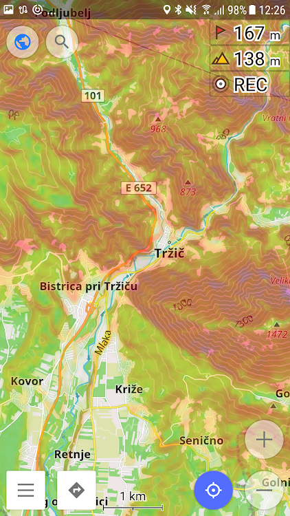
คำอธิบาย
")
To download the contour lines and hillshade maps, please go to OsmAnd > Download maps > choose the country you need > Contour Lines/Hillshade.
You can enable this layer of information by activating the plugin in OsmAnd > 'Plugins' and also enabling OsmAnd > Configure map > Contour Lines/Hillshade layer.
The global data (between 70 degrees north and 70 degrees south) is based on measurements by SRTM (Shuttle Radar Topography Mission) and ASTER (Advanced Spaceborne Thermal Emission and Reflection Radiometer), an imaging instrument onboard Terra, the flagship satellite of NASA's Earth Observing System. ASTER is a cooperative effort between NASA, Japan's Ministry of Economy, Trade and Industry (METI), and Japan Space Systems (J-spacesystems).
ภาพหน้าจอ


มีอะไรใหม่
- เวอร์ชัน: 1.0
- อัปเดต:
- Update Target API Level
ราคา
- วันนี้: $4.99
- ต่ำสุด: $0.99
- มากที่สุด: $4.99
ติดตามราคา
ผู้พัฒนา
แต้มแล
ไม่พบ ☹️
การจัดอันดับ
ไม่พบ ☹️
รายการ
ไม่พบ ☹️
ความเห็น
แสดงรีวิวเป็นคนแรกเลย!
ข้อมูลเพิ่มเติม
- หมวดหมู่:
Android แอป›การเดินทางและท้องถิ่น - ระบบปฏิบัติการ:
Android - การจัดประเภทเนื้อหา:
Everyone - Google Play คะแนนโดย:
4.0(2,128) - อัปเดต:
- วันที่วางจำหน่าย:
รายชื่อติดต่อ
- เว็บไซท์:
 http://osmand.net
คุณอาจชอบ
-
- Ski Map Plugin — OsmAnd
- Android แอป: การเดินทางและท้องถิ่น โดย: OsmAnd
- ฟรี
- รายการ: 0 + 0 การจัดอันดับ: 0 ความเห็น: 0
- แต้มแล: 0 + 786 เวอร์ชัน: 1.0 OsmAnd Ski Maps is a nice addition for OsmAnd Maps & Navigation app, that allows to see all the ski pistes and all available additional information related to ski maps. Usage ...
-
- Slovak Lines - Bus Tickets
- Android แอป: การเดินทางและท้องถิ่น โดย: Slovak Lines
- ฟรี
- รายการ: 0 + 0 การจัดอันดับ: 0 ความเห็น: 0
- แต้มแล: 0 + 260 เวอร์ชัน: 3.10.1 Travelling between Bratislava, Vienna and Schwechat Airport? Use the quick and convenient mobile app. You don t have to print out the ticket, just present it on the display of your ...
-
- Peter Pan Bus Lines
- Android แอป: การเดินทางและท้องถิ่น โดย: Peter Pan Bus Lines
- ฟรี
- รายการ: 0 + 0 การจัดอันดับ: 0 ความเห็น: 0
- แต้มแล: 0 + 169 เวอร์ชัน: 2024.1.0 Travel EXPRESS FOR LESS throughout the entire Northeast & Mid Atlantic with Peter Pan Bus Lines! Experience the convenience of purchasing your tickets on the go with our easy to use ...
-
- Mkshipping Lines
- Android แอป: การเดินทางและท้องถิ่น โดย: MK Shipping Lines
- ฟรี
- รายการ: 0 + 0 การจัดอันดับ: 0 ความเห็น: 0
- แต้มแล: 0 + 72 เวอร์ชัน: 1.7 Mkshipping Lines is the ticket booking app where users can buy the ticket. What do we provide for you? Easy Bookings provide a rapid, effective, and cost-effective solution to our ...
-
- Disney World Lines by TouringP
- Android แอป: การเดินทางและท้องถิ่น โดย: www.TouringPlans.com
- * ฟรี
- รายการ: 0 + 0 การจัดอันดับ: 0 ความเห็น: 0
- แต้มแล: 0 + 5,318 เวอร์ชัน: 2.0.22 LINES will help you save time and money during your Walt Disney World trip. Because we re independent travel writers, we can tell you what Disney can t, from actual waits in line, to ...
-
- Kerala Lines
- Android แอป: การเดินทางและท้องถิ่น โดย: Bus Operator Apps
- ฟรี
- รายการ: 0 + 0 การจัดอันดับ: 0 ความเห็น: 0
- แต้มแล: 0 + 53 เวอร์ชัน: 10.0 Kerala Lines is a renowned brand in the bus operating industry. Our vision is to give a new face to the bus industry. Since our inception passenger comfort was our top priority. We ...
-
- Fly Delta
- Android แอป: การเดินทางและท้องถิ่น โดย: Delta Air Lines, Inc.
- ฟรี
- รายการ: 0 + 0 การจัดอันดับ: 0 ความเห็น: 0
- แต้มแล: 0 + 140,972 เวอร์ชัน: 5.42.2 Welcome to Fly Delta, Delta s award-winning Android app that makes travel easier than ever before. Planning Your Trip Shop and book domestic and international flights Track and pay for
-
- SWISS
- Android แอป: การเดินทางและท้องถิ่น โดย: Swiss International Air Lines Ltd.
- ฟรี
- รายการ: 0 + 0 การจัดอันดับ: 0 ความเห็น: 0
- แต้มแล: 0 + 19,915 เวอร์ชัน: 6.416.1 Book flights, reserve seats and access your digital boarding passes. With the SWISS app, your mobile travel companion for journeys with the Lufthansa Group network airlines, you can do
-
- Greyhound: Buy Bus Tickets
- Android แอป: การเดินทางและท้องถิ่น โดย: Greyhound Lines Inc
- ฟรี
- รายการ: 0 + 0 การจัดอันดับ: 0 ความเห็น: 0
- แต้มแล: 0 + 72,894 เวอร์ชัน: 9.31.2 Book low-fare bus tickets with more options With the free, refreshed, and enhanced Greyhound app, you have more bus trip options, same low fares, and more new features than ever ...
-
- Korean Air My
- Android แอป: การเดินทางและท้องถิ่น โดย: KOREAN AIR LINES.CO., LTD.
- ฟรี
- รายการ: 0 + 0 การจัดอันดับ: 0 ความเห็น: 0
- แต้มแล: 0 + 13,147 เวอร์ชัน: New Korean Air My is now available on Wear OS. Service supported in Wear OS Device: - Mobile Boarding Pass - View SKYPASS Membership Card Korean Air My on Wear OS needs to be synced with ...
-
- IGNrando' – France hiking maps
- Android แอป: การเดินทางและท้องถิ่น โดย: Ubicarta
- * ฟรี
- รายการ: 0 + 0 การจัดอันดับ: 0 ความเห็น: 0
- แต้มแล: 0 + 3,760 เวอร์ชัน: 1.97.03 IGNrando is a collaborative platform for sharing routes and points of interest (POIs) related to outdoor activities in France. RICH DATA OFFER Tens of thousands of routes and POIs all ...
- Play Pass
- Accurate Altimeter
- Android แอป: การเดินทางและท้องถิ่น โดย: AR Labs
- * * ฟรี
- รายการ: 0 + 0 การจัดอันดับ: 0 ความเห็น: 0
- แต้มแล: 0 + 65,874 เวอร์ชัน: 2.3.16 The most downloaded Altimeter for Android that does not need internet to work! - Altitude estimation with three different methods to be always sure to get a reliable measure, even ...
-
- Guru Maps — GPS Route Planner
- Android แอป: การเดินทางและท้องถิ่น โดย: Evgen Bodunov
- * ฟรี
- รายการ: 0 + 0 การจัดอันดับ: 0 ความเห็น: 0
- แต้มแล: 1 + 9,796 เวอร์ชัน: 5.5.3 Guru Maps helps you find the best trail and spend some time enjoying the great outdoors like traveling, hiking, biking or off-roading. With detailed maps covering the entire world, ...
-
- Terra Map - Trail Explorer
- Android แอป: การเดินทางและท้องถิ่น โดย: GEC srl
- * ฟรี
- รายการ: 0 + 0 การจัดอันดับ: 0 ความเห็น: 0
- แต้มแล: 0 + 152 เวอร์ชัน: 26.9 Enjoy every adventure safely with the best technology for outdoor navigation. Developed with the help of experienced hikers and bikers, Terra Map can meet all your needs. FEATURES: ...