| Utvecklare: | Lim Geomatics Inc. (7) | ||
| Pris: | Gratis | ||
| Betyg: | 0 | ||
| Recensioner: | 0 Skriv en recension | ||
| Listor: | 0 + 0 | ||
| Poäng: | 0 + 0 ¡ | ||
| App Store | |||
Beskrivning
")
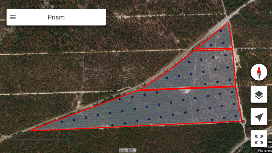
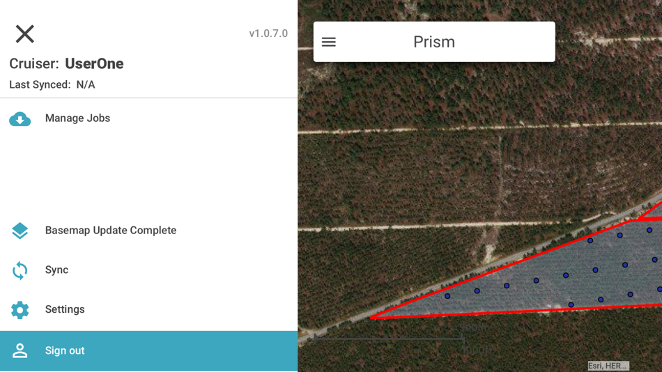
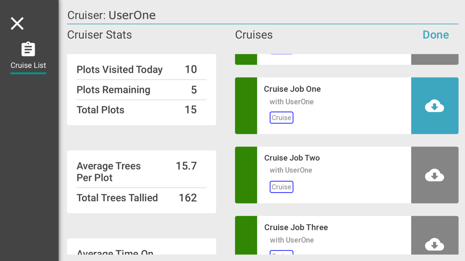
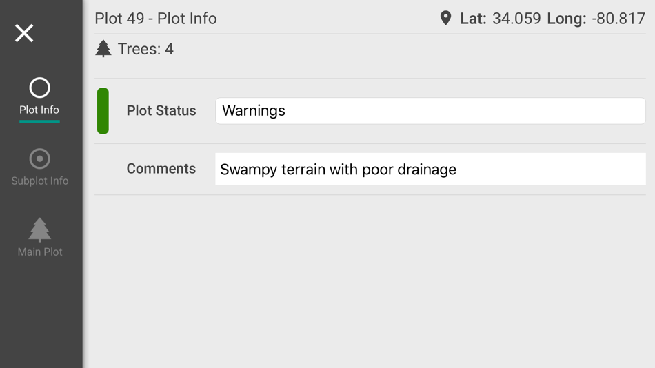
Forest managers can plan cruises in advance for diverse forest types, management goals, and environmental factors. Cruisers can then instantly sync data from the mobile app back to the office when within Wi-Fi, cellular, or satellite internet coverage. Pre-determined plans are downloaded to the mobile app so foresters can execute cruises offline in remote locations.
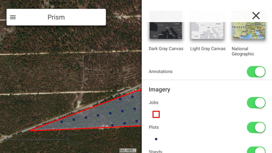
Another unique feature of Prism is built-in navigation, which harnesses the tablet's GPS system and automatically downloads offline basemaps including satellite, hillshade and road network imagery for the worksites to be visited. Cruisers don't have to switch between applications or devices to know where they are in the forest and where they're going next.
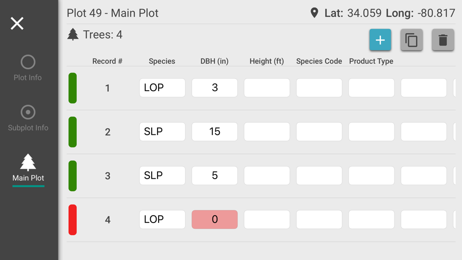
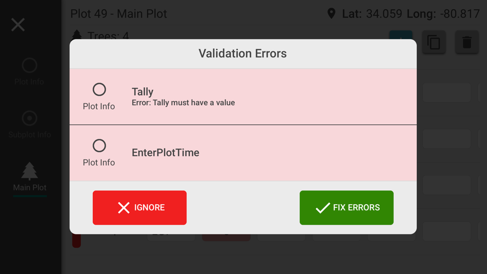
Prism is an all-in-one timber cruising app that is as powerful as it is user-friendly. It can even catch data entry errors before they get synced to the cloud with the Data Collection Validation Notification feature.
Try Prism today and dramatically enhance the efficiency and accuracy of your forest sampling program.
How Lim Geomatics Prism Benefits You:
- User-friendly and compatible with all major tablets
- Seamless data synchronization between the mobile app and cloud
- Cruise offline in remote locations with pre-defined cruises and basemaps
- GPS capability built into mobile app
- All-in-one cruise navigation and data entry
- Highly configurable for diverse management goals and forest types
- Immediate data validation safeguards data integrity
- Fully integrated with ArcGIS Online for unrivaled compatibility
Skärmbilder
Pris
- Idag: Gratis
- Minsta: Gratis
- Maximalt: Gratis
Bevaka priser
Utvecklare
- Lim Geomatics Inc.
- Plattformar: Android Appar (3) iOS Appar (2) Windows Appar (2)
- Listor: 0 + 0
- Poäng: 0 + 2 ¡
- Betyg: 0
- Recensioner: 0
- Rabatter: 0
- Videor: 0
- RSS: Prenumerera
Poäng
0 ☹️
Betyg
0 ☹️
Listor
0 ☹️
Recensioner
Var den första att granska 🌟
Ytterligare information
- Version: 1.8.4
- Kategori:
iOS Appar›Vägbeskrivningar - OS:
iPad,iPhone,iOS 13.0 och senare - Storlek:
180 Mb - Innehållsrankning:
4+ - App Store Betyg:
0 - Uppdaterad:
- Utgivningsdatum:
- 🌟 Dela
- App Store
Du kanske också gillar
-
- Op Tracker
- iOS Appar: Vägbeskrivningar Av: Lim Geomatics Inc.
- Gratis
- Listor: 0 + 0 Betyg: 0 Recensioner: 0
- Poäng: 0 + 2 (5.0) Version: 1.14.4 Smart tracking for safe, efficient, and productive forestry operations. Op Tracker is a simple, turnkey GIS solution to help you track harvesting equipment feller bunchers, forwarders, ⥯
-
- TGG Tracking
- iOS Appar: Vägbeskrivningar Av: transglobal geomatics private limited
- Gratis
- Listor: 0 + 0 Betyg: 0 Recensioner: 0
- Poäng: 0 + 0 Version: 2.19.2 This app helps in tracking the vehicles from Trans Global Geomatics Pvt Ltd ⥯
-
- Survey360
- iOS Appar: Vägbeskrivningar Av: Scanpoint Geomatics Ltd
- Gratis
- Listor: 0 + 0 Betyg: 0 Recensioner: 0
- Poäng: 0 + 0 Version: 6.0.3 See your GPS position and draw points, line and polygons on your maps. Collect field data and notes related to a location, attach a photo and fill custom properties and attributes. 2D ... ⥯
-
- Coordinates.
- iOS Appar: Vägbeskrivningar Av: Seng Hoong Lim
- Gratis
- Listor: 0 + 0 Betyg: 0 Recensioner: 0
- Poäng: 0 + 8 (4.3) Version: 2.0 Featured in iTunes "Navigation > What's Hot #5" Section - Did you know that coordinates can be an important tracking tool especially during emergencies? ( Vehicle breakdowns, Trapped ... ⥯
-
- iGeoTrans X
- iOS Appar: Vägbeskrivningar Av: TRAN TRUNG CHUYEN
- $49.99
- Listor: 0 + 0 Betyg: 0 Recensioner: 0
- Poäng: 0 + 5 (5.0) Version: 2.7.2 iGeoTrans X is a cloud app on the smartphone, designed to address common problems for fieldwork researchers hoping to use smartphones ad the field as GPS/GIS & Data collection devices. ⥯
-
- TUnIS Navigation
- iOS Appar: Vägbeskrivningar Av: VMT - gmbh
- Gratis
- Listor: 0 + 0 Betyg: 0 Recensioner: 0
- Poäng: 0 + 0 Version: 1.3.15 VMT stands for the best-selling Navigation systems in tunneling worldwide. We have equipped thousands of tunneling projects with navigation, information, monitoring and communication ... ⥯